

2009 Euro Tour -- Ride Day 20 — 15 July 2009 — 27130 Verneuil-sur-Avre to 14100 Lisieux CLONED FROM ROUTE 1682062
Un percorso ciclabile con partenza da Verneuil-sur-Avre, Normandia, Francia.
Panoramica
Su questo percorso
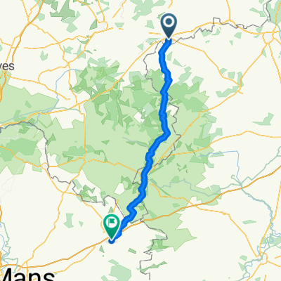
Bella pedalata oggi, anche se abbiamo avuto forti venti contrari. Fortunatamente, nella seconda metà del percorso, abbiamo incontrato una varietà di terreni e strade eccellenti. La D137 aveva una salita terribile che meritava almeno due frecce anziché la singola indicata sulla mappa. Subito dopo la salita, mentre pedalavamo lungo la D613 verso l'Etap, ha iniziato a piovere proprio come il giorno precedente, poco prima di arrivare a destinazione. Durante la giornata, siamo passati per brevi tratti dal dipartimento di Eure nella regione dell'Alta Normandia al dipartimento di Orne nella regione della Bassa Normandia. Alla fine, abbiamo lasciato il dipartimento di Eure ed entrati nel dipartimento di Calvados, che si trova anch'esso nella regione della Bassa Normandia. Background: Mia moglie ed io facciamo tour auto-sostenuti nell'Europa occidentale (per lo più in Francia) dal 1993. Questa serie di giri copre il nostro percorso del 2009 di 4,5 mesi attraverso parti di Francia, Germania, Austria, Svizzera e poi di nuovo in Francia. Il nostro punto di partenza e arrivo è vicino a Chadurie (a sud di Angoulême), dove i nostri amici hanno una fattoria con Gîtes e Chambres d'Hôtes. Abbiamo pedalato sulle nostre biciclette da turismo Dawes acquistate nel 1993, caricate con pneumatici 700Cx32. Tutta la nostra pedalata è stata su strade asfaltate, per lo più con pochissimo traffico. Praticamente gli unici tratti non asfaltati erano alcuni percorsi ciclabili in Germania e Austria. Purtroppo non è stato molto positivo, poiché Helen è caduta diverse volte sui percorsi non asfaltati. Fortunatamente, senza ferite gravi. Per qualsiasi domanda, sentitevi liberi di scrivermi a jeffkadet@netdiving.com. Jeff
- -:--
- Durata
- 80,4 km
- Distanza
- 250 m
- Salita
- 281 m
- Discesa
- ---
- Velocità media
- ---
- Altitudine max.

Qualità del percorso
Tipi di percorsi e superfici lungo il percorso
Tipi di percorso
Strada
18,5 km
(23 %)
Strada tranquilla
15,3 km
(19 %)
Superfici
Asfaltato
16,9 km
(21 %)
Non asfaltato
0,8 km
(1 %)
Asfalto
16,9 km
(21 %)
Terra
0,8 km
(1 %)
Non definito
62,7 km
(78 %)
Continua con Bikemap
Usa, modifica o scarica questo percorso ciclabile
Vuoi percorrere 2009 Euro Tour -- Ride Day 20 — 15 July 2009 — 27130 Verneuil-sur-Avre to 14100 Lisieux CLONED FROM ROUTE 1682062 o personalizzarlo per il tuo viaggio? Ecco cosa puoi fare con questo percorso su Bikemap:
Funzionalità gratuite
- Salva questo percorso tra i preferiti o in una raccolta
- Copia e pianifica la tua versione di questo percorso
- Dividilo in tappe per creare un tour di più giorni
- Sincronizza il tuo percorso con Garmin o Wahoo
Funzionalità Premium
Prova gratuita di 3 giorni o pagamento una tantum. Scopri di più su Bikemap Premium.
- Naviga questo percorso su iOS e Android
- Esporta un file GPX / KML di questo percorso
- Crea la tua stampa personalizzata (provala gratis)
- Scarica questo percorso per la navigazione offline
Scopri altre funzionalità Premium.
Ottieni Bikemap PremiumDalla nostra community
Verneuil-sur-Avre: Altri percorsi popolari che iniziano qui
 12–72 Route de Mortagne, Verneuil d'Avre et d'Iton à Les Barils
- Distanza
- 9,3 km
- Salita
- 164 m
- Discesa
- 142 m
- Posizione
- Verneuil-sur-Avre, Normandia, Francia
 De Rue Aristide Briand, Verneuil d'Avre et d'Iton à 39 Rue Saint-Germain, Brezolles
- Distanza
- 13 km
- Salita
- 57 m
- Discesa
- 59 m
- Posizione
- Verneuil-sur-Avre, Normandia, Francia
 2009 Euro Tour -- Ride Day 20 — 15 July 2009 — 27130 Verneuil-sur-Avre to 14100 Lisieux CLONED FROM ROUTE 1682062
- Distanza
- 80,4 km
- Salita
- 250 m
- Discesa
- 281 m
- Posizione
- Verneuil-sur-Avre, Normandia, Francia
 👌🏅
👌🏅- Distanza
- 28,8 km
- Salita
- 234 m
- Discesa
- 232 m
- Posizione
- Verneuil-sur-Avre, Normandia, Francia
 Verneuil-sur-Avre - Cherré
- Distanza
- 84,4 km
- Salita
- 629 m
- Discesa
- 705 m
- Posizione
- Verneuil-sur-Avre, Normandia, Francia
 Verneuil sur Avre - Courtils
- Distanza
- 213,9 km
- Salita
- 570 m
- Discesa
- 716 m
- Posizione
- Verneuil-sur-Avre, Normandia, Francia
 Verneuil - Saint Sylvestre de Cormeilles
- Distanza
- 93,5 km
- Salita
- 168 m
- Discesa
- 203 m
- Posizione
- Verneuil-sur-Avre, Normandia, Francia
 V2 Verneuil-s-Arve / Paris 140km
- Distanza
- 140,7 km
- Salita
- 361 m
- Discesa
- 475 m
- Posizione
- Verneuil-sur-Avre, Normandia, Francia
Aprila nell’app