Blistering ride in Benicia
- 55,3 km
- 5 m
- 40 m
- Crockett, California, Stati Uniti
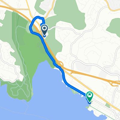
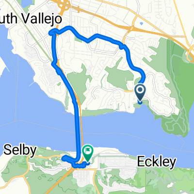
Vivi questo giro relativamente corto nella parte sud-occidentale di Vallejo e nell'estremo est di Benicia.
Il percorso inizia al nuovo e controverso Glen Cove Waterfront Park, dove percorrerai uno dei tratti più recenti del SF Bay Trail, un sentiero di ghiaia allentata/compattata lungo l'estremità occidentale del parco, svoltando a sud verso il Benicia State Recreational Park.
Vicino alla fine della strada asfaltata, ti unirai a un sentiero sterrato che conduce al parco statale, dove scalerai alcune colline in direzione nord-est, per poi pedalare sulla piatta e asfaltata Dillon Point Road lungo la baia di Southampton.
Una volta raggiunto l'ingresso principale del parco, attraverserai il nuovo ponte ciclopedonale sull'I-780 e inizierai il ritorno a Glen Cove tramite Columbus Parkway e Benicia Road.
Girando a sinistra su Glen Cove Parkway, continuerai la tua salita costante lungo la pista ciclabile, prima di scendere completamente fino al punto di partenza.
Strada tranquilla
2,5 km29 %Pista ciclabile
2,1 km24 %Asfaltato
3,4 km(40 %)Non asfaltato
1 km(12 %)Asfalto
2,8 km33 %Terra
0,4 km5 %Prova gratuita di 3 giorni o pagamento una tantum. Scopri di più su Bikemap Premium.
Scopri altre funzionalità Premium.
Ottieni Bikemap PremiumAprila nell’app