

St Margaret's Elbow- via Crail and Fife Ness to St Andrews
Un percorso ciclabile con partenza da Saint Monans, Scozia, Regno Unito.
Panoramica
Su questo percorso
Questa estensione del Cammino di St Margaret continua lungo il sentiero costiero di Fife attraverso antichi villaggi di pescatori lungo spiagge e sopra rocce fino a quando i campanili di St Andrews non compaiono in lontananza su miglia di dolci fairways. Il sentiero continua attraverso il porto fino all'area della cattedrale in rovina. Ci sono pub, ecc. lungo il percorso verso Crail e grandi opportunità per campeggiare in libertà. I ciclisti potrebbero dover scendere dalla bici a volte.
- -:--
- Durata
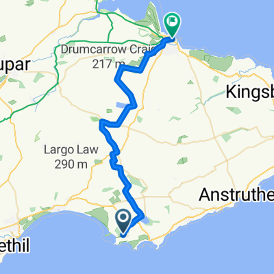
- 37,4 km
- Distanza
- 174 m
- Salita
- 159 m
- Discesa
- ---
- Velocità media
- ---
- Altitudine max.

Punti salienti del percorso
Punti di interesse lungo il percorso
Punto di interesse dopo 10,6 km
The Dreel Burn. King James IV (1473-1513) disguised as a piper was carried over this burn by a "stout gaberlunzie" woman and rewarded with his purse. "Gaberlunzie" is a medieval Scots word for licensed beggar.

Punto di interesse dopo 25,8 km
As glaciers advanced during the last ice age over 10,000 years ago they chipped off boulders and carried them along sometimes hundreds of miles. When the ice melted the boulders, like these ones here, were simply dumped. Thanks to geoHeritage Fife for advice and image.

Punto di interesse dopo 28,2 km
Here the sandstone contains many little pits which form parallel rows about 20 cm apart. Some rows cross over each other .These pits represent the footprints of a millipede-type animal, about 1.5 m long, which lived about 330 million years ago. At that time it was probably the largest land animal. Thanks to geoHeritage Fife for advice and image.
Punto di interesse dopo 30,7 km
Peekie Bridge over Kenly Burn, with panel showing arms of Prior Hepburn, in office around 1500.
Continua con Bikemap
Usa, modifica o scarica questo percorso ciclabile
Vuoi percorrere St Margaret's Elbow- via Crail and Fife Ness to St Andrews o personalizzarlo per il tuo viaggio? Ecco cosa puoi fare con questo percorso su Bikemap:
Funzionalità gratuite
- Salva questo percorso tra i preferiti o in una raccolta
- Copia e pianifica la tua versione di questo percorso
- Sincronizza il tuo percorso con Garmin o Wahoo
Funzionalità Premium
Prova gratuita di 3 giorni o pagamento una tantum. Scopri di più su Bikemap Premium.
- Naviga questo percorso su iOS e Android
- Esporta un file GPX / KML di questo percorso
- Crea la tua stampa personalizzata (provala gratis)
- Scarica questo percorso per la navigazione offline
Scopri altre funzionalità Premium.
Ottieni Bikemap PremiumDalla nostra community
Saint Monans: Altri percorsi popolari che iniziano qui
 St.Monans Loop
- Distanza
- 14,7 km
- Salita
- 74 m
- Discesa
- 66 m
- Posizione
- Saint Monans, Scozia, Regno Unito
 The Toft 16, Elie to Tolbooth Wynd 1a, Crail
- Distanza
- 20 km
- Salita
- 170 m
- Discesa
- 141 m
- Posizione
- Saint Monans, Scozia, Regno Unito
 Saint Monans - St Andrews
- Distanza
- 25,3 km
- Salita
- 197 m
- Discesa
- 190 m
- Posizione
- Saint Monans, Scozia, Regno Unito
 St Margaret's Elbow- via Crail and Fife Ness to St Andrews
- Distanza
- 37,4 km
- Salita
- 174 m
- Discesa
- 159 m
- Posizione
- Saint Monans, Scozia, Regno Unito
 Woodland Way, Kilconquhar2, Leven to Woodland Way, Kilconquhar, Leven
- Distanza
- 12,2 km
- Salita
- 116 m
- Discesa
- 110 m
- Posizione
- Saint Monans, Scozia, Regno Unito
 Saint to Saint
- Distanza
- 32,7 km
- Salita
- 134 m
- Discesa
- 118 m
- Posizione
- Saint Monans, Scozia, Regno Unito
 Route from 25 Station Road, Anstruther
- Distanza
- 13,6 km
- Salita
- 298 m
- Discesa
- 46 m
- Posizione
- Saint Monans, Scozia, Regno Unito
 Coastal Path - never again
- Distanza
- 9,7 km
- Salita
- 67 m
- Discesa
- 67 m
- Posizione
- Saint Monans, Scozia, Regno Unito
Aprila nell’app