
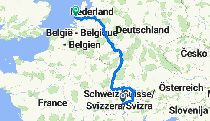
NL The Rhine Cycle Route
Un percorso ciclabile con partenza da Andermatt, Canton Uri, Svizzera.
Panoramica
Su questo percorso
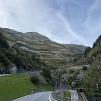
The Rhine Cycle Route is about 1,360 meters long and leads you through five countries. The track starts in the Swiss alps - the headwater area of the Rhine. Then it passes Austria, France and Germany. The route ends in Rotterdam in the Netherlands where the Rhine flows into the North Sea. (cloned from route 2567738)
- -:--
- Durata
- 1.352,1 km
- Distanza
- 88 m
- Salita
- 1.523 m
- Discesa
- ---
- Velocità media
- ---
- Altitudine max.
Qualità del percorso
Tipi di percorsi e superfici lungo il percorso
Tipi di percorso
Strada forestale
365,1 km
(27 %)
Strada tranquilla
297,5 km
(22 %)
Superfici
Asfaltato
919,4 km
(68 %)
Non asfaltato
256,9 km
(19 %)
Asfalto
878,8 km
(65 %)
Ghiaia
189,3 km
(14 %)
Punti salienti del percorso
Punti di interesse lungo il percorso

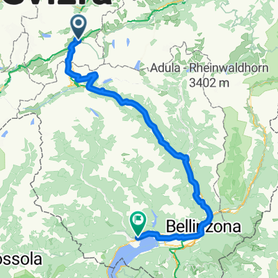
Punto di interesse dopo 293,6 km
The Rhine Falls (Rheinfall in German) is the largest plain waterfall in Europe. They are 150 m wide and 23 m high.

Punto di interesse dopo 667,2 km
Speyer is one of the oldest cities in Germany and is therefore historically and culturally important. Most famous is the Imperial Cathedral of Speyer

Punto di interesse dopo 829,8 km
The Lorelei is a rock on the eastern bank of the Rhine which soars some 120 metres above the waterline. It marks the narrowest part of the river between Switzerland and the North Sea, and is the most famous feature of the Rhine Gorge, a 65 km section of the river between Koblenz and Bingen that was

Punto di interesse dopo 893,7 km
One of Andernach's natural attractions is the world's highest (max. 64 m) cold-water geyser, driven by carbon dioxide with force generated in a fashion similar to that in a shaken bottle of table water.
Continua con Bikemap
Usa, modifica o scarica questo percorso ciclabile
Vuoi percorrere NL The Rhine Cycle Route o personalizzarlo per il tuo viaggio? Ecco cosa puoi fare con questo percorso su Bikemap:
Funzionalità gratuite
- Salva questo percorso tra i preferiti o in una raccolta
- Copia e pianifica la tua versione di questo percorso
- Dividilo in tappe per creare un tour di più giorni
- Sincronizza il tuo percorso con Garmin o Wahoo
Funzionalità Premium
Prova gratuita di 3 giorni o pagamento una tantum. Scopri di più su Bikemap Premium.
- Naviga questo percorso su iOS e Android
- Esporta un file GPX / KML di questo percorso
- Crea la tua stampa personalizzata (provala gratis)
- Scarica questo percorso per la navigazione offline
Scopri altre funzionalità Premium.
Ottieni Bikemap PremiumDalla nostra community
Andermatt: Altri percorsi popolari che iniziano qui
 Von Andermatt bis Locarno
- Distanza
- 115,9 km
- Salita
- 2.182 m
- Discesa
- 3.407 m
- Posizione
- Andermatt, Canton Uri, Svizzera
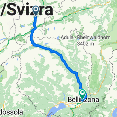
 Andermatt -Bellinzona Gotthardstrasse to Via San Gottardo
- Distanza
- 80,7 km
- Salita
- 708 m
- Discesa
- 1.919 m
- Posizione
- Andermatt, Canton Uri, Svizzera
 rhein von oberalppass nach hoek van holland
- Distanza
- 1.427,3 km
- Salita
- 146 m
- Discesa
- 2.169 m
- Posizione
- Andermatt, Canton Uri, Svizzera
 Rheinradtour Teil1/Etappe1
- Distanza
- 51,4 km
- Salita
- 620 m
- Discesa
- 1.924 m
- Posizione
- Andermatt, Canton Uri, Svizzera
 Bellinzona - Vizzola Ticino
- Distanza
- 130,7 km
- Salita
- 2.639 m
- Discesa
- 3.799 m
- Posizione
- Andermatt, Canton Uri, Svizzera
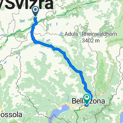
 Tag 3: Andermatt - Bellinzona
- Distanza
- 100 km
- Salita
- 2.518 m
- Discesa
- 3.216 m
- Posizione
- Andermatt, Canton Uri, Svizzera
 Furkastrasse, Realp nach Ritystrasse, Brigerbad
- Distanza
- 70,6 km
- Salita
- 558 m
- Discesa
- 2.246 m
- Posizione
- Andermatt, Canton Uri, Svizzera
 Tag 3: Göschenen - Giubiasco (Bellinzona)
- Distanza
- 105,5 km
- Salita
- 1.280 m
- Discesa
- 2.197 m
- Posizione
- Andermatt, Canton Uri, Svizzera
Aprila nell’app