champignol nach Renzwiller
- 281,6 km
- 2.483 m
- 2.441 m
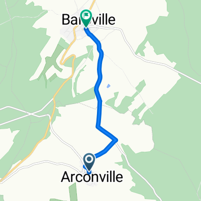
- Ville-sous-la-Ferté, Alsazia-Champagne-Ardenne-Lorena, Francia
Un percorso ciclabile con partenza da Ville-sous-la-Ferté, Alsazia-Champagne-Ardenne-Lorena, Francia.
Panoramica
<table border="0" cellpadding="0" cellspacing="0" style="width:618px;" width="619"> <colgroup> <col /> <col /> <col /> <col /> <col span="4" /> <col /> </colgroup> <tbody> <tr height="22"> <td height="22" style="height:22px;width:34px;"> 3,0</td> <td style="width:34px;"> 3,0</td> <td colspan="3" style="width:162px;"> (D12) Anstieg 120 hm</td> <td style="width:64px;"> </td> <td style="width:64px;"> </td> <td style="width:64px;"> </td> <td style="width:194px;"> </td> </tr> <tr height="22"> <td height="22" style="height:22px;width:34px;"> 8,9</td> <td style="width:34px;"> 5,9</td> <td colspan="7"> (D12) bis Champignol-lez-Mondeville Zentrum --> D70 (links)</td> </tr> <tr height="22"> <td height="22" style="height:22px;width:34px;"> 9,2</td> <td style="width:34px;"> 0,3</td> <td colspan="7"> am Ortsausgang: abknickende Vorfahrt nach rechts (D70)</td> </tr> <tr height="22"> <td height="22" style="height:22px;width:34px;"> 15,7</td> <td style="width:34px;"> 6,5</td> <td colspan="4"> Saint--Usage (links halten D70)</td> <td> </td> <td> </td> <td> </td> </tr> <tr height="22"> <td height="22" style="height:22px;width:34px;"> 17,7</td> <td style="width:34px;"> 2,0</td> <td colspan="3"> Fontette (D70)</td> <td> </td> <td> </td> <td> </td> <td> </td> </tr> <tr height="22"> <td height="22" style="height:22px;width:34px;"> 22,0</td> <td style="width:34px;"> 4,3</td> <td colspan="6"> Abbiege-Option vor Essoye (guter Schotterweg)</td> <td> </td> </tr> <tr height="22"> <td height="22" style="height:22px;width:34px;"> 24,5</td> <td style="width:34px;"> 2,5</td> <td colspan="4"> Essoyes (D67--> Loches)</td> <td> </td> <td> </td> <td> </td> </tr> <tr height="22"> <td height="22" style="height:22px;width:34px;"> 27,5</td> <td style="width:34px;"> 3,0</td> <td colspan="4"> Loches-sur-Ource (D145-->D67)</td> <td> </td> <td> </td> <td> </td> </tr> <tr height="22"> <td height="22" style="height:22px;width:34px;"> 30,0</td> <td style="width:34px;"> 2,5</td> <td colspan="2"> Londreville</td> <td> </td> <td> </td> <td> </td> <td> </td> <td> </td> </tr> <tr height="22"> <td height="22" style="height:22px;width:34px;"> 35,1</td> <td style="width:34px;"> 5,1</td> <td colspan="4"> Celles-sur-Ource (Brücke)</td> <td> </td> <td> </td> <td> </td> </tr> <tr height="22"> <td height="22" style="height:22px;width:34px;"> 35,7</td> <td style="width:34px;"> 0,6</td> <td colspan="7"> Abzweig nach Süden (gegenüber der Post: Rue de l'Église)</td> </tr> <tr height="22"> <td height="22" style="height:22px;width:34px;"> 36,9</td> <td style="width:34px;"> 1,2</td> <td colspan="7"> geradeaus in die Rue de Puits de Tour/Rue de Craies-->D671</td> </tr> <tr height="22"> <td height="22" style="height:22px;width:34px;"> 37,2</td> <td style="width:34px;"> 0,3</td> <td colspan="6"> --> hinter der Bahn D452 nach links Ri Polisy</td> <td> </td> </tr> <tr height="22"> <td height="22" style="height:22px;width:34px;"> 42,0</td> <td style="width:34px;"> 4,8</td> <td colspan="3"> Balnot-sur-Laignes</td> <td> </td> <td> </td> <td> </td> <td> </td> </tr> <tr height="21"> <td height="21" style="height:21px;width:34px;"> 45,1</td> <td style="width:34px;"> 3,1</td> <td colspan="3"> Ricey-Bas</td> <td> </td> <td> </td> <td> </td> <td> </td> </tr> </tbody> </table>
Hotel Le Marius 2 Place De L'église<br /> 10340 Les Riceys Telefon +33325293165creato 11 anni fa
Qualità del percorso
Strada
9,9 km
22 %
Strada forestale
4,5 km
10 %
Asfaltato
5 km
(11 %)
Non asfaltato
1,8 km
(4 %)
Asfalto
4,5 km
10 %
Ghiaia
1,8 km
4 %
Continua con Bikemap
Vuoi percorrere Camino 2015 6b Clairvaux nach Les Riceys o personalizzarlo per il tuo viaggio? Ecco cosa puoi fare con questo percorso su Bikemap:
Prova gratuita di 3 giorni o pagamento una tantum. Scopri di più su Bikemap Premium.
Scopri altre funzionalità Premium.
Ottieni Bikemap PremiumDalla nostra community
Aprila nell’app