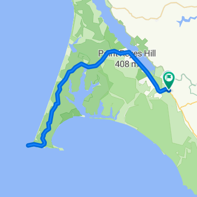
Leon Marshall Wall and Wilson Hill
Un percorso ciclabile con partenza da Inverness, California, Stati Uniti.
Panoramica
Su questo percorso
Questo è il giro di Leon Sun. Conduirà un giro il 20 a West Marin. Vers la fine del giro, voglio fermarmi alla G.R.O. Art Gallery a Pt Reyes Station dove il mio amico Lucien Kubo ha una mostra personale. Ecco i dettagli del giro, se non ti dispiace pubblicarli: Partenza: 9:00, Bear Valley Visitor Center, Bear Valley Rd, Olema. Percorso: Uscita dal Centro Visitatori, a destra su Bear Valley Rd, a sinistra (nord) su Hwy 1, a destra su Marshall-Petaluma Rd (Marshall Wall, circa 1100' di dislivello guadagnato), a sinistra su Wilson Hill Rd, a sinistra su Chileno Valley Rd, a sinistra su Tomales-Petaluma Rd, a destra su Hwy 1 fino a Tomales, fermati per pranzo o spuntino, Ritorno a sud su Hwy 1 fino a Bear Valley Rd, girare a destra, a sinistra nel Centro Visitatori. Marshall Wall e Wilson Hill sono le due principali salite, circa 1500' di guadagno di elevazione combinato. Il resto sono ondulazioni. Circa 60 miglia, distanza totale. Sovrappone parti del percorso di pellegrinaggio. Fermarsi alla galleria, ovviamente, è facoltativo.
- -:--
- Durata
- 98,3 km
- Distanza
- 1.271 m
- Salita
- 1.276 m
- Discesa
- ---
- Velocità media
- 220 m
- Altitudine max.
Qualità del percorso
Tipi di percorsi e superfici lungo il percorso
Tipi di percorso
Strada
20,6 km
(21 %)
Strada tranquilla
1 km
(1 %)
Non definito
76,7 km
(78 %)
Superfici
Asfaltato
44,2 km
(45 %)
Asfalto
44,2 km
(45 %)
Non definito
54,1 km
(55 %)
Punti salienti del percorso
Punti di interesse lungo il percorso
Punto di interesse dopo 20,3 km
R Marshall-Petaluma Rod (Marshall Wall about 1100' elev gain)
Punto di interesse dopo 42,4 km
L Chileno Valley Rd
Punto di interesse dopo 53,4 km
R Chileno Valley Rd
Punto di interesse dopo 58,1 km
L Tomales Petaluma Rd.
Punto di interesse dopo 67,1 km
Punto di interesse dopo 67,8 km
LUNCH IN TOMALES
Punto di interesse dopo 68,4 km
L Shoreline HWY1
Continua con Bikemap
Usa, modifica o scarica questo percorso ciclabile
Vuoi percorrere Leon Marshall Wall and Wilson Hill o personalizzarlo per il tuo viaggio? Ecco cosa puoi fare con questo percorso su Bikemap:
Funzionalità gratuite
- Salva questo percorso tra i preferiti o in una raccolta
- Copia e pianifica la tua versione di questo percorso
- Dividilo in tappe per creare un tour di più giorni
- Sincronizza il tuo percorso con Garmin o Wahoo
Funzionalità Premium
Prova gratuita di 3 giorni o pagamento una tantum. Scopri di più su Bikemap Premium.
- Naviga questo percorso su iOS e Android
- Esporta un file GPX / KML di questo percorso
- Crea la tua stampa personalizzata (provala gratis)
- Scarica questo percorso per la navigazione offline
Scopri altre funzionalità Premium.
Ottieni Bikemap PremiumDalla nostra community
Inverness: Altri percorsi popolari che iniziano qui
 Point Reyes Ride
- Distanza
- 26,8 km
- Salita
- 305 m
- Discesa
- 333 m
- Posizione
- Inverness, California, Stati Uniti
 Point reyes station to point out and back
- Distanza
- 63,7 km
- Salita
- 714 m
- Discesa
- 714 m
- Posizione
- Inverness, California, Stati Uniti
 route 20
- Distanza
- 43,7 km
- Salita
- 344 m
- Discesa
- 376 m
- Posizione
- Inverness, California, Stati Uniti
 Pierce Point
- Distanza
- 26,5 km
- Salita
- 391 m
- Discesa
- 350 m
- Posizione
- Inverness, California, Stati Uniti
 Point Reyes, CA -USA
- Distanza
- 64 km
- Salita
- 572 m
- Discesa
- 577 m
- Posizione
- Inverness, California, Stati Uniti
 Point Reyes to Sf to Corte Madera
- Distanza
- 77,9 km
- Salita
- 1.537 m
- Discesa
- 1.558 m
- Posizione
- Inverness, California, Stati Uniti
 Johnston, Inverness to , Inverness
- Distanza
- 23,5 km
- Salita
- 388 m
- Discesa
- 399 m
- Posizione
- Inverness, California, Stati Uniti
 Point Reyes N 1
- Distanza
- 23,3 km
- Salita
- 508 m
- Discesa
- 508 m
- Posizione
- Inverness, California, Stati Uniti
Aprila nell’app

