

Anello del Caucaso
Un percorso ciclabile con partenza da Neirone, Liguria, Italy.
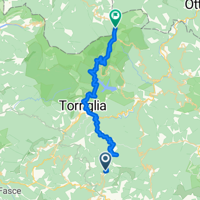
Panoramica
Su questo percorso
The path winds among Monte Caucaso’s slopes, characterized by a first climb to the peak, a long downhill with a panoramic view on Fontanabuona valley. It continues in a dense forest of secular chestnuts trees. A new climb to Scoglina and, through the river Aveto Valley, returns to the starting point. If you start from Barbagelata, climbing the country road that to the summit of Monte Caucaso, where you will find a small chapel and the shelter. The view opens on Golfo Paradiso, from Portofino to Sestri Levante. Return down to the base of the summit and follow the ridge path in the direction of Pietra Cavallina, first uphill and then downhill. To the left you will find the turnoff to Passo Croci, sliding descent with some technical sections, steps, roots and rocks. At Passo Croci there are two possibilities:
- On right side the path leads down to Pian del Pero medium difficulty trail. From here by country road you will reach site Spina. Following the track across fields and a beech forest, with a path of reduced width, you will reach the little chapel of San Rocco;
- On left side the trail descends near the San Rocco chapel (with some difficult technical trail for MBT). From San Rocco, follow the country road down for about 1 km and then, with an ascent of 3 km, you will reach Struvega (rest area with slate benches). Then through a technical course marked by rock slabs and often bumpy, you will reach the asphalted road that leads to Passo della Scoglina. Pay attention to rockfall and fords. At Passo della Scoglina you will find two itineraries:
- If you are tired, you can go through the asphalted road directly to Barbagelata
- If you still have energy, you can cross the trail that winds among River Aveto. Pay attention to a series of fords. Climb up to Stre Burche (steep slope, passing by walk for a single track for MBT). From here retracing the initial section of route back to Barbagelata.
STARTING POINT Barbagelata (Municipality of Lorsica) ARRIVAL POINT Barbagelata (Municipality of Lorsica) Distance 25 km Trail type trekking - trail running and MBT Technical difficulty for experts with a good technical degree of MBT (medium-high) Difference in height 2100 m Max hight 1245 m (Monte Caucaso top) Shelter Monte Caucaso (12 beds) Manager Maurizio Chénal (+39) 347 3011016
- -:--
- Durata
- 45,9 km
- Distanza
- 1.997 m
- Salita
- 2.504 m
- Discesa
- ---
- Velocità media
- ---
- Altitudine max.
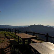
Foto del percorso


Continua con Bikemap
Usa, modifica o scarica questo percorso ciclabile
Vuoi percorrere Anello del Caucaso o personalizzarlo per il tuo viaggio? Ecco cosa puoi fare con questo percorso su Bikemap:
Funzionalità gratuite
- Salva questo percorso tra i preferiti o in una raccolta
- Copia e pianifica la tua versione di questo percorso
- Sincronizza il tuo percorso con Garmin o Wahoo
Funzionalità Premium
Prova gratuita di 3 giorni o pagamento una tantum. Scopri di più su Bikemap Premium.
- Naviga questo percorso su iOS e Android
- Esporta un file GPX / KML di questo percorso
- Crea la tua stampa personalizzata (provala gratis)
- Scarica questo percorso per la navigazione offline
Scopri altre funzionalità Premium.
Ottieni Bikemap PremiumDalla nostra community
Neirone: Altri percorsi popolari che iniziano qui
 Toski09_5
- Distanza
- 96,5 km
- Salita
- 1.392 m
- Discesa
- 1.707 m
- Posizione
- Neirone, Liguria, Italy
 prova 1
- Distanza
- 34,8 km
- Salita
- 1.490 m
- Discesa
- 454 m
- Posizione
- Neirone, Liguria, Italy
 Anello del Caucaso
- Distanza
- 45,9 km
- Salita
- 1.997 m
- Discesa
- 2.504 m
- Posizione
- Neirone, Liguria, Italy
Aprila nell’app