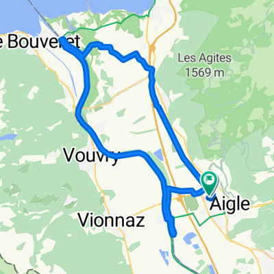
- 204,6 km
- 4.602 m
- 4.602 m
- Aigle, Canton Vaud, Svizzera
Les Classiques des Alpes Vaudoises
Un percorso ciclabile con partenza da Aigle, Canton Vaud, Svizzera.
Panoramica
Su questo percorso
This loop starts in Aigle and goes in search of the classic passes of the Vaud Alps. The little town of Aigle in Switzerland’s Chablais region is home to the UCI, the International Cycling Union.
The first few kilometres in the Rhone valley are an opportunity to warm up before the ascent to the Croix pass (alt. 1778m). Featuring a difference in altitude in excess of 1300m over a distance of 23km, this pass is one of the longest and most arduous Switzerland has to offer.
During the climb, you pass through the village of Villars-sur-Ollon, which hosted a leg of the Tour de Romandie won in 2016 by British cyclist Chris Froome.
Following a descent of 8km, you reach the village of Les Diablerets and start the ascent to the Pillon pass (alt. 1546m). The summit marks the linguistic border with Swiss-German-speaking Switzerland, and you soon find yourself in the famous resort of Gstaad. A few kilometres further on and you re-enter French-speaking Switzerland.
At Château d’Oex, you head left for the Mosses pass, which featured in the 2016 Tour de France. The ascent is interspersed with level sections and passes through the village of l’Etivaz, famous for its eponymous cheese. The pass at alt. 1445m precedes the long final descent back to Aigle.
This loop can equally well be started in Villars, Les Diablerets, Gstaad or Château d’Oex.
- -:--
- Durata
- 107,9 km
- Distanza
- 2.277 m
- Salita
- 2.277 m
- Discesa
- ---
- Velocità media
- ---
- Altitudine max.
creato 9 anni fa
Qualità del percorso
Tipi di percorsi e superfici lungo il percorso
Tipi di percorso
Strada
18,3 km
(17 %)
Strada tranquilla
18,3 km
(17 %)
Superfici
Asfaltato
76,6 km
(71 %)
Non asfaltato
1,1 km
(1 %)
Asfalto
75,5 km
(70 %)
Pavimentato (non definito)
1,1 km
(1 %)
Continua con Bikemap
Usa, modifica o scarica questo percorso ciclabile
Vuoi percorrere Les Classiques des Alpes Vaudoises o personalizzarlo per il tuo viaggio? Ecco cosa puoi fare con questo percorso su Bikemap:
Funzionalità gratuite
- Salva questo percorso tra i preferiti o in una raccolta
- Copia e pianifica la tua versione di questo percorso
- Dividilo in tappe per creare un tour di più giorni
- Sincronizza il tuo percorso con Garmin o Wahoo
Funzionalità Premium
Prova gratuita di 3 giorni o pagamento una tantum. Scopri di più su Bikemap Premium.
- Naviga questo percorso su iOS e Android
- Esporta un file GPX / KML di questo percorso
- Crea la tua stampa personalizzata (provala gratis)
- Scarica questo percorso per la navigazione offline
Scopri altre funzionalità Premium.
Ottieni Bikemap PremiumDalla nostra community
Aigle: Altri percorsi popolari che iniziano qui
- Aigle-VD-BE-FR : Chemins de traverse pour cols et D+ en pagaille
- TT_U-E09
- 45,8 km
- 1.581 m
- 983 m
- Aigle, Canton Vaud, Svizzera
- Aigle-Mosses-Pillon-Croix-Aigle
- 99,2 km
- 2.914 m
- 2.630 m
- Aigle, Canton Vaud, Svizzera
- De Chemin de Pré d'Emoz 3, Aigle à Chemin de Pré d'Emoz 9, Aigle
- 29,1 km
- 153 m
- 160 m
- Aigle, Canton Vaud, Svizzera
- 47° Nord Tour de Suisse Etappe 4
- 63,7 km
- 1.423 m
- 938 m
- Aigle, Canton Vaud, Svizzera
- Hongrin Loop
- 55 km
- 2.167 m
- 2.152 m
- Aigle, Canton Vaud, Svizzera
- Aigle-Col du Lein-Col du sanetsch-Aigle
- 140,1 km
- 3.382 m
- 3.381 m
- Aigle, Canton Vaud, Svizzera
- Aigle Valley 1
- 27,6 km
- 148 m
- 148 m
- Aigle, Canton Vaud, Svizzera
Aprila nell’app


