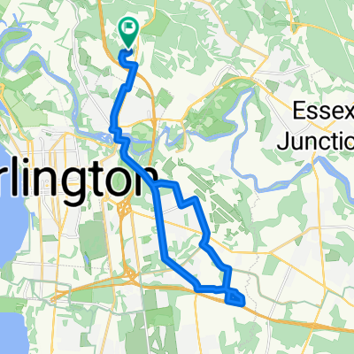
Work
- 4,1 km
- 56 m
- 5 m
- Winooski, Vermont, Stati Uniti
Un percorso ciclabile con partenza da Winooski, Vermont, Stati Uniti.
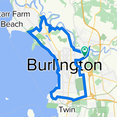
Panoramica
Il Tour de Winooski è un tour in bicicletta autoguidato proposto che inizia all'Intervale Center. Questo centro di agricoltura comunitaria è una risorsa per la produzione alimentare coltivata e gestita a livello locale nell'area di Burlington, ed è in prossimità di segni di storia geologica presso la prossima tappa del tour, Salmon Hole. Questa area naturale sul fiume Winooski è un habitat importante per le specie ittiche riparie e mostra la sua storia geologica attraverso le affioramenti di dolostoni di cui è abitata. La prossima tappa del tour in bicicletta è lo stabilimento di Ben & Jerry's a Waterbury, VT. Questo è uno stabilimento di produzione alimentare locale amato da molti abitanti del Vermont e persone di tutto il mondo. Prima che i ciclisti raggiungano Waterbury, passeranno davanti al Monte Mansfield, che è la vetta montuosa più alta del Vermont. La successiva fermata del tour è la Hubbard Tower a Montpelier. I ciclisti possono salire sulla torre di osservazione e osservare la geologia del bacino idrografico di Winooski attraverso le viste delle Green Mountains intorno a loro. Se sono stanchi, i ciclisti possono passare la notte in uno dei molteplici bed and breakfast a conduzione familiare a Montpelier. La mattina, i ciclisti seguiranno il tour fino a Barre. Possono prendere qualche genere alimentare e riflettere sulla geologia presso Granite City Grocery, la cooperativa alimentare a Barre. A questo punto del tour in bicicletta, è tempo di tornare indietro. I ciclisti seguiranno il tour su un lungo tragitto di ritorno a Burlington, dove potranno gustare cibo locale in una varietà di ristoranti e riposare presso il Burlington Hostel.
creato 7 anni fa
Qualità del percorso
Strada
69,5 km
(42 %)
Strada tranquilla
28,2 km
(17 %)
Asfaltato
124,2 km
(75 %)
Non asfaltato
36,4 km
(22 %)
Asfalto
120,9 km
(73 %)
Ghiaia
31,5 km
(19 %)
Continua con Bikemap
Vuoi percorrere Tour de Winooski o personalizzarlo per il tuo viaggio? Ecco cosa puoi fare con questo percorso su Bikemap:
Prova gratuita di 3 giorni o pagamento una tantum. Scopri di più su Bikemap Premium.
Scopri altre funzionalità Premium.
Ottieni Bikemap PremiumDalla nostra community
Aprila nell’app