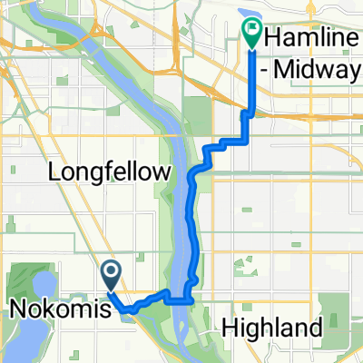
B2B00348 55417 > 55401 via Minnehaha
Un percorso ciclabile con partenza da Richfield, Minnesota, United States of America.
Panoramica
Su questo percorso
-
Take 38th Ave north to 54th St.
-
Take a right onto 54th St and cross Hiawatha.
Take a left onto Minnehaha Parkway.
-
Take Minnehaha Ave's bike lane northwest to Lake Street.
-
Cross Lake Street as Minnehaha Ave changes to 26th Ave S and continue north to 26th Street.
At this point you can either continue on 26th all the way through to Riverside and 26th. 26th is safe, but there is no bike lane. The route that is mapped is on more bike paths, as follows
-
Take a left onto 26th St. and look for the light rail trail bike path (which appears right before Hiawatha Ave).
-
Take a right onto the trail, and follow the path until it ends at 11th Avenue.
7. Take a left onto 11th, and follow the bike lane to 5th St.
8. Take a right onto 5th street. (note: 5th St is without a bike lane but traffic should be manageable. Also, veer to the left of the LRT once given the option to choose a side of the tracks).
9. Take 5th up to Marquette, and take a right into the bike lane.
10. Take Marquette to 4th St and your destination.
- -:--
- Durata
- 13 km
- Distanza
- 16 m
- Salita
- 14 m
- Discesa
- ---
- Velocità media
- 258 m
- Altitudine max.
Qualità del percorso
Tipi di percorsi e superfici lungo il percorso
Tipi di percorso
Pista ciclabile
3,9 km
(30 %)
Strada
3,4 km
(26 %)
Superfici
Asfaltato
6,7 km
(52 %)
Asfalto
5,1 km
(39 %)
Calcestruzzo
1,1 km
(8 %)
Continua con Bikemap
Usa, modifica o scarica questo percorso ciclabile
Vuoi percorrere B2B00348 55417 > 55401 via Minnehaha o personalizzarlo per il tuo viaggio? Ecco cosa puoi fare con questo percorso su Bikemap:
Funzionalità gratuite
- Salva questo percorso tra i preferiti o in una raccolta
- Copia e pianifica la tua versione di questo percorso
- Sincronizza il tuo percorso con Garmin o Wahoo
Funzionalità Premium
Prova gratuita di 3 giorni o pagamento una tantum. Scopri di più su Bikemap Premium.
- Naviga questo percorso su iOS e Android
- Esporta un file GPX / KML di questo percorso
- Crea la tua stampa personalizzata (provala gratis)
- Scarica questo percorso per la navigazione offline
Scopri altre funzionalità Premium.
Ottieni Bikemap PremiumDalla nostra community
Richfield: Altri percorsi popolari che iniziano qui
- B2B00001 55419 > 55416 via Lake Harriet, 38th, France
- Distanza
- 8,4 km
- Salita
- 75 m
- Discesa
- 76 m
- Posizione
- Richfield, Minnesota, United States of America
- the Bike & Bistro's premiere tour
- Distanza
- 6,7 km
- Salita
- 26 m
- Discesa
- 9 m
- Posizione
- Richfield, Minnesota, United States of America
- B2B00920 55407>55438 via Portland, Mnnha Pwy, Logan, Hylund Prk
- Distanza
- 23,7 km
- Salita
- 98 m
- Discesa
- 95 m
- Posizione
- Richfield, Minnesota, United States of America
- MoA - Grand Route - MoA
- Distanza
- 61,9 km
- Salita
- 156 m
- Discesa
- 158 m
- Posizione
- Richfield, Minnesota, United States of America
- 30 miler
- Distanza
- 48,5 km
- Salita
- 308 m
- Discesa
- 310 m
- Posizione
- Richfield, Minnesota, United States of America
- Day 1 Lag 3
- Distanza
- 106,3 km
- Salita
- 327 m
- Discesa
- 359 m
- Posizione
- Richfield, Minnesota, United States of America
- B2B00114 55409 >55414 via Park Ave and stone arch bridge
- Distanza
- 9 km
- Salita
- 48 m
- Discesa
- 57 m
- Posizione
- Richfield, Minnesota, United States of America
- B2B00042 55419 > 55422 via Greenway, Cedar Lake, and Theo Wirth
- Distanza
- 13,3 km
- Salita
- 61 m
- Discesa
- 59 m
- Posizione
- Richfield, Minnesota, United States of America
Aprila nell’app