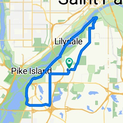
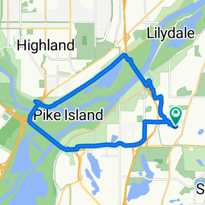
B2B00331 55417 > 55404 via Minnehaha
Un percorso ciclabile con partenza da Mendota Heights, Minnesota, Stati Uniti.
Panoramica
Su questo percorso
- Prendi la 54th St verso est fino a Minnehaha.
- Prendi la pista ciclabile della Minnehaha Ave verso nord-ovest fino a Lake Street.
- Attraversa Lake Street mentre la Minnehaha Ave cambia in 26th Ave S e continua a nord fino a 26th Street. A questo punto puoi continuare sulla 26th fino a Riverside e 26th. La 26th è sicura, ma non ha una corsia per biciclette. L'itinerario mappato è su più piste ciclabili, come segue
- Svolta a sinistra su 26th St e cerca il sentiero della light rail (che appare appena prima di Hiawatha Ave).
- Svolta a destra sul sentiero e segui il percorso fino a quando non termina a 11th Avenue.
- Svolta a sinistra su 11th e segui la corsia per biciclette fino a 5th St.
- Svolta a destra su 5th Street. (nota: la 5th St non ha una corsia per biciclette ma il traffico dovrebbe essere gestibile. Inoltre, devia a sinistra dal LRT una volta che hai l'opzione di scegliere un lato dei binari).
- Prendi la 5th fino a Portland e gira a sinistra nella corsia per biciclette.
- Prendi Portland fino a 15th St e gira a destra.
- Prendi 15th sopra il ponte fino al semaforo, dove puoi girare solo a sinistra (perché termina in un parcheggio).
- Gira a sinistra (su 16th St) e segui la curva a destra. Vedrai che il tuo primo giro a destra è 3rd Ave S.
- Svolta a destra su 3rd Ave S che ti porta alla tua destinazione. Nota: una volta che giri da Portland, non ci sono più corsie per biciclette su questo percorso, ma sfortunatamente non ci sono altre opzioni. Il traffico è solitamente gestibile in quest'area e ci sono spalle larghe. Un'altra opzione per il passo 12 è: Continua su 16th Street fino a Nicollet, gira a destra. Prendi Nicollet Ave fino a 12th St e gira lì nella corsia per biciclette.
- -:--
- Durata
- 12,5 km
- Distanza
- 15 m
- Salita
- 12 m
- Discesa
- ---
- Velocità media
- 257 m
- Altitudine max.
Qualità del percorso
Tipi di percorsi e superfici lungo il percorso
Tipi di percorso
Strada tranquilla
4,2 km
(34 %)
Strada
3 km
(24 %)
Superfici
Asfaltato
6,7 km
(54 %)
Asfalto
5,2 km
(42 %)
Pavimentato (non definito)
0,9 km
(7 %)
Continua con Bikemap
Usa, modifica o scarica questo percorso ciclabile
Vuoi percorrere B2B00331 55417 > 55404 via Minnehaha o personalizzarlo per il tuo viaggio? Ecco cosa puoi fare con questo percorso su Bikemap:
Funzionalità gratuite
- Salva questo percorso tra i preferiti o in una raccolta
- Copia e pianifica la tua versione di questo percorso
- Sincronizza il tuo percorso con Garmin o Wahoo
Funzionalità Premium
Prova gratuita di 3 giorni o pagamento una tantum. Scopri di più su Bikemap Premium.
- Naviga questo percorso su iOS e Android
- Esporta un file GPX / KML di questo percorso
- Crea la tua stampa personalizzata (provala gratis)
- Scarica questo percorso per la navigazione offline
Scopri altre funzionalità Premium.
Ottieni Bikemap PremiumDalla nostra community
Mendota Heights: Altri percorsi popolari che iniziano qui
 Up Ohio
- Distanza
- 25,2 km
- Salita
- 170 m
- Discesa
- 170 m
- Posizione
- Mendota Heights, Minnesota, Stati Uniti
 South Minnehaha Drive 4935-4925, Minneapolis to South Minnehaha Drive, Minneapolis
- Distanza
- 39,9 km
- Salita
- 10 m
- Discesa
- 3 m
- Posizione
- Mendota Heights, Minnesota, Stati Uniti
 Mississippi River Boulevard South 615-645 to Mississippi River Boulevard South 615-645
- Distanza
- 36,7 km
- Salita
- 152 m
- Discesa
- 145 m
- Posizione
- Mendota Heights, Minnesota, Stati Uniti
 Mostly flat Twin Cities trails ride
- Distanza
- 48,2 km
- Salita
- 176 m
- Discesa
- 176 m
- Posizione
- Mendota Heights, Minnesota, Stati Uniti
 Snail-like route in Mendota Heights
- Distanza
- 14 km
- Salita
- 325 m
- Discesa
- 325 m
- Posizione
- Mendota Heights, Minnesota, Stati Uniti
 Mendota to Calhoun
- Distanza
- 22 km
- Salita
- 171 m
- Discesa
- 132 m
- Posizione
- Mendota Heights, Minnesota, Stati Uniti
 Sibley Memorial Highway 1332, Mendota to West 26th Street 819, Minneapolis
- Distanza
- 17,3 km
- Salita
- 75 m
- Discesa
- 13 m
- Posizione
- Mendota Heights, Minnesota, Stati Uniti
 The Origin
- Distanza
- 28 km
- Salita
- 173 m
- Discesa
- 174 m
- Posizione
- Mendota Heights, Minnesota, Stati Uniti
Aprila nell’app

