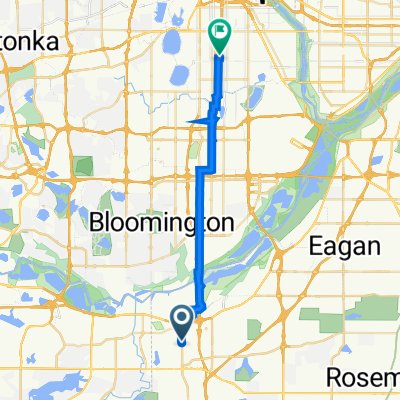
Black Dog Rd, Burnsville to Black Dog Rd, Burnsville
- 11,7 km
- 9 m
- 6 m
- Burnsville, Minnesota, Stati Uniti
Un percorso ciclabile con partenza da Burnsville, Minnesota, Stati Uniti.
Panoramica
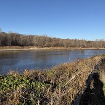
Questo percorso offre molte opzioni poiché la distanza è così lunga. Il percorso mappato si basa principalmente su piste ciclabili e sentieri. Pilot Knob ha percorsi su entrambi i lati della strada ma bisogna prestare attenzione poiché il percorso attraversa incroci e ingressi molto trafficati.
Il percorso continua attraverso Ft Snelling e sul Hiawatha Trail, dove pedalate praticamente accanto alla ferrovia leggera fino al centro città.
Se il traffico non è un problema, sarebbe possibile prendere Sibley Hwy (13) fino al ponte Mendota, ma dovreste fare affidamento su una spalla.
Un'altra opzione è prendere la ferrovia leggera dal ponte 494. Il passaggio termina in una cul-de-sac dove puoi accedere alla strada (E 80th/American Blvd) e seguire la strada fino a un semaforo. Se giri a sinistra su 34th Ave/Old Shakopee ci sarà un percorso per arrivare a una stazione della ferrovia leggera.
creato 17 anni fa
Punti salienti del percorso
494 path to light rail station
Continue on path to light rail station
Light Rail station
Continua con Bikemap
Vuoi percorrere B2B00357 55337>55403 via High Line Trl, Pilot Knob Rd, Mendota Bridge, Hiawatha Trl o personalizzarlo per il tuo viaggio? Ecco cosa puoi fare con questo percorso su Bikemap:
Prova gratuita di 3 giorni o pagamento una tantum. Scopri di più su Bikemap Premium.
Scopri altre funzionalità Premium.
Ottieni Bikemap PremiumDalla nostra community
Aprila nell’app