Templars, Germans & a Poet
Un percorso ciclabile con partenza da Barrowby, Inghilterra, Regno Unito.
Panoramica
Su questo percorso
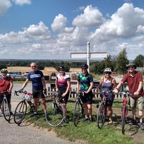
Visita al Preceptorio dei Cavalieri Templari a Temple Bruer e alle tombe di guerra di Scopwick. Non sono uno di quelli che si concentrano e macinano chilometri. Preferisco godere dell'ambiente circostante e cercare nuovi luoghi - mentre percorro chilometri. Oggi è stata una di quelle giornate. Avevamo in programma di visitare i resti del Preceptorio Templare a Temple Bruer. Dopo di che non c'era piano. Riconoscendo Scopwick come il luogo di riposo di John Gillespie Magee, il pilota di 19 anni della WW11 che scrisse la famosa poesia 'High Flight', ci siamo fermati per una visita. Mentre cercavamo la sua tomba, ci siamo imbattuti in un piccolo gruppo di tombe tedesche. Quattro di queste erano dell'equipaggio di un Dornier che ha effettuato un audace attacco aereo in solitaria su Lincoln. Dopo aver seminato morte e distruzione, ebbero la sfortuna di incontrare uno dei migliori della RAF, sotto forma di un Mosquito. Il conflitto ha visto il Mosquito gravemente danneggiato ma l'equipaggio è riuscito a farlo atterrare senza feriti, mentre i quattro membri dell'equipaggio del Dornier furono tutti uccisi dall'impatto della caduta vicino a Boothby Graffoe. È stata una corsa di 53 miglia, ma non sembrava così, principalmente a causa delle distrazioni.
- -:--
- Durata
- 84,4 km
- Distanza
- 422 m
- Salita
- 422 m
- Discesa
- ---
- Velocità media
- ---
- Altitudine max.
Qualità del percorso
Tipi di percorsi e superfici lungo il percorso
Tipi di percorso
Strada
22,8 km
(27 %)
Strada tranquilla
21,1 km
(25 %)
Superfici
Asfaltato
25,3 km
(30 %)
Asfalto
17,7 km
(21 %)
Pavimentato (non definito)
7,6 km
(9 %)
Non definito
59,1 km
(70 %)
Continua con Bikemap
Usa, modifica o scarica questo percorso ciclabile
Vuoi percorrere Templars, Germans & a Poet o personalizzarlo per il tuo viaggio? Ecco cosa puoi fare con questo percorso su Bikemap:
Funzionalità gratuite
- Salva questo percorso tra i preferiti o in una raccolta
- Copia e pianifica la tua versione di questo percorso
- Dividilo in tappe per creare un tour di più giorni
- Sincronizza il tuo percorso con Garmin o Wahoo
Funzionalità Premium
Prova gratuita di 3 giorni o pagamento una tantum. Scopri di più su Bikemap Premium.
- Naviga questo percorso su iOS e Android
- Esporta un file GPX / KML di questo percorso
- Crea la tua stampa personalizzata (provala gratis)
- Scarica questo percorso per la navigazione offline
Scopri altre funzionalità Premium.
Ottieni Bikemap PremiumDalla nostra community
Barrowby: Altri percorsi popolari che iniziano qui
 A Continental Century to Velo Verde
- Distanza
- 109,4 km
- Salita
- 577 m
- Discesa
- 590 m
- Posizione
- Barrowby, Inghilterra, Regno Unito
 Stretching the Legs to the Castle
- Distanza
- 39,6 km
- Salita
- 363 m
- Discesa
- 360 m
- Posizione
- Barrowby, Inghilterra, Regno Unito
 2017 Viking Challenge 50km Route
- Distanza
- 55,5 km
- Salita
- 440 m
- Discesa
- 438 m
- Posizione
- Barrowby, Inghilterra, Regno Unito
 Belvoir Sunday slouch
- Distanza
- 44,6 km
- Salita
- 207 m
- Discesa
- 205 m
- Posizione
- Barrowby, Inghilterra, Regno Unito
 Vale 42
- Distanza
- 67,1 km
- Salita
- 516 m
- Discesa
- 517 m
- Posizione
- Barrowby, Inghilterra, Regno Unito
 54 miles via Velo Verde
- Distanza
- 86,3 km
- Salita
- 481 m
- Discesa
- 490 m
- Posizione
- Barrowby, Inghilterra, Regno Unito
 Belvoir to Hickling
- Distanza
- 45,4 km
- Salita
- 294 m
- Discesa
- 293 m
- Posizione
- Barrowby, Inghilterra, Regno Unito
 Three Counties 50 miles
- Distanza
- 80,4 km
- Salita
- 466 m
- Discesa
- 466 m
- Posizione
- Barrowby, Inghilterra, Regno Unito
Aprila nell’app


