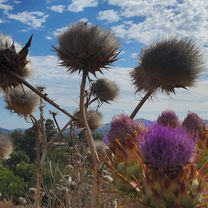
Garden Rd to 67
Un percorso ciclabile con partenza da Poway, California, Stati Uniti.
Panoramica
Su questo percorso
Sycamore Cyn Rd fino quasi a Scripps Poway Pkwy. Sono uscito dalla strada. Il mio obiettivo era fare MTB fino al 67 passando attraverso i numerosi sentieri. Circa due terzi in su in questo boschetto ho perso il sentiero a causa della nuova crescita delle piante. Ho preso il sentiero verso il tunnel del Pkwy (per gli animali), poi sono tornato indietro per circa 0,7 miglia passando oltre il boschetto. In realtà ho camminato attraverso il boschetto, ho anche attraversato il letto asciutto. Salendo la piccola collina. Per quanto ho cercato, non sono riuscito a trovare il sentiero. Puoi vedere dove ho deviato verso sud unendomi al Pkwy e salendo la 67 fino a Poway, PS. Non scendere Poway grade, molto pericoloso. Quasi nessuna spalla per la maggior parte della strada!
- -:--
- Durata
- 26,2 km
- Distanza
- 505 m
- Salita
- 505 m
- Discesa
- ---
- Velocità media
- ---
- Altitudine max.
Continua con Bikemap
Usa, modifica o scarica questo percorso ciclabile
Vuoi percorrere Garden Rd to 67 o personalizzarlo per il tuo viaggio? Ecco cosa puoi fare con questo percorso su Bikemap:
Funzionalità gratuite
- Salva questo percorso tra i preferiti o in una raccolta
- Copia e pianifica la tua versione di questo percorso
- Sincronizza il tuo percorso con Garmin o Wahoo
Funzionalità Premium
Prova gratuita di 3 giorni o pagamento una tantum. Scopri di più su Bikemap Premium.
- Naviga questo percorso su iOS e Android
- Esporta un file GPX / KML di questo percorso
- Crea la tua stampa personalizzata (provala gratis)
- Scarica questo percorso per la navigazione offline
Scopri altre funzionalità Premium.
Ottieni Bikemap PremiumDalla nostra community
Poway: Altri percorsi popolari che iniziano qui
 Oak Knoll Road 12223, Poway to Oak Knoll Road 12223, Poway
- Distanza
- 15,4 km
- Salita
- 219 m
- Discesa
- 220 m
- Posizione
- Poway, California, Stati Uniti
 Around Poway
- Distanza
- 41,7 km
- Salita
- 439 m
- Discesa
- 439 m
- Posizione
- Poway, California, Stati Uniti
 Creekview - around Blue Sky Canyon
- Distanza
- 52,6 km
- Salita
- 626 m
- Discesa
- 626 m
- Posizione
- Poway, California, Stati Uniti
 Poblado Road 10978, San Diego to Del Dios Hwy. & Bing Crosby Bl., Rancho Santa Fe
- Distanza
- 11,3 km
- Salita
- 188 m
- Discesa
- 283 m
- Posizione
- Poway, California, Stati Uniti
 Attempt Up Mt Woodson ~1.7 mi. From Top
- Distanza
- 12,2 km
- Salita
- 431 m
- Discesa
- 68 m
- Posizione
- Poway, California, Stati Uniti
 looks easy
- Distanza
- 13,1 km
- Salita
- 139 m
- Discesa
- 136 m
- Posizione
- Poway, California, Stati Uniti
 Pow Poway
- Distanza
- 82,3 km
- Salita
- 876 m
- Discesa
- 876 m
- Posizione
- Poway, California, Stati Uniti
 Vueltecita
- Distanza
- 50,9 km
- Salita
- 647 m
- Discesa
- 647 m
- Posizione
- Poway, California, Stati Uniti
Aprila nell’app

