

Route des Grand Alps in France
Un percorso ciclabile con partenza da Nizza, Provenza-Alpi-Costa Azzurra, Francia.
Panoramica
Su questo percorso
The Alps can be biked dozens of ways, new passes each time. This summer I felt bold. Once again I flew to Nice, but this time I intended to bike as close as possible to the Italian border, along the Route des Grandes Alpes. Weather was warm, blue skies, and I biked with all my belongings in just the front bag, so I was fast and nimble. This trip is a dream if you’re lucky with the weather.
I did Tour de France legends like Col de la Cayolle, Col de Vars, Col d’Izoard, Col du Galibier, Col du Télégraphe, Col de l’Iseran and finally Little St Bernard Pass into Italy. From there it would appear to be smooth sailing to the Aosta valley, but the final pass, Colle San Carlo in Italy was perhaps the toughest ever in my life. 10 km at a constant 10% with short stretches at 15%! I was forever slaloming up, to reduce the steepness of the road, and almost gave up.
The last stretch was grueling in a completely different way. It was hard head wind, and really hot, so I had to fight myself down (!) the valley to the city of Aosta. When I arrived my thighs were covered in wet blisters. There’s photographic evidence of the grimy mess, but trust me, you don’t want to see it.
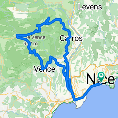
Please note: The route out of Nice is hand-drawn, I wouldn't trust it in real life.
- -:--
- Durata
- 510 km
- Distanza
- 21.336 m
- Salita
- 20.792 m
- Discesa
- ---
- Velocità media
- ---
- Altitudine max.

Continua con Bikemap
Usa, modifica o scarica questo percorso ciclabile
Vuoi percorrere Route des Grand Alps in France o personalizzarlo per il tuo viaggio? Ecco cosa puoi fare con questo percorso su Bikemap:
Funzionalità gratuite
- Salva questo percorso tra i preferiti o in una raccolta
- Copia e pianifica la tua versione di questo percorso
- Dividilo in tappe per creare un tour di più giorni
- Sincronizza il tuo percorso con Garmin o Wahoo
Funzionalità Premium
Prova gratuita di 3 giorni o pagamento una tantum. Scopri di più su Bikemap Premium.
- Naviga questo percorso su iOS e Android
- Esporta un file GPX / KML di questo percorso
- Crea la tua stampa personalizzata (provala gratis)
- Scarica questo percorso per la navigazione offline
Scopri altre funzionalità Premium.
Ottieni Bikemap PremiumDalla nostra community
Nizza: Altri percorsi popolari che iniziano qui
 Col de la Madone 74km
- Distanza
- 72,6 km
- Salita
- 1.515 m
- Discesa
- 1.516 m
- Posizione
- Nizza, Provenza-Alpi-Costa Azzurra, Francia
 Bummer-Tour , 215km straight 50km climbing + Roller-coaster
- Distanza
- 215,7 km
- Salita
- 3.494 m
- Discesa
- 3.494 m
- Posizione
- Nizza, Provenza-Alpi-Costa Azzurra, Francia
 EZF Nizza
- Distanza
- 25,8 km
- Salita
- 1.125 m
- Discesa
- 1.116 m
- Posizione
- Nizza, Provenza-Alpi-Costa Azzurra, Francia
 Nice-Castillon-Turini-Nice
- Distanza
- 141,7 km
- Salita
- 2.793 m
- Discesa
- 2.787 m
- Posizione
- Nizza, Provenza-Alpi-Costa Azzurra, Francia
 Nice Ventimiglia Sospel Nice - Escape from Tourrorism !
- Distanza
- 120,2 km
- Salita
- 1.562 m
- Discesa
- 1.561 m
- Posizione
- Nizza, Provenza-Alpi-Costa Azzurra, Francia
 Nice 70.3
- Distanza
- 93,5 km
- Salita
- 1.101 m
- Discesa
- 1.099 m
- Posizione
- Nizza, Provenza-Alpi-Costa Azzurra, Francia
 Florence1
- Distanza
- 474,5 km
- Salita
- 1.129 m
- Discesa
- 1.086 m
- Posizione
- Nizza, Provenza-Alpi-Costa Azzurra, Francia
 Nizza Cap D'Ail Moyenne Corniche 51 800
- Distanza
- 51 km
- Salita
- 876 m
- Discesa
- 875 m
- Posizione
- Nizza, Provenza-Alpi-Costa Azzurra, Francia
Aprila nell’app