
2013_North Cap
Kolekcja 13 tras rowerowych, utworzona przez Oschep Heinz.
Przegląd
O tej kolekcji
The North Cap Tour - has been a fantastic experience. Throughout the three weeks we have seen a lot of the “higher north”, enjoyed marvellous nature and interesting sightseeing places. Planning a cycling tour up to North Cap has some difficulties. North of the Arctic Circle there is just a limited number of streets. You would expect that in this remote areas might be less traffic, but that is not always so. To avoid the most annoying traffic you should not use “E” roads, sadly this is not possible on few occasions.
- 13
- Trasy
- -:--
- Czas
- 1562,3 km
- Dystans
- ---
- Śr. Prędkość
- 6238 m
- Przewyższenia
- 5968 m
- Spadek

2013_North Cap
Trasy w tej kolekcji
Wszystkie 13 trasy z tej kolekcji można otworzyć na mapie lub w aplikacji Bikemap, aby uzyskać więcej informacji. Możesz je dostosować w planerze tras lub pobrać jako plik GPX lub KML. Użyj ich jako szablonu do planowania własnych przejazdów lub pozwól Bikemap prowadzić cię bezpośrednio.

Lulea - Kalix
Trasa rowerowa w Luleå, Norrbotten, Szwecja
- 101,7 km
- Dystans
- 167 m
- Przewyższenia
- 168 m
- Spadek

Kalix - Ylitornio
Trasa rowerowa w Rolfs, Norrbotten, Szwecja
- 95 km
- Dystans
- 421 m
- Przewyższenia
- 378 m
- Spadek

Ylitornio - Rovaniemi
Trasa rowerowa w Ylitornio, Laponia, Finlandia
- 120,2 km
- Dystans
- 315 m
- Przewyższenia
- 264 m
- Spadek

Rovaniemi - Raudanjoki
Trasa rowerowa w Rovaniemi, Laponia, Finlandia
- 99,4 km
- Dystans
- 409 m
- Przewyższenia
- 310 m
- Spadek

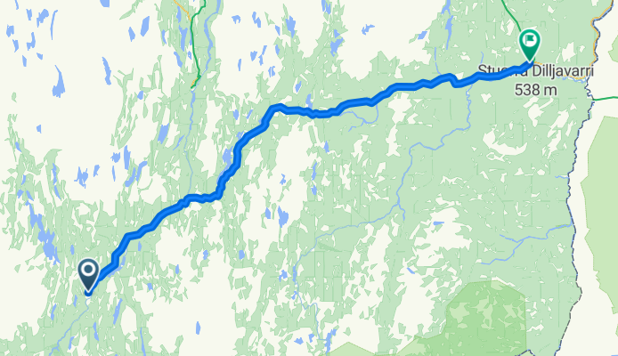
Raudanjoki - Kittila
Trasa rowerowa w
- 170,5 km
- Dystans
- 280 m
- Przewyższenia
- 308 m
- Spadek

Kittila - Enontekio
Trasa rowerowa w Kittilä, Laponia, Finlandia
- 142,6 km
- Dystans
- 269 m
- Przewyższenia
- 141 m
- Spadek

Enontekio - Kautokeino
Trasa rowerowa w Enontekiö, Laponia, Finlandia
- 84,4 km
- Dystans
- 286 m
- Przewyższenia
- 259 m
- Spadek
Kautokeion - Karasjok
Trasa rowerowa w Guovdageaidnu Kautokeino, Finnmark, Norwegia
- 127,6 km
- Dystans
- 328 m
- Przewyższenia
- 510 m
- Spadek

Karasjok - Olderfjord
Trasa rowerowa w Kárášjohka, Finnmark, Norwegia
- 139,4 km
- Dystans
- 504 m
- Przewyższenia
- 641 m
- Spadek

Olderfjord - Honnigvag
Trasa rowerowa w
- 103,5 km
- Dystans
- 1121 m
- Przewyższenia
- 1199 m
- Spadek

Harstad - Riksgränsen
Trasa rowerowa w Harstad, Troms, Norwegia
- 155,1 km
- Dystans
- 1372 m
- Przewyższenia
- 876 m
- Spadek

Riksgränsen - Kiruna
Trasa rowerowa w
- 136,2 km
- Dystans
- 512 m
- Przewyższenia
- 475 m
- Spadek