
Routes around Le Peyrat
Wyprawa rowerowa z 11 etapów, rozpoczynająca się w Bélesta, Occitanie, Francja.
Przegląd
O tej trasie
Wszystkie lokalne trasy z moich tylnych drzwi
- 11
- Trasy
- 10 h 10 min
- Czas
- 788,2 km
- Dystans
- 77,5 km/h
- Śr. Prędkość
- 11 228 m
- Przewyższenia
- 11 216 m
- Spadek

utworzono 8 lat temu temu
Routes around Le Peyrat
Etapy tej wycieczki
Wszystkie 11 etapy tej wycieczki można otworzyć na mapie lub w aplikacji Bikemap, aby uzyskać więcej szczegółów, gdzie możesz dostosować je w planerze tras lub pobrać jako plik GPX lub KML. Wykorzystaj je jako szablon do planowania własnej wycieczki lub pozwól Bikemap prowadzić Cię bezpośrednio po nich.

Col du Montsegur et Col de la Lauze
Trasa rowerowa w Bélesta, Occitanie, Francja
- 80 km
- Dystans
- 1201 m
- Przewyższenia
- 1203 m
- Spadek

Montsegur
Trasa rowerowa w Bélesta, Occitanie, Francja
- 54 km
- Dystans
- 869 m
- Przewyższenia
- 862 m
- Spadek

Le Peyrat - Espezel
Trasa rowerowa w Bélesta, Occitanie, Francja
- 53,8 km
- Dystans
- 684 m
- Przewyższenia
- 684 m
- Spadek

44k Le Peyrat-Chalabre-Col du Tuquet - Puivert
Trasa rowerowa w Bélesta, Occitanie, Francja
- 44,3 km
- Dystans
- 612 m
- Przewyższenia
- 615 m
- Spadek

Le Bete
Trasa rowerowa w Bélesta, Occitanie, Francja
- 139,5 km
- Dystans
- 1898 m
- Przewyższenia
- 1896 m
- Spadek

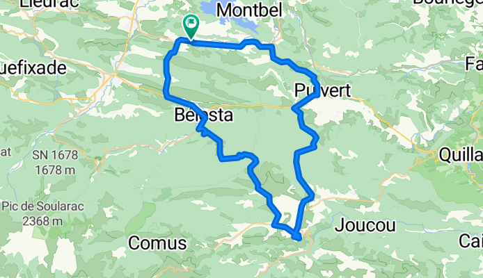
Around Montbel
Trasa rowerowa w Bélesta, Occitanie, Francja
- 26,9 km
- Dystans
- 474 m
- Przewyższenia
- 475 m
- Spadek

Le Peyrat - Roquefuil- Camurac- Ezpezel
Trasa rowerowa w Bélesta, Occitanie, Francja
- 79,5 km
- Dystans
- 1175 m
- Przewyższenia
- 1175 m
- Spadek


Le Peyrat-Espezel-Puivert 50k
Trasa rowerowa w Bélesta, Occitanie, Francja
- 56,2 km
- Dystans
- 635 m
- Przewyższenia
- 632 m
- Spadek


Le Peyrat - Col du Pradel
Trasa rowerowa w Bélesta, Occitanie, Francja
- 108,3 km
- Dystans
- 1823 m
- Przewyższenia
- 1823 m
- Spadek

Chalabre-Puivert-Espezel
Trasa rowerowa w Bélesta, Occitanie, Francja
- 72,2 km
- Dystans
- 982 m
- Przewyższenia
- 976 m
- Spadek

Le Peyrat - Esperaza - Le Peyrat
Trasa rowerowa w Bélesta, Occitanie, Francja
- 73,5 km
- Dystans
- 875 m
- Przewyższenia
- 875 m
- Spadek