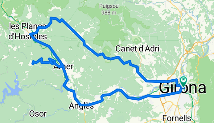
Girona
Wyprawa rowerowa z 3 etapami, rozpoczynająca się w Girona, Catalonia, Spain.
Przegląd
O tej trasie
Ta wycieczka rowerowa ma 3 etapy i łączną długość 235,5 km.
- 3
- Trasy
- -:--
- Czas
- 235,5 km
- Dystans
- ---
- Śr. Prędkość
- 3792 m
- Przewyższenia
- 3689 m
- Spadek
Girona
Etapy tej wycieczki
Wszystkie 3 etapy tej wycieczki można otworzyć na mapie lub w aplikacji Bikemap, aby uzyskać więcej szczegółów, gdzie możesz dostosować je w planerze tras lub pobrać jako plik GPX lub KML. Wykorzystaj je jako szablon do planowania własnej wycieczki lub pozwól Bikemap prowadzić Cię bezpośrednio po nich.
Sant Marti Sacalm
Trasa rowerowa w Girona, Catalonia, Spain
A fast large loop with a long smooth gentle climb to Sant Esteve de Llemena, a steeper 3-4km climb to Les Encies and a fast descent heading back South to Amer. You can continue all the way back to Girona on the C63 (which can have a steady flow of traffic though the road is nice and wide) but the climb up to Sant Marti Sacalm is not to be missed if the legs are good. Take the right turn for Mas Llunes just after Angles if you want a quieter road home (see Les Serres route).
- 85,4 km
- Dystans
- 1633 m
- Przewyższenia
- 1601 m
- Spadek
Els Angels
Trasa rowerowa w Girona, Catalonia, Spain
The famous climb to Els Angels from the Girona side. Take care on the bumpy descent from the Angel to Madremanya. After that, its a lovely smooth ride through the Girona countryside, and a fantastic smooth climb to Santa Pellaia (or 'Hincapie Hill'). If you`re fit have some fun with race simulation in the 53-12 (!) then its a relatively fast descent to Cassa de la Selva and back home to Girona.
- 60,9 km
- Dystans
- 1279 m
- Przewyższenia
- 1267 m
- Spadek
Girona - La Bisbal d'E - Cassà intent d'imitar IM
Trasa rowerowa w Girona, Catalonia, Spain
- 89,2 km
- Dystans
- 880 m
- Przewyższenia
- 821 m
- Spadek


