Bike Across Canada Route Network

Bike Across Canada Route Network

Kolekcja 118 tras rowerowych, utworzona przez Trans Canada Bike Route.

Przegląd

O tej kolekcji

You can download the full GPX file of the network here https://www.facebook.com/groups/bikeacrosscanada/permalink/1909719059097371/

118
Trasy
-:--
Czas
10 577,4 km
Dystans
---
Śr. Prędkość
34 230 m
Przewyższenia
34 942 m
Spadek
Trans Canada Bike Route

utworzono 7 lat temu temu

Bike Across Canada Route Network

Trasy w tej kolekcji

Wszystkie 118 trasy z tej kolekcji można otworzyć na mapie lub w aplikacji Bikemap, aby uzyskać więcej informacji. Możesz je dostosować w planerze tras lub pobrać jako plik GPX lub KML. Użyj ich jako szablonu do planowania własnych przejazdów lub pozwól Bikemap prowadzić cię bezpośrednio.

1of12 BC - 13a Cranbrook, BC to Fernie, BC (Raging Elk Hostel) 103km
Rower szosowyRower górskiRower miejskiUtwardzony
Trans Canada Bike Route
1

1of12 BC - 13a Cranbrook, BC to Fernie, BC (Raging Elk Hostel) 103km

Trasa rowerowa w Cranbrook, British Columbia, Canada

1of12 BC - 13a Cranbrook, BC to Fernie, BC (Raging Elk Hostel) 103km 1of12 BC - British Columbia Bike Across Canada Route Network & GPS tracks https://drive.google.com/open?id=1yniizksmYYqJy32SYCbf5LMZyZk&usp=sharing
102,6 km
Dystans
379 m
Przewyższenia
297 m
Spadek
1of12 BC - 12a Creston, BC to Cranbrook, BC (Mount Baker RV Park & Tenting) 108km
Rower szosowyRower górskiRower miejskiUtwardzony
Trans Canada Bike Route
0

1of12 BC - 12a Creston, BC to Cranbrook, BC (Mount Baker RV Park & Tenting) 108km

Trasa rowerowa w Creston, British Columbia, Canada

1of12 BC - 12a Creston, BC to Cranbrook, BC (Mount Baker RV Park & Tenting) 108km 1of12 BC - British Columbia Bike Across Canada Route Network & GPS tracks https://drive.google.com/open?id=1yniizksmYYqJy32SYCbf5LMZyZk&usp=sharing
108,5 km
Dystans
606 m
Przewyższenia
272 m
Spadek
1of12 BC - 03e Hope, BC to Boston Bar, BC (Canyon Alpine RV Park and Campground) 73km
Rower szosowyRower górskiRower miejskiUtwardzony
Trans Canada Bike Route
0

1of12 BC - 03e Hope, BC to Boston Bar, BC (Canyon Alpine RV Park and Campground) 73km

Trasa rowerowa w

1of12 BC - 03e Hope, BC to Boston Bar, BC (Canyon Alpine RV Park and Campground) 73km  ---  Copyright Creative Commons - Attribution (please do share this work, just source back to where it came from)
77,1 km
Dystans
690 m
Przewyższenia
564 m
Spadek
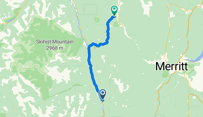
1of12 BC - 04e Boston Bar, BC to Spences Bridge, BC (Acacia Grove RV Park & Cabins) 77km
Rower szosowyRower górskiRower miejski
Trans Canada Bike Route
0

1of12 BC - 04e Boston Bar, BC to Spences Bridge, BC (Acacia Grove RV Park & Cabins) 77km

Trasa rowerowa w

1of12 BC - 04e Boston Bar, BC to Spences Bridge, BC (Acacia Grove RV Park & Cabins) 77km ---  Copyright Creative Commons - Attribution (please do share this work, just source back to where it came from)
77 km
Dystans
796 m
Przewyższenia
760 m
Spadek
1of12 BC - 05e Spences Bridge, BC to Cache Creek, BC (Brookside Campsite) 49km
Rower szosowyRower górskiRower miejski
Trans Canada Bike Route
0

1of12 BC - 05e Spences Bridge, BC to Cache Creek, BC (Brookside Campsite) 49km

Trasa rowerowa w

1of12 BC - 05e Spences Bridge, BC to Cache Creek, BC (Brookside Campsite) 49km ---  Copyright Creative Commons - Attribution (please do share this work, just source back to where it came from)
48,8 km
Dystans
495 m
Przewyższenia
228 m
Spadek
1of12 BC - 06e Cache Creek, BC to Kamloops, BC (Silver Sage Trailer Park) 87km
Rower szosowyRower górskiRower miejskiUtwardzony
Trans Canada Bike Route
0

1of12 BC - 06e Cache Creek, BC to Kamloops, BC (Silver Sage Trailer Park) 87km

Trasa rowerowa w Cache Creek, British Columbia, Canada

1of12 BC - 06e Cache Creek, BC to Kamloops, BC (Silver Sage Trailer Park) 87km ---  Copyright Creative Commons - Attribution (please do share this work, just source back to where it came from)
86,9 km
Dystans
836 m
Przewyższenia
990 m
Spadek
1of12 BC - 07e Kamloops, BC to Salmon Arm, BC (Pierre's Point Campground) 102km
Rower szosowyRower górskiRower miejskiUtwardzony
Trans Canada Bike Route
2

1of12 BC - 07e Kamloops, BC to Salmon Arm, BC (Pierre's Point Campground) 102km

Trasa rowerowa w Kamloops, British Columbia, Canada

1of12 BC - 07e Kamloops, BC to Salmon Arm, BC (Pierre's Point Campground) 102km ---  Copyright Creative Commons - Attribution (please do share this work, just source back to where it came from)
102,2 km
Dystans
442 m
Przewyższenia
429 m
Spadek
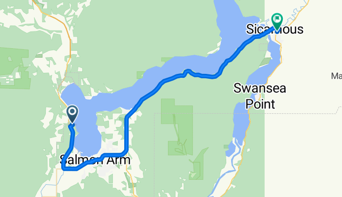
1of12 BC - 08e Salmon Arm, BC to Sicamous, BC (Paradise Motel) 41km
Rower szosowyRower górskiRower miejski
Trans Canada Bike Route
1

1of12 BC - 08e Salmon Arm, BC to Sicamous, BC (Paradise Motel) 41km

Trasa rowerowa w Salmon Arm, British Columbia, Canada

1of12 BC - 08e Salmon Arm, BC to Sicamous, BC (Paradise Motel) 41km ---  Copyright Creative Commons - Attribution (please do share this work, just source back to where it came from)
40,6 km
Dystans
384 m
Przewyższenia
390 m
Spadek
6of12 SouthCentralON - 05a South Baymouth, ON to Owen Sound, ON (Kelso Beach Campground) + ferry 154km
Rower szosowyRower górskiRower miejskiUtwardzony
Trans Canada Bike Route
1

6of12 SouthCentralON - 05a South Baymouth, ON to Owen Sound, ON (Kelso Beach Campground) + ferry 154km

Trasa rowerowa w

6of12 SouthCentralON - 05a South Baymouth, ON to Owen Sound, ON (Kelso Beach Campground) + ferry 154km ---  Copyright Creative Commons - Attribution (please do share this work, just source back to where it came from)
154,7 km
Dystans
194 m
Przewyższenia
196 m
Spadek
6of12 SouthCentralON - 06a Owen Sound, ON to Orangeville, ON (Orangeville Motel) 110km
Rower szosowyRower górskiRower miejskiUtwardzony
Trans Canada Bike Route
2

6of12 SouthCentralON - 06a Owen Sound, ON to Orangeville, ON (Orangeville Motel) 110km

Trasa rowerowa w Owen Sound, Ontario, Canada

6of12 SouthCentralON - 06a Owen Sound, ON to Orangeville, ON (Orangeville Motel) 110km ---  Copyright Creative Commons - Attribution (please do share this work, just source back to where it came from)
110,4 km
Dystans
453 m
Przewyższenia
213 m
Spadek
6of12 SouthCentralON - 07a Orangeville, ON to Brampton, ON (Indian Line Campground) 55km
Rower szosowyRower górskiRower miejskiUtwardzony
Trans Canada Bike Route
1

6of12 SouthCentralON - 07a Orangeville, ON to Brampton, ON (Indian Line Campground) 55km

Trasa rowerowa w Orangeville, Ontario, Canada

6of12 SouthCentralON - 07a Orangeville, ON to Brampton, ON (Indian Line Campground) 55km ---  Copyright Creative Commons - Attribution (please do share this work, just source back to where it came from)
54,9 km
Dystans
90 m
Przewyższenia
343 m
Spadek
6of12 SouthCentralON - 8a Brampton, ON to Scarborough, ON (Glen Rouge Campground) 73km
Rower szosowyRower górskiRower miejskiUtwardzony
Trans Canada Bike Route
1

6of12 SouthCentralON - 8a Brampton, ON to Scarborough, ON (Glen Rouge Campground) 73km

Trasa rowerowa w Etobicoke, Ontario, Canada

6of12 SouthCentralON - 8a Brampton, ON to Scarborough, ON (Glen Rouge Campground) 73km ---  Copyright Creative Commons - Attribution (please do share this work, just source back to where it came from)
73,3 km
Dystans
200 m
Przewyższenia
280 m
Spadek