
Fife
Wyprawa rowerowa z 4 etapami, rozpoczynająca się w Ceres, Szkocja, Zjednoczone Królestwo Wielkiej Brytanii.
Przegląd
O tej trasie
Ta wycieczka rowerowa ma 4 etapy i łączną długość 219,7 km.
- 4
- Trasy
- -:--
- Czas
- 219,7 km
- Dystans
- ---
- Śr. Prędkość
- 1624 m
- Przewyższenia
- 1625 m
- Spadek

utworzono 7 lat temu temu
Fife
Etapy tej wycieczki
Wszystkie 4 etapy tej wycieczki można otworzyć na mapie lub w aplikacji Bikemap, aby uzyskać więcej szczegółów, gdzie możesz dostosować je w planerze tras lub pobrać jako plik GPX lub KML. Wykorzystaj je jako szablon do planowania własnej wycieczki lub pozwól Bikemap prowadzić Cię bezpośrednio po nich.


Ceres - Pittenweem - Anstruther loop
Trasa rowerowa w Ceres, Szkocja, Zjednoczone Królestwo Wielkiej Brytanii
- 54,9 km
- Dystans
- 431 m
- Przewyższenia
- 432 m
- Spadek


Ceres - Tay shore - Tentsmuir - Leuchars
Trasa rowerowa w Ceres, Szkocja, Zjednoczone Królestwo Wielkiej Brytanii
- 65,4 km
- Dystans
- 445 m
- Przewyższenia
- 446 m
- Spadek

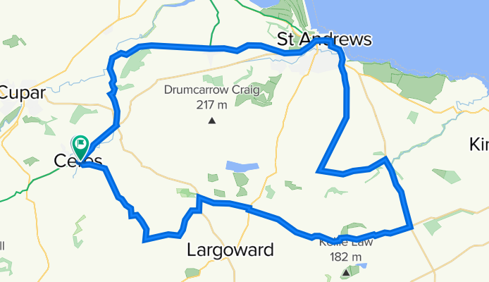
Ceres - St Andrews - Peat Inn circular
Trasa rowerowa w Ceres, Szkocja, Zjednoczone Królestwo Wielkiej Brytanii
- 46,7 km
- Dystans
- 393 m
- Przewyższenia
- 392 m
- Spadek


Ceres - Falkland - Auchtermuchty - Ladybank - Cupar
Trasa rowerowa w Ceres, Szkocja, Zjednoczone Królestwo Wielkiej Brytanii
- 52,8 km
- Dystans
- 355 m
- Przewyższenia
- 355 m
- Spadek