Kreta
Wyprawa rowerowa z 6 etapów, rozpoczynająca się w Agía Marína, Crete, Grecja.
Przegląd
O tej trasie
Ta wycieczka rowerowa ma 6 etapów i łączną długość 599,5 km.
- 6
- Trasy
- -:--
- Czas
- 599,5 km
- Dystans
- ---
- Śr. Prędkość
- 8385 m
- Przewyższenia
- 8372 m
- Spadek
Cato Steinsvåg
utworzono 6 lat temu temu
Kreta
Etapy tej wycieczki
Wszystkie 6 etapy tej wycieczki można otworzyć na mapie lub w aplikacji Bikemap, aby uzyskać więcej szczegółów, gdzie możesz dostosować je w planerze tras lub pobrać jako plik GPX lub KML. Wykorzystaj je jako szablon do planowania własnej wycieczki lub pozwól Bikemap prowadzić Cię bezpośrednio po nich.
Kreta-Platanias-Omalos-Platanias
Trasa rowerowa w Agía Marína, Crete, Grecja
- 83,2 km
- Dystans
- 1240 m
- Przewyższenia
- 1243 m
- Spadek
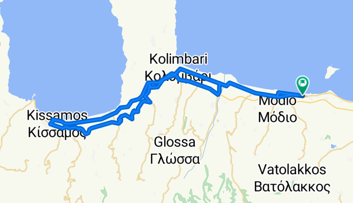
Platanias - Kissamos 11.8.2010
Trasa rowerowa w Agía Marína, Crete, Grecja
Nice ride via old road to Kissamos through small villages and olive trees. A couple of short 10 degree gradients, mostly 4-5 degrees. Back via National Road, longish rise 5+ degrees but easier than the old road.
- 58,9 km
- Dystans
- 382 m
- Przewyższenia
- 382 m
- Spadek
Chania Krozna 150k
Trasa rowerowa w Agía Marína, Crete, Grecja
Chnia kroźna 150 km
- 149,3 km
- Dystans
- 2054 m
- Przewyższenia
- 2045 m
- Spadek
Fournes 20k-5p
Trasa rowerowa w Agía Marína, Crete, Grecja
Fournes-Omalos 20 km 5%
- 126,2 km
- Dystans
- 1905 m
- Przewyższenia
- 1898 m
- Spadek
K Agia M-Fournes-Zourva-Ramni-H-AM
Trasa rowerowa w Agía Marína, Crete, Grecja
- 93,5 km
- Dystans
- 1572 m
- Przewyższenia
- 1572 m
- Spadek
Omalos plateau round - Hellasbikes.org recomended
Trasa rowerowa w Agía Marína, Crete, Grecja
88-kilometrowa wycieczka z przewyższeniem około 1500 m. Trasza, którą wybrałem, była najłatwiejsza. Najdłuższe podjazdy, ale o stałym nachyleniu. Najtrudniejsza część jest tam, gdzie skręcasz w lewo przy wiatrakach na górze w kierunku Omalos na płaskowyżu. Wciąż jest trochę podjazdu, więc nie ściga…
- 88,3 km
- Dystans
- 1232 m
- Przewyższenia
- 1232 m
- Spadek


