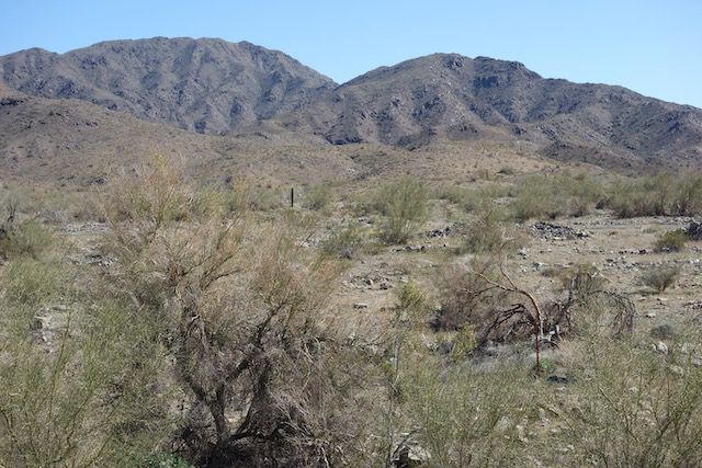
SW U.S.

SW U.S.

Wyprawa rowerowa z 11 etapów, rozpoczynająca się w Campo, California, United States of America.

Przegląd

O tej trasie

Ta wycieczka rowerowa ma 11 etapów i łączną długość 898,8 km.

11
Trasy
-:--
Czas
898,8 km
Dystans
---
Śr. Prędkość
4050 m
Przewyższenia
3396 m
Spadek
Jeff Kadet
Jeff Kadet

utworzono 5 lat temu temu

SW U.S.

Etapy tej wycieczki

Wszystkie 11 etapy tej wycieczki można otworzyć na mapie lub w aplikacji Bikemap, aby uzyskać więcej szczegółów, gdzie możesz dostosować je w planerze tras lub pobrać jako plik GPX lub KML. Wykorzystaj je jako szablon do planowania własnej wycieczki lub pozwól Bikemap prowadzić Cię bezpośrednio po nich.

2020 SW US Tour - Boulevard to Brawley - Ride Day 3
Rower szosowyUtwardzony
Jeff Kadet
0

2020 SW US Tour - Boulevard to Brawley - Ride Day 3

Trasa rowerowa w Campo, California, United States of America

This was a heck of a ride on a variety of roads. First, the portion on Old Highway 80 was great. Not the smoothest road surface, but almost zero traffic. Second, on Interstate 8, there was an outstanding and very wide road shoulder for bicycles. This was a heck of a downhill at 6% over 7 miles. We dropped from over 3000 to below 1000. Third, of the 30+ miles on CA 98, the first 20+ had excellent very wide shoulder. The last 10 miles into Calexico had narrower shoulder, but still a little for most of it. In addition to dropping to sea level, we were helped along by an almost gale force tailwind. This was a fast section. Fourth…and sadly, when we turned north on CA 111, we were heading into the wind. This was a very slow portion of the ride. Excellent and wide road shoulder the entire way to Brawley.
130,6 km
Dystans
178 m
Przewyższenia
1272 m
Spadek
2020 SW US Tour - El Cajon to Boulevard - Ride Day 2
Rower szosowyUtwardzony
Jeff Kadet
3

2020 SW US Tour - El Cajon to Boulevard - Ride Day 2

Trasa rowerowa w Bostonia, California, United States of America

This was one of our hardest rides ever. We had relative heat in the first half of the ride and devoured the heat tablets we use in our water bottles like they were candy. And the climbing felt never ending. For the first time in my memory since Japan in the early 90s, I had some muscle cramping. Fortunately, for the most part, the legs worked OK. Heck of a ride. Highway 94 was great mostly scenic road. The first half or so, though, had too much traffic. Later, after Campo, it was a great low traffic road. Overall, 94 had good shoulder maybe half the time. On the long climb to Potrero, there was less shoulder than we would have desired.
88,8 km
Dystans
1542 m
Przewyższenia
589 m
Spadek
2020 SW US Tour - San Diego to El Cajon - Ride Day 1
Rower szosowyUtwardzony
Jeff Kadet
1

2020 SW US Tour - San Diego to El Cajon - Ride Day 1

Trasa rowerowa w San Diego, California, United States of America

This is the first day of our tour that will hopefully, if we survive it, get us from San Diego to Austin Tx, and maybe elsewhere. For almost the entire ride, we were on either bicycle path or heavily trafficked roads with bike lanes. So, all things considered, not a bad way to ride through a major city. One hill on Texas St was terribly steep. We had to push our heavily ladened bikes up the last few hundred meters. Character building. Due to the fact that we went first to the wrong hotel, we added a few additional kilometers to our ride total for the day. This accounts for our slightly triangular ride. One other comment. We got to our San Diego starting point via Amtrak. While the train ride was long, using the train to easily carry along our bicycles was a relative pleasure.
30,6 km
Dystans
285 m
Przewyższenia
152 m
Spadek
1

2020 SW US Tour - Brawley to Blyth - Ride Day 4

Trasa rowerowa w Brawley, California, United States of America

This was a marathon 90 mile ride through beautful countryside. Much of the road had excellent shoulder, but there was a reasonably long section in the middle that had little or no shoulder. The ride went thorugh agricultural areas, sand dunes, and beautiful desert. As there's not much between Brawley and Blyth, bring plenty of water. There are stores in Glamis and Palo Verde where one can buy water, but don't depend on them to be open.
142,9 km
Dystans
347 m
Przewyższenia
266 m
Spadek
0

2020 SW US Tour - Blyth to Quartzsite - Ride Day 5

Trasa rowerowa w Blythe, California, United States of America

Much of this short ride section was on the shoulder of I-10. Noisy, buy not bad...except that we had a gail force side wind for the first few miles. Very scenic countryside after crossing the Colorado River into Arizona..
35,2 km
Dystans
294 m
Przewyższenia
86 m
Spadek
2020 SW US Tour - Quartzsite to Salome - Ride Day 6
Rower szosowyUtwardzony
Jeff Kadet
0

2020 SW US Tour - Quartzsite to Salome - Ride Day 6

Trasa rowerowa w Quartzsite, Arizona, United States of America

Today’s ride was a relative pleasure given the side and slightly head winds, which were relatively gentle compared to what we’ve been experiencing in the past few days. The route for the first ten miles or so was particularly noisy as we were on the I-10 wide shoulder with all the traffic and big trucks that that means. After that, we were on US 60 which was much less traffic. Up until Hope, there was wide shoulder, but it was a bit bumpy a lot of the time. After Hope, the shoulder narrowed a little, but it was much smoother. Overall, an acceptable route with very nice scenery.
64,8 km
Dystans
502 m
Przewyższenia
222 m
Spadek
2020 SW US Tour - Salome to Wickenburg - Ride Day 7
Rower szosowyUtwardzony
Jeff Kadet
0

2020 SW US Tour - Salome to Wickenburg - Ride Day 7

Trasa rowerowa w Salome, Arizona, United States of America

We rode through a lot of very flat desert countryside today, with the only really apparent ups and downs being the last portion of the ride a little up and then a little down into Wickenburg. Virtually all of the route had good shoulder, though a lot of the route also had relatively rough gritty payment. Along the way, I picked up what appeared to be the end of a staple, which gave me my first flat tire of the trip. It was easily fixed. Wickenburg has a very big footprint lasting maybe six or seven miles along Route 60. While traffic was sporatic before Wickenburg, it was heavy after Wickenburg.
88,9 km
Dystans
256 m
Przewyższenia
203 m
Spadek
2020 SW US Tour - Wickenburg to Peoria - Ride Day 8
Rower szosowyUtwardzony
Jeff Kadet
0

2020 SW US Tour - Wickenburg to Peoria - Ride Day 8

Trasa rowerowa w Wickenburg, Arizona, United States of America

All riding today had good should except for the last mile or so. US 60 east of Wickenburg was very heavy traffic, but with the good shoulder, it was not a problem; only noisy. AZ 74 was much better with good shoulder and relatively little traffic. Getting onto Lake Pleasant Parkway in Peoria, there was outstanding bicycle lanes almost the entire time. Excellent cycling infrastructure.
76,8 km
Dystans
171 m
Przewyższenia
420 m
Spadek
2020 SW US Tour - Peoria to Scottsdale - Ride Day 9
Rower szosowyUtwardzony
Jeff Kadet
1

2020 SW US Tour - Peoria to Scottsdale - Ride Day 9

Trasa rowerowa w Peoria, Arizona, United States of America

This was a short easy ride with great cycling path and bike lanes within the Phoenix metropolitan area. The first ten miles or so was on excellent cycling path along an irrigation canal. After that, we were pretty much only on roads with very well-marked bike lanes.
38,2 km
Dystans
101 m
Przewyższenia
26 m
Spadek
2020 SW US Tour - Scottsdale to Casa Grande - Ride Day 10
Rower szosowyUtwardzony
Jeff Kadet
0

2020 SW US Tour - Scottsdale to Casa Grande - Ride Day 10

Trasa rowerowa w Paradise Valley, Arizona, United States of America

The first 37 miles of this ride were on urban streets or cycling paths. Only when going onto AZ-87 did we finally get into some countryside. The roads and cycling paths were excellent in the urban areas. Only the first three miles or so of Scottsdale Road had no bike lane. The cycling paths weren't marked well, but mostly the quality was great. AZ-87 had a wide shoulder, but it was relatively bumpy. When we turned onto AZ-187, there was no shoulder. With the light traffic, though, it wasn't bad. Overall, a great ride. Just a lot of headwind.
109,8 km
Dystans
139 m
Przewyższenia
160 m
Spadek
2020 SW US Tour - Casa Grande to Tucson - Ride Day 11
Rower szosowyUtwardzony
Jeff Kadet
2

2020 SW US Tour - Casa Grande to Tucson - Ride Day 11

Trasa rowerowa w Casa Grande, Arizona, United States of America

Today's ride was full of stiff headwinds. Much of the ride was also along the frontage road that runs along I-10. It was a great route for trying to ride to Tucson with the least mileage. However, if one has more time and a desire for a better and more scenic route, then one should look for an alternative. The first couple of miles on the frontage road from Casa Grande south to Jimmie Kerr Blvd were unpaved.
92,2 km
Dystans
235 m
Przewyższenia
0 m
Spadek