
Aug/Sep 2020+2021 local rides
Kolekcja 12 tras rowerowych, utworzona przez puddock.
Przegląd
O tej kolekcji
Menu lokalnych tras do wyboru
- 12
- Trasy
- -:--
- Czas
- 798,3 km
- Dystans
- ---
- Śr. Prędkość
- 5906 m
- Przewyższenia
- 5910 m
- Spadek

utworzono 5 lat temu temu
Aug/Sep 2020+2021 local rides
Trasy w tej kolekcji
Wszystkie 12 trasy z tej kolekcji można otworzyć na mapie lub w aplikacji Bikemap, aby uzyskać więcej informacji. Możesz je dostosować w planerze tras lub pobrać jako plik GPX lub KML. Użyj ich jako szablonu do planowania własnych przejazdów lub pozwól Bikemap prowadzić cię bezpośrednio.

Route 1 Adlington to Wildboarclough loop. 26 miles, hilly
Trasa rowerowa w Adlington, Anglia, Zjednoczone Królestwo Wielkiej Brytanii
- 41,9 km
- Dystans
- 639 m
- Przewyższenia
- 639 m
- Spadek

Route 2 Parsley Hay circular via Monsal Trail and High Peak Trail
Trasa rowerowa w Bakewell, Anglia, Zjednoczone Królestwo Wielkiej Brytanii
- 63,6 km
- Dystans
- 607 m
- Przewyższenia
- 608 m
- Spadek

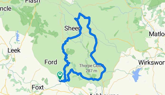
Route 3 Parsley Hay to Ashbourne, return via Hulme End
Trasa rowerowa w Bakewell, Anglia, Zjednoczone Królestwo Wielkiej Brytanii
- 58,1 km
- Dystans
- 653 m
- Przewyższenia
- 655 m
- Spadek
Route 4 Waterhouses circuit to Manifold and Tissington Trails
Trasa rowerowa w Mayfield, Anglia, Zjednoczone Królestwo Wielkiej Brytanii
- 54,8 km
- Dystans
- 497 m
- Przewyższenia
- 503 m
- Spadek

Route 5 Davenham and south to Wrenbury
Trasa rowerowa w Northwich, Anglia, Zjednoczone Królestwo Wielkiej Brytanii
- 74,8 km
- Dystans
- 209 m
- Przewyższenia
- 207 m
- Spadek

Route 6 Dodleston - Llangollen circular
Trasa rowerowa w Rossett, Walia, Zjednoczone Królestwo Wielkiej Brytanii
- 73,4 km
- Dystans
- 554 m
- Przewyższenia
- 554 m
- Spadek

Route 7 Delamere Forest to N Wales circuit
Trasa rowerowa w Oakmere, Anglia, Zjednoczone Królestwo Wielkiej Brytanii
- 88,8 km
- Dystans
- 467 m
- Przewyższenia
- 466 m
- Spadek

Route 8 Middlewich circuit to Ellesmere and Wem
Trasa rowerowa w Middlewich, Anglia, Zjednoczone Królestwo Wielkiej Brytanii
- 121,2 km
- Dystans
- 284 m
- Przewyższenia
- 284 m
- Spadek

Route 10 Carsington Water circular
Trasa rowerowa w Ashbourne, Anglia, Zjednoczone Królestwo Wielkiej Brytanii
- 43,6 km
- Dystans
- 513 m
- Przewyższenia
- 514 m
- Spadek

Route 11 Adlington to Buxton and Wildboarclough
Trasa rowerowa w Adlington, Anglia, Zjednoczone Królestwo Wielkiej Brytanii
- 57 km
- Dystans
- 1027 m
- Przewyższenia
- 1027 m
- Spadek


Aughton - Southport circular 40 miles
Trasa rowerowa w Maghull, Anglia, Zjednoczone Królestwo Wielkiej Brytanii
- 63,9 km
- Dystans
- 160 m
- Przewyższenia
- 160 m
- Spadek

Flint - Prestatyn circular
Trasa rowerowa w Flint, Walia, Zjednoczone Królestwo Wielkiej Brytanii
- 57 km
- Dystans
- 296 m
- Przewyższenia
- 293 m
- Spadek