Chania
Wyprawa rowerowa z 7 etapów, rozpoczynająca się w Chania, Crete, Greece.
Przegląd
O tej trasie
Ta wycieczka rowerowa ma 7 etapów i łączną długość 203,2 km.
- 7
- Trasy
- -:--
- Czas
- 203,2 km
- Dystans
- ---
- Śr. Prędkość
- 1875 m
- Przewyższenia
- 1871 m
- Spadek
Chania
Etapy tej wycieczki
Wszystkie 7 etapy tej wycieczki można otworzyć na mapie lub w aplikacji Bikemap, aby uzyskać więcej szczegółów, gdzie możesz dostosować je w planerze tras lub pobrać jako plik GPX lub KML. Wykorzystaj je jako szablon do planowania własnej wycieczki lub pozwól Bikemap prowadzić Cię bezpośrednio po nich.
Chania - Meskla
Trasa rowerowa w Chania, Crete, Greece
Easy route from the city of Chania to the village Meskla. Paved road.
- 39,3 km
- Dystans
- 231 m
- Przewyższenia
- 231 m
- Spadek
Chania-Gouverneto Monastery
Trasa rowerowa w Chania, Crete, Greece
The only really hard part is the hill up to the monastery. The road is steep (and not very well paved, so be careful with your racing bikes). But it's only about 2 km.
It's a really nice route. You'll need about 3 hours for it
- 43,9 km
- Dystans
- 567 m
- Przewyższenia
- 567 m
- Spadek
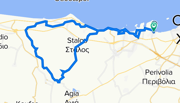
Chania - Agia - Stalos - Chania
Trasa rowerowa w Chania, Crete, Greece
Easy route. About 1 km dirt road (between km 11 and 12)
- 24,7 km
- Dystans
- 179 m
- Przewyższenia
- 175 m
- Spadek
Chania- Perivolia- Agia Lake- Monasteries of Ag Kyriaki and 7 Paidwn (7 Children)
Trasa rowerowa w Chania, Crete, Greece
Agia Lake: km 8
Monasteries: km 21
Easy and fully paved route. Mostly through olive and orange fields on low traffic road (beside the last part back to Chania).
You have to walk the part from the Ag Kyriaki Monastery to the Caves or The Monastery of the 7 Children, or use a mountain bike or trekking bike.
The highest location (~230m, at km 22) is at a Cave opposite of the 7 Children Monastery.
- 31,9 km
- Dystans
- 270 m
- Przewyższenia
- 269 m
- Spadek
Chania- Ag Kyriaki Monastery
Trasa rowerowa w Chania, Crete, Greece
After the monastery, there is a small part (less than 2km) unpaved road
- 18,7 km
- Dystans
- 262 m
- Przewyższenia
- 262 m
- Spadek


