Slovenia
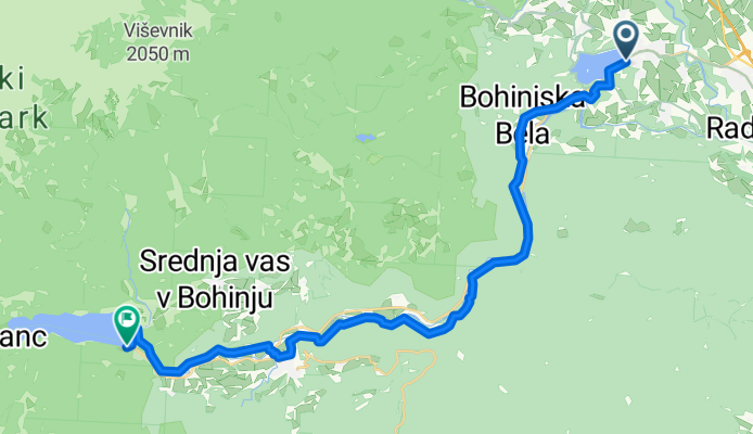
Wyprawa rowerowa z 5 etapów, rozpoczynająca się w Bled, Občina Bled, Słowenia.
Przegląd
O tej trasie
Ta wycieczka rowerowa ma 5 etapów i łączną długość 203,5 km.
- 5
- Trasy
- 5 h 7 min
- Czas
- 203,5 km
- Dystans
- 39,8 km/h
- Śr. Prędkość
- 4581 m
- Przewyższenia
- 4426 m
- Spadek
Slovenia
Etapy tej wycieczki
Wszystkie 5 etapy tej wycieczki można otworzyć na mapie lub w aplikacji Bikemap, aby uzyskać więcej szczegółów, gdzie możesz dostosować je w planerze tras lub pobrać jako plik GPX lub KML. Wykorzystaj je jako szablon do planowania własnej wycieczki lub pozwól Bikemap prowadzić Cię bezpośrednio po nich.
Bled - Žganjekuha
Trasa rowerowa w Bled, Občina Bled, Słowenia
- 21,5 km
- Dystans
- 441 m
- Przewyższenia
- 440 m
- Spadek
2025/090 Bohinjska Bistrica
Trasa rowerowa w Bohinjska Bistrica, Gmina Bohinj, Słowenia
- 50,9 km
- Dystans
- 1326 m
- Przewyższenia
- 1303 m
- Spadek
Bled to Bohinj around the back
Trasa rowerowa w Bled, Občina Bled, Słowenia
Coming out of Bled, following the cycle path, the small residential roads through Radovdjica get quite confusing, which is why we ended up going down to the river, crossing the bridge and through the woods, which on our mountain bikes was fine but on a road bike would have been very difficult. Rejo…
- 53,1 km
- Dystans
- 989 m
- Przewyższenia
- 976 m
- Spadek
Up Pokljuka to Bohinj Lake
Trasa rowerowa w Bled, Občina Bled, Słowenia
Beatiful road through small towns with amazing views till the Krnica turning, after Pokljuka starts to build. The road starts getting steeper and into trees lining the road, which you cant see much through. It is a relentlessly winding road, each one you swear must be the last, this continues for a…
- 48,1 km
- Dystans
- 904 m
- Przewyższenia
- 881 m
- Spadek
Route to Bohinjsko jezero
Trasa rowerowa w Bled, Občina Bled, Słowenia
- 29,8 km
- Dystans
- 921 m
- Przewyższenia
- 827 m
- Spadek


