
Fennell Bay na rowerze
Odkrywaj mapę z 84 trasami rowerowymi i szlakami w pobliżu Fennell Bay, stworzonymi przez naszą społeczność.
Portret regionu
Poznaj Fennell Bay
Znajdź odpowiednią trasę rowerową dla siebie w Fennell Bay – mamy tam 84 tras do odkrycia. Większość osób wybiera się tutaj na rower w miesiącach Luty i Kwiecień.
1072 km
Zarejestrowany dystans
84
Trasy rowerowe
1474
Populacja
Wspólnota
Najaktywniejsi użytkownicy w Fennell Bay
Od naszej społeczności
Najlepsze trasy rowerowe w Fennell Bay i okolicach
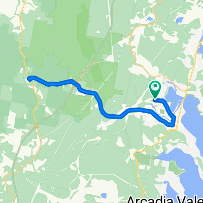
Circumnavigate Edmonds Bay/Stoney Creek
Trasa rowerowa w Fennell Bay, Nowa Południowa Walia, Australia
Leave Blackalls Park Public School from its entrance at the corner of Rupert and Todd Streets travelling NE on Rupert.
At the corner of Rupert St and South Parade, carefully cross diagonally into Rose Street (East) and travel the 100m to the Greenway-Cycleway.
Follow the Greenway-Cycleway north to Fassifern township. At the junction for Fassifern Railway Station, travel east a few metres and enter Awaba Street.
On Awaba Street, travel north and cross the bridge into Bridge Street, Fassifern and travel NW onto the intersection with Macquarie Road.
Turn right onto Macquarie Road and travel about 1.5km to Brougham Ave ((generally SE most of the way).
Turn right down Brougham Ave (south) and turn left into Edwards Street ... carefully negotiating FIVE cross-streets until joining the Main Road over Fennell Bay Bridge and 1200 metres to Day Street.
Turn Left at Day street and go 50 m sweeping gently onto Renwick Street.It's just under 600m to a right turn into Bay Street passing McDonald's Toronto as you get back to the Main Road.
Safely cross the Main Road at the lights and then go 100m SOUTH to the Greenway-Cycleway entry point opposite the Victory Parade intersection.
Stay on the Greenway about 1750 metres (travelling generally NORTH-WEST) until you see the exit path for Todd Street.
Carefully cross the Main Road the travel west on Todd Street the 400 metres to where we started this route.
- 9,2 km
- Dystans
- 54 m
- Przewyższenia
- 63 m
- Spadek
Toronto Pool (short) + Back Home (long)
Trasa rowerowa w Fennell Bay, Nowa Południowa Walia, Australia
Main Roads then Stony Creek Cycleway west to Toronto High School ... then back onto Main Roads to end up at the pool (9-11 mins depending on traffic)
Swim your heart out THEN ... head east to Jindalee Street, the long way to Jarrett Street ... then north to Cafe Tinto, Toronto Waterfront, the old railway station, the yacht club, McDonalds ...
Onto the cycleway at Victory Parade then to Ocean Melody Chinese then through the less steep Centre Avenue and Faucett Street to home.
- 12,1 km
- Dystans
- 109 m
- Przewyższenia
- 106 m
- Spadek
Blackalls Park to North Toronto Industrial Estate then home through Fassifern
Trasa rowerowa w Fennell Bay, Nowa Południowa Walia, Australia
Leave Blackalls Park PS travelling east on Todd Street. Cross South Parade to the Greenway-Cycleway and travel south-east to Stoney Creek.
Join Cook Street at Stoney Creek and travel south turning left into James Street at the tennis courts/bowling green.
Turn left onto Cary Street and travel north to Nelson Street. Turn left into Nelson then right into Oak Street.
Take a right at Day Street, carefully crossing the busy Cary Street and right turn into Renwick Street. Travel south past Toronto Public School and immediately turn right into Bay Street (passing McDonald's Toronto).
Cross Cary Street at the traffic lights in front of McDonald's and proceed a short way south adjacent to Cary Street.
Turn right onto the Greenway-Cycleway and head back through Blackalls Park in a generally north-westerly direction.
Continue on to the Fassifern Greenway-Cycleway intersection whereupon you could make a U-turn.
Head back south a few hundred metres and exit the Greenway at Rose Street. Travel west. Cross South Parade and immediately divert into Rupert Street. Travel (generally) south west about 200m and arrive at Blackalls Park Public School at the intersection of Todd Street.
A slow rider (such as me) can manage this rout in 26-33 minutes even on a 37C (100F) day such as today. DRINK PLENTY!
- 8,5 km
- Dystans
- 74 m
- Przewyższenia
- 48 m
- Spadek
Around Fennell Bay & connected suburbs
Trasa rowerowa w Fennell Bay, Nowa Południowa Walia, Australia
To Toronto via Greenway-Cycleway. Pick up coffee in The Boulevard.
Back past Toronto Railway Station, the Royal Motor Yacht Club, Toronto Public School THEN via Renwick Street to Toronto Lions' Club Park.
Cross Fennell Bay Bridge (travelling north) then walk your bike across the Main Road to Ottey's Lane.
Travel in streets parallel to the Fennell Bay waterfront to Brougham Avenue. Right Turn (Brougham Ave) then Left Turn into Macquarie Road.
Travel about 1.42km and access the bush track off the access lane to Fassifern Rsail Station. Turn east onto the Greenway-Cycleway and travel to Blackalls Park.
Utilise the path that links The Greenway-Cycleway to North Parade. Travel 320m south-east on North Parade.
Turn right onto Faucett THEN quickly LEFT onto Railway Parade ... After 220m, execute a RIGHT turn into Adam Street, a RIGHT into Fennell Crescent, a RIGHT into Faucett Street and a LEFT onto Railway Parade.
At the liquor store & Chinese Restaurant, turn left into Centre Avenue. Then a minor kink into Rhodes Street, a LEFT into Charles Street, a RIGHT into Faucett Street THEN a final RIGHT into Rupert Street.
Travel just 120 metres downhill THEN swing LEFT into the Todd Street cul-de-sac. You are now less than 80 metres from your original starting point.
WELL DONE!
- 13,2 km
- Dystans
- 82 m
- Przewyższenia
- 94 m
- Spadek
Odkryj więcej tras
- Blackalls Park Public School to Toronto Pool +
- Dystans
- 10,5 km
- Przewyższenia
- 67 m
- Spadek
- 66 m
- Lokalizacja
- Fennell Bay, Nowa Południowa Walia, Australia
- Blackalls Park - THS - Toronto - home - 10.5km
- Dystans
- 10,7 km
- Przewyższenia
- 81 m
- Spadek
- 80 m
- Lokalizacja
- Fennell Bay, Nowa Południowa Walia, Australia
- Lapped Fennell Bay & Edmunds Bay + Toronto Shops
- Dystans
- 11,2 km
- Przewyższenia
- 87 m
- Spadek
- 85 m
- Lokalizacja
- Fennell Bay, Nowa Południowa Walia, Australia
- Bay Lap and Lunch at McCafe TOR
- Dystans
- 13 km
- Przewyższenia
- 84 m
- Spadek
- 81 m
- Lokalizacja
- Fennell Bay, Nowa Południowa Walia, Australia
- Toronto High School, Coles, home
- Dystans
- 16,7 km
- Przewyższenia
- 84 m
- Spadek
- 88 m
- Lokalizacja
- Fennell Bay, Nowa Południowa Walia, Australia
- Another Local Suburban Exercise Course
- Dystans
- 11,9 km
- Przewyższenia
- 83 m
- Spadek
- 86 m
- Lokalizacja
- Fennell Bay, Nowa Południowa Walia, Australia
- 13.5km plus Suburban Run
- Dystans
- 14,2 km
- Przewyższenia
- 80 m
- Spadek
- 83 m
- Lokalizacja
- Fennell Bay, Nowa Południowa Walia, Australia
- BPPS to Freemans Waterhole Subway
- Dystans
- 28,6 km
- Przewyższenia
- 197 m
- Spadek
- 197 m
- Lokalizacja
- Fennell Bay, Nowa Południowa Walia, Australia