
Buôn Ma Thuột na rowerze
Odkrywaj mapę z 66 trasami rowerowymi i szlakami w pobliżu Buôn Ma Thuột, stworzonymi przez naszą społeczność.
Portret regionu
Poznaj Buôn Ma Thuột
Znajdź odpowiednią trasę rowerową dla siebie w Buôn Ma Thuột – mamy tam 66 tras do odkrycia. Większość osób wybiera się tutaj na rower w miesiącach Sierpień i Wrzesień.
1546 km
Zarejestrowany dystans
66
Trasy rowerowe
146 975
Populacja
Wspólnota
Najaktywniejsi użytkownicy w Buôn Ma Thuột


Starannie wybrane trasy
Odkryj Buôn Ma Thuột dzięki tym kolekcjom
Wycieczka
Od naszej społeczności
Najlepsze trasy rowerowe w Buôn Ma Thuột i okolicach

Central Highland 8 days on bike
Trasa rowerowa w Buôn Ma Thuột, Prowincja Đăk Lăk, Wietnam
- 257,7 km
- Dystans
- 2802 m
- Przewyższenia
- 3288 m
- Spadek

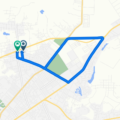
Buon Ma Thuot to Lake Lak
Trasa rowerowa w Buôn Ma Thuột, Prowincja Đăk Lăk, Wietnam
- 76,4 km
- Dystans
- 240 m
- Przewyższenia
- 342 m
- Spadek

J.4 Buôn Ma Thuôt-Pong D'rang (Buon Trang)
Trasa rowerowa w Buôn Ma Thuột, Prowincja Đăk Lăk, Wietnam
- 46,8 km
- Dystans
- 487 m
- Przewyższenia
- 212 m
- Spadek
Easy ride
Trasa rowerowa w Buôn Ma Thuột, Prowincja Đăk Lăk, Wietnam
- 5,3 km
- Dystans
- 33 m
- Przewyższenia
- 60 m
- Spadek
Odkryj więcej tras
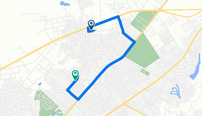
 Xô Viết Nghệ Tĩnh 33, Thành phố Buôn Ma Thuột to Quang Trung 92, Thành phố Buôn Ma Thuột
- Dystans
- 15,1 km
- Przewyższenia
- 245 m
- Spadek
- 239 m
- Lokalizacja
- Buôn Ma Thuột, Prowincja Đăk Lăk, Wietnam
 Moderate route
- Dystans
- 6,6 km
- Przewyższenia
- 37 m
- Spadek
- 49 m
- Lokalizacja
- Buôn Ma Thuột, Prowincja Đăk Lăk, Wietnam
 Slow ride
- Dystans
- 11,3 km
- Przewyższenia
- 84 m
- Spadek
- 88 m
- Lokalizacja
- Buôn Ma Thuột, Prowincja Đăk Lăk, Wietnam
 15) Buon Ma Thuot - Nhon Hoa
- Dystans
- 129,4 km
- Przewyższenia
- 764 m
- Spadek
- 828 m
- Lokalizacja
- Buôn Ma Thuột, Prowincja Đăk Lăk, Wietnam
 Relaxed route
- Dystans
- 9,3 km
- Przewyższenia
- 69 m
- Spadek
- 72 m
- Lokalizacja
- Buôn Ma Thuột, Prowincja Đăk Lăk, Wietnam
 Moderate route
- Dystans
- 10,8 km
- Przewyższenia
- 37 m
- Spadek
- 35 m
- Lokalizacja
- Buôn Ma Thuột, Prowincja Đăk Lăk, Wietnam
 Slow ride
- Dystans
- 9,7 km
- Przewyższenia
- 52 m
- Spadek
- 58 m
- Lokalizacja
- Buôn Ma Thuột, Prowincja Đăk Lăk, Wietnam
 Easy ride
- Dystans
- 9,2 km
- Przewyższenia
- 51 m
- Spadek
- 64 m
- Lokalizacja
- Buôn Ma Thuột, Prowincja Đăk Lăk, Wietnam