
Forster na rowerze
Odkrywaj mapę z 53 trasami rowerowymi i szlakami w pobliżu Forster, stworzonymi przez naszą społeczność.
Portret regionu
Poznaj Forster
Znajdź odpowiednią trasę rowerową dla siebie w Forster – mamy tam 53 tras do odkrycia. Większość osób wybiera się tutaj na rower w miesiącach Czerwiec i Lipiec.
1025 km
Zarejestrowany dystans
53
Trasy rowerowe
17 591
Populacja
Wspólnota
Najaktywniejsi użytkownicy w Forster


Starannie wybrane trasy
Odkryj Forster dzięki tym kolekcjom

Od naszej społeczności
Najlepsze trasy rowerowe w Forster i okolicach


Forster to Mungo Brush
Trasa rowerowa w Forster, Nowa Południowa Walia, Australia
- 65,6 km
- Dystans
- 312 m
- Przewyższenia
- 309 m
- Spadek

Forster to Taree
Trasa rowerowa w Forster, Nowa Południowa Walia, Australia
- 67,8 km
- Dystans
- 820 m
- Przewyższenia
- 783 m
- Spadek

Forster - Tuncurry (NSW AU) round trip north
Trasa rowerowa w Forster, Nowa Południowa Walia, Australia
- 30,3 km
- Dystans
- 168 m
- Przewyższenia
- 171 m
- Spadek

17–23 Memorial Dr, Forster to Tuncurry
Trasa rowerowa w Forster, Nowa Południowa Walia, Australia
- 4,1 km
- Dystans
- 10 m
- Przewyższenia
- 6 m
- Spadek
Odkryj więcej tras
 13 Tea Tree Rd, Forster to 17–23 Memorial Dr, Forster
- Dystans
- 7,4 km
- Przewyższenia
- 16 m
- Spadek
- 15 m
- Lokalizacja
- Forster, Nowa Południowa Walia, Australia
 Ray Street 2, Tuncurry to Manning Street 4, Tuncurry
- Dystans
- 11,8 km
- Przewyższenia
- 32 m
- Spadek
- 32 m
- Lokalizacja
- Forster, Nowa Południowa Walia, Australia
 100 Myall Dr, Forster to 97 Myall Dr, Forster
- Dystans
- 8,8 km
- Przewyższenia
- 7 m
- Spadek
- 7 m
- Lokalizacja
- Forster, Nowa Południowa Walia, Australia
 1.B Fra Forster til Harrington
- Dystans
- 67,6 km
- Przewyższenia
- 267 m
- Spadek
- 268 m
- Lokalizacja
- Forster, Nowa Południowa Walia, Australia
 Lakeview Rd, Tuncurry to 1 Baird St, Tuncurry
- Dystans
- 30,8 km
- Przewyższenia
- 139 m
- Spadek
- 134 m
- Lokalizacja
- Forster, Nowa Południowa Walia, Australia
 11-13 Baird St, Tuncurry to 1 Baird St, Tuncurry
- Dystans
- 15,2 km
- Przewyższenia
- 78 m
- Spadek
- 78 m
- Lokalizacja
- Forster, Nowa Południowa Walia, Australia
 chain gang
- Dystans
- 9 km
- Przewyższenia
- 3 m
- Spadek
- 11 m
- Lokalizacja
- Forster, Nowa Południowa Walia, Australia
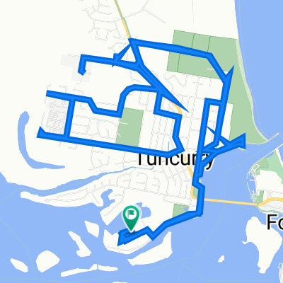 1 Baird St, Tuncurry to 1 Baird St, Tuncurry
- Dystans
- 19,4 km
- Przewyższenia
- 42 m
- Spadek
- 46 m
- Lokalizacja
- Forster, Nowa Południowa Walia, Australia