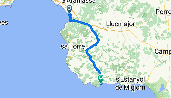
- 181,3 km
- 1551 m
- 1553 m
- s'Arenal, Comunitat Autònoma de les Illes Balears, Hiszpania

Comunitat Autònoma de les Illes Balears na rowerze
Odkrywaj mapę z 33 900 trasami rowerowymi i szlakami w Comunitat Autònoma de les Illes Balears, stworzonymi przez naszą społeczność.
Portret regionu
Poznaj Comunitat Autònoma de les Illes Balears
Znajdź odpowiednią trasę rowerową dla siebie w Comunitat Autònoma de les Illes Balears – mamy tam 33 900 tras do odkrycia. Większość osób wybiera się tutaj na rower w miesiącach Marzec i Kwiecień.
2 631 285 km
Zarejestrowany dystans
33 900
Trasy rowerowe
Wspólnota
Najaktywniejsi użytkownicy w Comunitat Autònoma de les Illes Balears
Starannie wybrane trasy
Odkryj Comunitat Autònoma de les Illes Balears dzięki tym kolekcjom
Od naszej społeczności
Najlepsze trasy rowerowe w Comunitat Autònoma de les Illes Balears
Recovered Route
Trasa rowerowa w Sant Francesc de Formentera, Comunitat Autònoma de les Illes Balears, Hiszpania
- 10,3 km
- Dystans
- 23 m
- Przewyższenia
- 24 m
- Spadek
Carrer Conques, Puigpunyent a Carrer Conques, Puigpunyent
Trasa rowerowa w Puigpunyent, Comunitat Autònoma de les Illes Balears, Hiszpania
- 37,6 km
- Dystans
- 1783 m
- Przewyższenia
- 1783 m
- Spadek
38.743, 1.433 to 38.722, 1.457
Trasa rowerowa w Sant Francesc de Formentera, Comunitat Autònoma de les Illes Balears, Hiszpania
- 33,2 km
- Dystans
- 400 m
- Przewyższenia
- 396 m
- Spadek
Carrer del Llaüt, Palma nach Carrer de les Penyes Cala Pista, Llucmajor
Trasa rowerowa w s'Arenal, Comunitat Autònoma de les Illes Balears, Hiszpania
- 26,5 km
- Dystans
- 173 m
- Przewyższenia
- 153 m
- Spadek
Od naszych redaktorów
Najlepsze trasy rowerowe w Comunitat Autònoma de les Illes Balears i okolicach

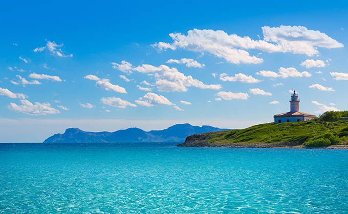
There's lots to do and see on the north coast of Mallorca. Alcanada near Port d’Alcudia is a former Muslim farmstead and has a beach and a tiny islet with a lighthouse dating back to the mid-19th Century. A definite highlight is a bike trip to Cap de Formentor. While the road covers a relatively short distance – just 40 km (25 miles) – you’ll need to climb 1000 meters (3300 ft) to reach the famous lighthouse at the end of the peninsula. Cala Ratjada and Cala Mesquida lie in the northeast of the island. Both are beautiful sand beaches in natural surroundings. What could be better? They are also connected by a great cycle route! This scenic little return journey is 18 km (11 miles) long and leads through varying terrain of quiet countryside paths, woods and sand dunes.
The big one
Mallorca
The largest island Mallorca (literally “the large one”) is extremely popular with cyclists. No point on the island is ever more than 40 km (25 miles) away from the sea. Its picturesque coastline stretches over 581 km (361 miles) and includes steep cliffs as well as beautiful sand beaches reserved for swimming and water sports. A comprehensive network of roads connect the two mountain ranges on the edges – Sierra de Tramuntana in the north-west and the Serres de Levant in the east – with the great plain in the center of the island. Sunscreen and plenty of drinking water are a must when cycling in Mallorca.
Featured routes on Mallorca

The small one
Menorca
Menorca (“the small one”) features gentler hills in the north, flat trails in the south and idyllic unpaved backroads enjoyed by riders of all abilities. This doesn’t mean there aren’t any cycling challenges to be had here: each year in May, the “Ruta de los Faros” takes in five of the island’s lighthouses over a grueling distance of 206 km (128 miles). Alternatively, the recently opened “Cami de Cavalls” trail follows the winding coastline for 190 km (118 miles). Unlike in Mallorca, the coast is rarely privately owned but accessible to hikers or riders, so it’s well worth hunting those unforgettable sea views.
Featured routes on Menorca
- Menorca, Cami de cavalls am SW-Eck
- 14,6 km
- 56 m
- 57 m
- Ciutadella, Comunitat Autònoma de les Illes Balears, Hiszpania
- Mao-Fornells-Ciutadella-Es migjorn-Torralba-St. Climent-Mao
- 105,1 km
- 627 m
- 617 m
- Maó, Comunitat Autònoma de les Illes Balears, Hiszpania

Most visitors to Mallorca arrive via its capital city Palma. While passing through, pay a visit to La Almadaina Palace, an Arabian fort offering arresting views over the bay. Platja de Palma, the 6 km (3.7 miles) long beach near Palma, are a great place to start exploring less touristy regions inland, relatively unspoilt mountain villages such as Valldemossa in the Sierra de Tramuntana mountains and notable “natural areas of special interest” such as the white sand beach of Es Trenc, where sea salt is harvested. Also worth a stop is Cala Fornells, a uniquely designed holiday resort on the south coast. Architect Pedro Otzoup made the houses appear like Mexican pueblos, each with intricate detail. Narrow streets organically carve their paths into the hillside.
Odkryj więcej tras
- Mar y Tierra
- 85 km
- 386 m
- 388 m
- Santa Margalida, Comunitat Autònoma de les Illes Balears, Hiszpania
- Pollença und Coll de l'Era / Coll de sa Batalla - Einrollen in die Berge
- 94,3 km
- 1260 m
- 1249 m
- Port d'Alcúdia, Comunitat Autònoma de les Illes Balears, Hiszpania
- Valdemossa per Kuestenstrasse
- 93,3 km
- 1263 m
- 1264 m
- Camp de Mar, Comunitat Autònoma de les Illes Balears, Hiszpania
- ´Malle St. Joan ;Tour2 aus "Roadbike"
- 62,5 km
- 454 m
- 482 m
- Sant Joan, Comunitat Autònoma de les Illes Balears, Hiszpania
- Carrer Vidalba, Alcúdia to Carrer Vidalba, Alcúdia
- 42,6 km
- 115 m
- 122 m
- Port d'Alcúdia, Comunitat Autònoma de les Illes Balears, Hiszpania
- Avinguda de Miramar, Formentera nach Camí s'Avenc, Formentera
- 10,2 km
- 104 m
- 36 m
- Sant Francesc de Formentera, Comunitat Autònoma de les Illes Balears, Hiszpania
- Carrer de Sant Jaume to Carrer de Sant Jaume
- 129 km
- 946 m
- 992 m
- Alcúdia, Comunitat Autònoma de les Illes Balears, Hiszpania
- 2Via Verde-zurück Außen
- 54,6 km
- 327 m
- 328 m
- Manacor, Comunitat Autònoma de les Illes Balears, Hiszpania
Regiony rowerowe w Comunitat Autònoma de les Illes Balears
Algaida
238 trasy rowerowe
Costitx
31 trasy rowerowe
Valldemossa
146 trasy rowerowe
Sant Francesc de Formentera
137 trasy rowerowe
Banyalbufar
82 trasy rowerowe
Zobacz, gdzie ludzie jeżdżą na rowerze w Hiszpania
Popularne regiony do jazdy na rowerze w Hiszpania


