Jak może wyglądać jazda na rowerze w Mayfield.

Mayfield na rowerze

Odkrywaj mapę z 49 trasami rowerowymi i szlakami w pobliżu Mayfield, stworzonymi przez naszą społeczność.

Portret regionu

Poznaj Mayfield

Znajdź odpowiednią trasę rowerową dla siebie w Mayfield – mamy tam 49 tras do odkrycia.

1110 km

Zarejestrowany dystans

49

Trasy rowerowe

2158

Populacja

Wspólnota

Najaktywniejsi użytkownicy w Mayfield

Od naszej społeczności
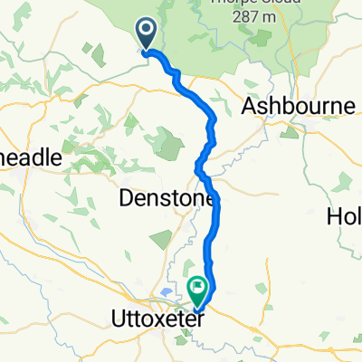
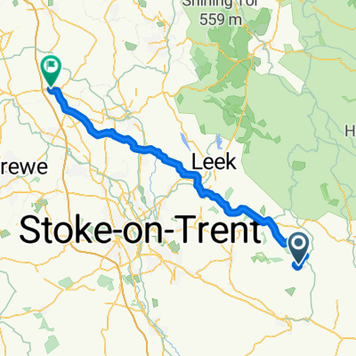
Najlepsze trasy rowerowe w Mayfield i okolicach

Route 4 Waterhouses circuit to Manifold and Tissington Trails
Rower szosowyUtwardzony
puddock
0

Route 4 Waterhouses circuit to Manifold and Tissington Trails

Trasa rowerowa w Mayfield, England, United Kingdom

Waterhouses, Hulme End, Hartington, Tissington, Thorpe, Ilam and return.
54,8 km
Dystans
497 m
Przewyższenia
503 m
Spadek
towers short circuit
Rower górskiNieutwardzony
0

towers short circuit

Trasa rowerowa w Mayfield, England, United Kingdom

5,1 km
Dystans
125 m
Przewyższenia
124 m
Spadek
0

Pt4 The Peak District

Trasa rowerowa w Mayfield, England, United Kingdom

End of the Manifold Way to Hartington looks to be a road that could well have fast moving traffic. Not a very long strech and I can't see a way of avoiding it. It does have good visibility though so you can see what's coming a long way off. A stretch on the High Peak Trail after Hurdlow. Surface might not be great, could reroute onto a paralell road. The section befor Harpur Hill is quite hard to work out. Satellite images make it looks quite reasonable but it looks like the route is quite recent. Be prepared to reroute if it doesn't exist. Section of Old Road leading up to White Hall outdoor centre looks suspect. Be prepared to get off and walk. New Mills to Mellor has surfacing that would be a problem in bad weather. If there's been rain take Mellor Rd instead.  Marple Rd/Glossop Rd around Charlesworth look like they will be busy roads. Take care, possibly use pavement if quiet.
71,5 km
Dystans
777 m
Przewyższenia
770 m
Spadek
0

Manifold valley South to North 13km

Trasa rowerowa w Mayfield, England, United Kingdom

13,4 km
Dystans
124 m
Przewyższenia
126 m
Spadek

Odkryj więcej tras