Kingussie na rowerze
Odkrywaj mapę z 153 trasami rowerowymi i szlakami w pobliżu Kingussie, stworzonymi przez naszą społeczność.
Portret regionu
Poznaj Kingussie
Znajdź odpowiednią trasę rowerową dla siebie w Kingussie – mamy tam 153 tras do odkrycia. Większość osób wybiera się tutaj na rower w miesiącach Lipiec i Sierpień.
10 514 km
Zarejestrowany dystans
153
Trasy rowerowe
1442
Populacja
Starannie wybrane trasy
Odkryj Kingussie dzięki tym kolekcjom

Wycieczka
Od naszej społeczności
Najlepsze trasy rowerowe w Kingussie i okolicach
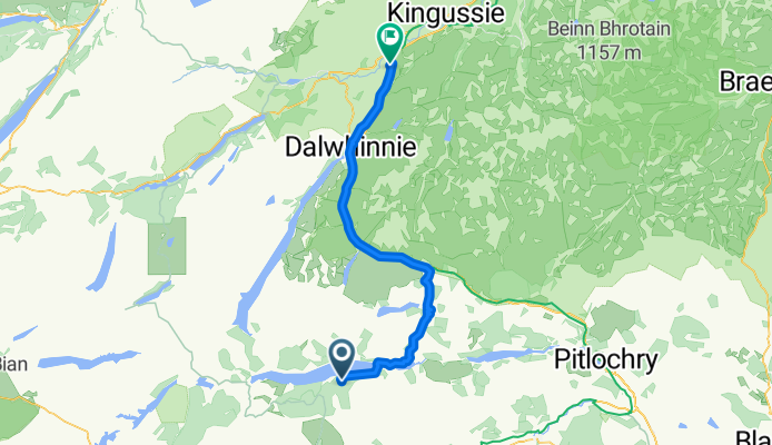
Day 5, 42 wet and windy miles from Newtonmore to Pitlockry
Trasa rowerowa w Kingussie, Scotland, United Kingdom
September 5, 2006. This was our first really wet day. We left Newtonmore in light drizzle at 11 degrees to climb the 1513 foot Drummochter Pass into a SW wind. After a few hours in heavy rain and persistent wind with the temperature dropping to 8 degrees, those of us without rain booties had less than warm feet. Much of the ride was on the not terribly well maintained cycle path that follows the old highway beside the A9 and the rail lines. We stopped for coffee at the New Inn in Dalwhinney and reluctantly passed on the opportinity to visit "Scotland's highest distillery" because it was obvious that we were going to be making poor time in these conditions. Although we could not enjoy the distant views of the mountains and heather, we were impressed with the variety of road kill - several pheasants, hares, and frogs, a mink and a sheep. There were many grand houses as we got farther south and at Blair Athol we marvelled at the 4-miles of 5-foot stone wall along the road on one side of Blair Castle. After 5 hours and 42 miles of this, we arrived at the very pretty town of Pitlochry near 2 pm in time to get our bikes tuned up by the very competent Kevin at the Escape Route cycle shop and repaired to the Moulin Inn (est. 1695) for their real ale brewed on the premises (we all had the 5.2 percent "The Remediator") and excellent lunch (our selections included venison platter, steak and ale pie, game pudding, scotchman's hat - a large Yorkshire pudding with meat and mushroom filling).
- 67,9 km
- Dystans
- 423 m
- Przewyższenia
- 570 m
- Spadek
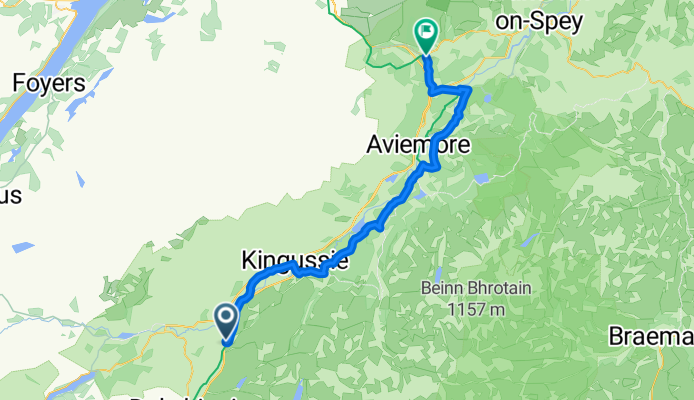
KOS Skye and Wester Ross 2021 Day 6
Trasa rowerowa w Kingussie, Scotland, United Kingdom
Train Carbisdale - Newtonmore
Cycle Newtonmore - Tulloch Station
Train Tulloch - Crianlarich
- 47,5 km
- Dystans
- 248 m
- Przewyższenia
- 280 m
- Spadek
Kingussie, Newtonmore Wild Cat trail and Loch Gynack
Trasa rowerowa w Kingussie, Scotland, United Kingdom
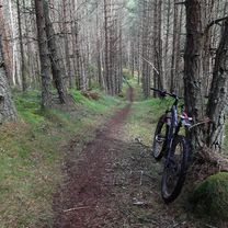
This is a medium length route of 16km / 10 miles suitable for mountain bikes. Some sections are on tarmac and estate tracks but others are on rough paths and for one section the bike will need to be lifted over a number of fences. Allow 2 hours. Ordinance Survey sheet 35 Kingussie and Monadliath Mountains. Refreshments: Cafes and bars in Kingussie and Newtonmore. Start in the centre of Kingussie and take the dedicated cycle track to Newtonmore. Turn right up the Glen Road in Newtonmore town centre and follow this quiet road until you reach a signpost for the Wildcat trail on your right. Follow the Wildcat Trail waymarks through light woodland and sheep fields where the terrain is rough in places. The bike will need to be lifted over a number of styles and fences on this stretch (it may be easier to divert and cycle down the adjacent field). When the trail emerges out onto open countryside take an estate track a few meters to the right and then almost immediately turn left and uphill alongside a small burn. This estate track narrows to single track after a while but continue to follow it until you come to a gate and a green waymark pointing right to Kingussie. The surface is better here and leads along the edge of a conifer forest until you reach a bridge over a burn and a large estate gate to the left. Go through this gate and follow the wide track uphill and through a 2nd gate. Turn right here and follow this well surfaced estate track along the northside of the scenic Loch Gynack. When you reach the far side of the Loch follow the way marks for Kingussie. After crossing the newly reinstated bridge over the Gynack (the previous bridge was washed away by the tail of Hurricane Bertha in August 2014!) it is then all downhill on a quiet smooth tarmac road back down to Kingussie.
Cycle Friendly Kingussie
- 16 km
- Dystans
- 219 m
- Przewyższenia
- 219 m
- Spadek
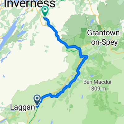
Kingussie, Glen Tromie and Gaick
Trasa rowerowa w Kingussie, Scotland, United Kingdom
This is a serious route of 53km / 33 miles leading into a remote glen. Suitable for mountain bikes. Some sections are on tarmac but long sections are on rough Land Rover tracks and at one point requires fording a river. Allow 5 hours. Ordinance Survey sheets 35 - Kingussie and Monadliath Mountains, 42 - Glen Garry and Loch Rannoch Refreshments: Cafes and bars in Kingussie. Start in Kingussie town centre and take the B970 quiet minor road past the Ruthven Barracks. After one and half miles take the grassy land-rover track which forks off to the right through a gate. Follow this track through moorland and trees along the west side of the river Tromie until you arrive at the keepers house for Glen Tromie Lodge. Cross the river by the bridge here and turn right on the land-rover track leading up the east side of the Tromie. The track then passes through a section of trees, past Lynaberack Lodge where the surface becomes tarmac and then crosses the river via a bridge. Always follow the main track, ignoring any side tracks to left or right. When the route reaches Tromie Dam the tarmaced road ends and the track becomes a well maintained Land Rover track. Pass Loch an t-Seilach and the Gaick Lodge where the track becomes more rough. Just after the lodge at a fork in the road turn right to cross the river again at a ford. Care will have to be taken here and if the river level is too high the route ends here. If the water is passable it is best to wade across rather than attempt to cycle. After passing Loch Bhrodainn on the right the track becomes steeper and reaches Loch an Duin, although this routes ends where the land rover track ends before quite reaching the loch. After a deserved rest, turn around and enjoy the much easier return back down Glen Tromie by the outbound route. It is also possible to extend the route if there has not been too much recent rainfall via a track on the east side of Loch Duin. This joins another Land Rover track which leads eventually to Dalnacardoch Lodge. From here it is possible to join the Sustrans Route 7 running northwards leading back to Newtonmore and Kingussie.
- 26,5 km
- Dystans
- 313 m
- Przewyższenia
- 57 m
- Spadek
Odkryj więcej tras
- Inshriach Singletrack 2
- Dystans
- 25,8 km
- Przewyższenia
- 405 m
- Spadek
- 405 m
- Lokalizacja
- Kingussie, Scotland, United Kingdom
- Spey 2
- Dystans
- 35,7 km
- Przewyższenia
- 23 m
- Spadek
- 48 m
- Lokalizacja
- Kingussie, Scotland, United Kingdom
- KOS Speyside 2019 Day 1
- Dystans
- 66,7 km
- Przewyższenia
- 243 m
- Spadek
- 273 m
- Lokalizacja
- Kingussie, Scotland, United Kingdom
- Scotsman - T10
- Dystans
- 110,1 km
- Przewyższenia
- 905 m
- Spadek
- 1106 m
- Lokalizacja
- Kingussie, Scotland, United Kingdom
- Day 2 Copathlon
- Dystans
- 340,8 km
- Przewyższenia
- 870 m
- Spadek
- 1102 m
- Lokalizacja
- Kingussie, Scotland, United Kingdom
- Kingussie to FeshieBridge 2
- Dystans
- 27,6 km
- Przewyższenia
- 235 m
- Spadek
- 235 m
- Lokalizacja
- Kingussie, Scotland, United Kingdom
- May 16th Scotland
- Dystans
- 87,7 km
- Przewyższenia
- 629 m
- Spadek
- 546 m
- Lokalizacja
- Kingussie, Scotland, United Kingdom
- Kingussie to Feshiebridge
- Dystans
- 34,7 km
- Przewyższenia
- 371 m
- Spadek
- 374 m
- Lokalizacja
- Kingussie, Scotland, United Kingdom