
Galgate na rowerze
Odkrywaj mapę z 55 trasami rowerowymi i szlakami w pobliżu Galgate, stworzonymi przez naszą społeczność.
Portret regionu
Poznaj Galgate
Znajdź odpowiednią trasę rowerową dla siebie w Galgate – mamy tam 55 tras do odkrycia. Większość osób wybiera się tutaj na rower w miesiącu Maj.
2160 km
Zarejestrowany dystans
55
Trasy rowerowe
1612
Populacja
Wspólnota
Najaktywniejsi użytkownicy w Galgate


Od naszej społeczności
Najlepsze trasy rowerowe w Galgate i okolicach


Day 8, 37 hilly miles from Lancaster to Tockholes
Trasa rowerowa w Galgate, Anglia, Zjednoczone Królestwo Wielkiej Brytanii
September 8, 2008. Today we started a half hour earlier than normal (8:00 instead of 8:30). It was a glorious day and we had not realized how pastorally "green and pleasant" is northern Lancashire just a few miles from the (former) dark satanic mills of Preston, Blackburn, Manchester, Liverpool and the dozens of factory towns in between. We turned east off the A6 at Galgate and took back roads through Oakenclough, Inglewhite, and Longridge (where we had coffee at a stylish cafe-wine bar internally integrated, we discovered on entering, with a hair salon. This was actually a short day of cycling - 37 miles in linear distance but about 4,000 feet in accumulated vertical assent. Half way to Blackburn we celebrated our "Everest moment" when the trip accumulated assent reached 29,028 feet. We began to wonder whether the line from the Beatles song was actually "there are 4,000 hills in Blackburn, Lancashire" but we eventually emerged into the rural road to Tockholes, where Charles I hid in a tree from Cromwell's army. Our cycling day ended with a relaxed late lunch at the canine-filled Royal Arms. Our hotel was The Lion, an old and quite large hotel on the High Street, of Shrewsbury.
- 58,4 km
- Dystans
- 660 m
- Przewyższenia
- 458 m
- Spadek

Glasson Dock to Grasmere
Trasa rowerowa w Galgate, Anglia, Zjednoczone Królestwo Wielkiej Brytanii
- 83,6 km
- Dystans
- 465 m
- Przewyższenia
- 400 m
- Spadek

Glasson Gallimaufry
Trasa rowerowa w Galgate, Anglia, Zjednoczone Królestwo Wielkiej Brytanii
A tremendous, easy and level route taking in canal towpath, seaside promenade and riverside riding. Best ridden anticlockwise from Glasson - it encompasses breathtaking views of the bay and superb cycling pathways... Enjoy!
- 39,2 km
- Dystans
- 42 m
- Przewyższenia
- 41 m
- Spadek

Glasson Dock to Grasmere
Trasa rowerowa w Galgate, Anglia, Zjednoczone Królestwo Wielkiej Brytanii
None
(cloned from route 826470)
- 83,6 km
- Dystans
- 463 m
- Przewyższenia
- 397 m
- Spadek
Odkryj więcej tras
 38m Ride home via Silverdale and Arnside
- Dystans
- 61,8 km
- Przewyższenia
- 562 m
- Spadek
- 547 m
- Lokalizacja
- Galgate, Anglia, Zjednoczone Królestwo Wielkiej Brytanii
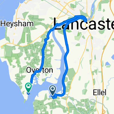
 Jeremy Lane to Tithebarn Hill 2, Glasson Dock
- Dystans
- 1,2 km
- Przewyższenia
- 0 m
- Spadek
- 0 m
- Lokalizacja
- Galgate, Anglia, Zjednoczone Królestwo Wielkiej Brytanii
 bowland off orad evening/weekend-henry
- Dystans
- 27,6 km
- Przewyższenia
- 708 m
- Spadek
- 713 m
- Lokalizacja
- Galgate, Anglia, Zjednoczone Królestwo Wielkiej Brytanii
 Day 8 - Lancaster to Broughton-in-Furness
- Dystans
- 110,9 km
- Przewyższenia
- 1005 m
- Spadek
- 1051 m
- Lokalizacja
- Galgate, Anglia, Zjednoczone Królestwo Wielkiej Brytanii
 Fast ride in Lancaster
- Dystans
- 27,7 km
- Przewyższenia
- 68 m
- Spadek
- 66 m
- Lokalizacja
- Galgate, Anglia, Zjednoczone Królestwo Wielkiej Brytanii
 Glasson Marina to Sunderland Point
- Dystans
- 19,6 km
- Przewyższenia
- 67 m
- Spadek
- 65 m
- Lokalizacja
- Galgate, Anglia, Zjednoczone Królestwo Wielkiej Brytanii
 caton short
- Dystans
- 25,4 km
- Przewyższenia
- 178 m
- Spadek
- 177 m
- Lokalizacja
- Galgate, Anglia, Zjednoczone Królestwo Wielkiej Brytanii
 Route from Hillam Lane, Cockerham, Lancaster
- Dystans
- 19,8 km
- Przewyższenia
- 10 m
- Spadek
- 12 m
- Lokalizacja
- Galgate, Anglia, Zjednoczone Królestwo Wielkiej Brytanii