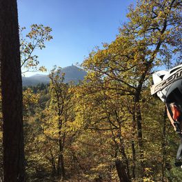
Sankt Stephan na rowerze
Odkrywaj mapę z 25 trasami rowerowymi i szlakami w pobliżu Sankt Stephan, stworzonymi przez naszą społeczność.
Portret regionu
Poznaj Sankt Stephan
Znajdź odpowiednią trasę rowerową dla siebie w Sankt Stephan – mamy tam 25 tras do odkrycia.
856 km
Zarejestrowany dystans
25
Trasy rowerowe
1352
Populacja
Wspólnota
Najaktywniejsi użytkownicy w Sankt Stephan
Od naszej społeczności
Najlepsze trasy rowerowe w Sankt Stephan i okolicach
Rinderberg - Schönried
Trasa rowerowa w Sankt Stephan, Berno, Szwajcaria
- 10,2 km
- Dystans
- 83 m
- Przewyższenia
- 852 m
- Spadek
Ried-Scheidwegen-Rossberg-Ried
Trasa rowerowa w Sankt Stephan, Berno, Szwajcaria
- 45,9 km
- Dystans
- 1010 m
- Przewyższenia
- 1007 m
- Spadek
Rinderberg Geisshöri
Trasa rowerowa w Sankt Stephan, Berno, Szwajcaria
- 3,4 km
- Dystans
- 0 m
- Przewyższenia
- 541 m
- Spadek
Rinderberg - Saanenmöser
Trasa rowerowa w Sankt Stephan, Berno, Szwajcaria
- 8,8 km
- Dystans
- 81 m
- Przewyższenia
- 816 m
- Spadek
Odkryj więcej tras
 Ried-Rodomont-Jaunpass-Ried
- Dystans
- 74,8 km
- Przewyższenia
- 1816 m
- Spadek
- 1816 m
- Lokalizacja
- Sankt Stephan, Berno, Szwajcaria
 Ried-Hahnenmoospass-Frutigen-Spiez-Zweisimmen- Ried
- Dystans
- 93,1 km
- Przewyższenia
- 1431 m
- Spadek
- 1431 m
- Lokalizacja
- Sankt Stephan, Berno, Szwajcaria
 Stöckli-Gsess-Stöckli
- Dystans
- 33,9 km
- Przewyższenia
- 725 m
- Spadek
- 725 m
- Lokalizacja
- Sankt Stephan, Berno, Szwajcaria
 Stöckli-Nessleren-Stöckli
- Dystans
- 14,7 km
- Przewyższenia
- 679 m
- Spadek
- 679 m
- Lokalizacja
- Sankt Stephan, Berno, Szwajcaria
 Verbindung Gutenbrunnen-Färmel
- Dystans
- 4,7 km
- Przewyższenia
- 118 m
- Spadek
- 257 m
- Lokalizacja
- Sankt Stephan, Berno, Szwajcaria
 Esel
Esel- Dystans
- 0 km
- Przewyższenia
- 0 m
- Spadek
- 0 m
- Lokalizacja
- Sankt Stephan, Berno, Szwajcaria
 Ried-Leiterli-Lauenen-Gstaad-Ried
- Dystans
- 54,1 km
- Przewyższenia
- 1342 m
- Spadek
- 1344 m
- Lokalizacja
- Sankt Stephan, Berno, Szwajcaria
 Eselroute
- Dystans
- 0 km
- Przewyższenia
- 0 m
- Spadek
- 0 m
- Lokalizacja
- Sankt Stephan, Berno, Szwajcaria


