Sankt Margrethen na rowerze
Odkrywaj mapę z 275 trasami rowerowymi i szlakami w pobliżu Sankt Margrethen, stworzonymi przez naszą społeczność.
Portret regionu
Poznaj Sankt Margrethen
Znajdź odpowiednią trasę rowerową dla siebie w Sankt Margrethen – mamy tam 275 tras do odkrycia. Większość osób wybiera się tutaj na rower w miesiącach Lipiec i Sierpień.
31 508 km
Zarejestrowany dystans
275
Trasy rowerowe
5395
Populacja
Wspólnota
Najaktywniejsi użytkownicy w Sankt Margrethen
Starannie wybrane trasy
Odkryj Sankt Margrethen dzięki tym kolekcjom
Od naszej społeczności
Najlepsze trasy rowerowe w Sankt Margrethen i okolicach
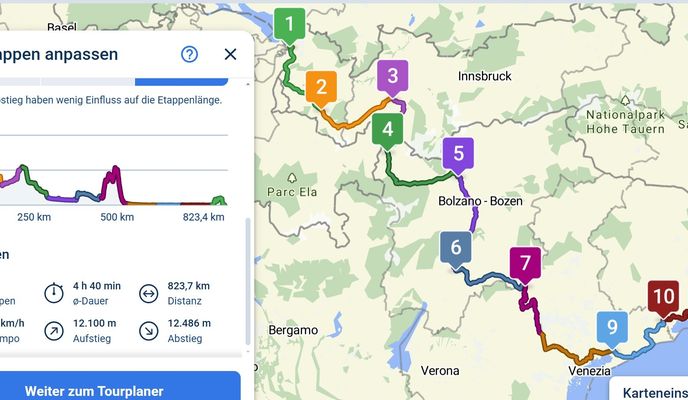
SchweizMobil 4: Alpenpanorama-Route
Trasa rowerowa w Sankt Margrethen, Kanton St. Gallen, Szwajcaria
- 480 km
- Dystans
- 8735 m
- Przewyższenia
- 8732 m
- Spadek
BRUTAL 2013 Rainer Waigel Variante A-CH
Trasa rowerowa w Sankt Margrethen, Kanton St. Gallen, Szwajcaria
- 1016,5 km
- Dystans
- 8675 m
- Przewyższenia
- 8658 m
- Spadek
St.Anton
Trasa rowerowa w Sankt Margrethen, Kanton St. Gallen, Szwajcaria
- 38,3 km
- Dystans
- 852 m
- Przewyższenia
- 849 m
- Spadek
2013 St. Margerethen-Zagreb
Trasa rowerowa w Sankt Margrethen, Kanton St. Gallen, Szwajcaria
- 876,8 km
- Dystans
- 7042 m
- Przewyższenia
- 7085 m
- Spadek
Odkryj więcej tras
 Höchst-Konstanz (3)
- Dystans
- 53,1 km
- Przewyższenia
- 57 m
- Spadek
- 56 m
- Lokalizacja
- Sankt Margrethen, Kanton St. Gallen, Szwajcaria
 Bodensee harmadik nap megtett út
- Dystans
- 60,3 km
- Przewyższenia
- 40 m
- Spadek
- 42 m
- Lokalizacja
- Sankt Margrethen, Kanton St. Gallen, Szwajcaria
 BS Tag 1 Höchst - Romanshorn - Konstanz
- Dystans
- 68,2 km
- Przewyższenia
- 18 m
- Spadek
- 18 m
- Lokalizacja
- Sankt Margrethen, Kanton St. Gallen, Szwajcaria
 Bodensee-Comer See
- Dystans
- 315,6 km
- Przewyższenia
- 2560 m
- Spadek
- 2523 m
- Lokalizacja
- Sankt Margrethen, Kanton St. Gallen, Szwajcaria
 Alpenpanorama- Route Nr. 4
- Dystans
- 478,9 km
- Przewyższenia
- 12 216 m
- Spadek
- 12 212 m
- Lokalizacja
- Sankt Margrethen, Kanton St. Gallen, Szwajcaria
 20160804_173222.gpx
- Dystans
- 38,1 km
- Przewyższenia
- 14 m
- Spadek
- 16 m
- Lokalizacja
- Sankt Margrethen, Kanton St. Gallen, Szwajcaria
 Höchst - Walzenhausen - Heiden - Retour
- Dystans
- 26 km
- Przewyższenia
- 759 m
- Spadek
- 759 m
- Lokalizacja
- Sankt Margrethen, Kanton St. Gallen, Szwajcaria
 4-Tages-Passfahrt Vorarlberg-Italien-Graubünden
- Dystans
- 330,4 km
- Przewyższenia
- 4568 m
- Spadek
- 4447 m
- Lokalizacja
- Sankt Margrethen, Kanton St. Gallen, Szwajcaria


