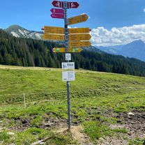
Glarus na rowerze
Odkrywaj mapę z 949 trasami rowerowymi i szlakami w Glarus, stworzonymi przez naszą społeczność.
Portret regionu
Poznaj Glarus
Znajdź odpowiednią trasę rowerową dla siebie w Glarus – mamy tam 949 tras do odkrycia. Większość osób wybiera się tutaj na rower w miesiącach Lipiec i Sierpień.
60 812 km
Zarejestrowany dystans
949
Trasy rowerowe
Wspólnota
Najaktywniejsi użytkownicy w Glarus
Od naszej społeczności
Najlepsze trasy rowerowe w Glarus
Bikeroute 1 Schwanden-Kies
Trasa rowerowa w Schwanden, Glarus, Szwajcaria
- 13,6 km
- Dystans
- 650 m
- Przewyższenia
- 651 m
- Spadek
TT_U-E02
Trasa rowerowa w Niederurnen, Glarus, Szwajcaria
- 71,6 km
- Dystans
- 1953 m
- Przewyższenia
- 1899 m
- Spadek
Urnerboden - Fisetenpass - Klausenpass - Urnerboden
Trasa rowerowa w Linthal, Glarus, Szwajcaria
- 24,3 km
- Dystans
- 997 m
- Przewyższenia
- 997 m
- Spadek
Pragelpass and Klausen from Leuggelbach
Trasa rowerowa w Luchsingen, Glarus, Szwajcaria
- 124,8 km
- Dystans
- 2756 m
- Przewyższenia
- 2756 m
- Spadek
Odkryj więcej tras
 Sunntigstürli
- Dystans
- 46,8 km
- Przewyższenia
- 1434 m
- Spadek
- 1420 m
- Lokalizacja
- Glarus, Glarus, Szwajcaria
 Näfels - Schübelbach
- Dystans
- 20,8 km
- Przewyższenia
- 117 m
- Spadek
- 123 m
- Lokalizacja
- Mollis, Glarus, Szwajcaria
 Lachengrad
- Dystans
- 39,9 km
- Przewyższenia
- 1385 m
- Spadek
- 1386 m
- Lokalizacja
- Näfels, Glarus, Szwajcaria
 Näfels - Längeneggpass - Schwialppass - Siebnen
- Dystans
- 51,7 km
- Przewyższenia
- 1837 m
- Spadek
- 1838 m
- Lokalizacja
- Näfels, Glarus, Szwajcaria
 Glarus-Klausenpass-Glarus
- Dystans
- 76,6 km
- Przewyższenia
- 1453 m
- Spadek
- 1454 m
- Lokalizacja
- Ennenda, Glarus, Szwajcaria
 Glarus-Pfäffikon-Rappi-Glarus
- Dystans
- 79,9 km
- Przewyższenia
- 277 m
- Spadek
- 277 m
- Lokalizacja
- Ennenda, Glarus, Szwajcaria
 Alpine Tour: Klontal -> Lehmen
- Dystans
- 88,1 km
- Przewyższenia
- 1278 m
- Spadek
- 1179 m
- Lokalizacja
- Glarus, Glarus, Szwajcaria
 Ennenda Amden Stein Amden Ennenda
- Dystans
- 73,3 km
- Przewyższenia
- 2419 m
- Spadek
- 2432 m
- Lokalizacja
- Ennenda, Glarus, Szwajcaria
Regiony rowerowe w Glarus
Niederurnen
283 trasy rowerowe
Ennenda
38 trasy rowerowe
Glarus
171 trasy rowerowe
Netstal
52 trasy rowerowe
Mollis
36 trasy rowerowe
Zobacz, gdzie ludzie jeżdżą na rowerze w Szwajcaria
Popularne regiony do jazdy na rowerze w Szwajcaria


