
Attalens na rowerze
Odkrywaj mapę z 32 trasami rowerowymi i szlakami w pobliżu Attalens, stworzonymi przez naszą społeczność.
Portret regionu
Poznaj Attalens
Znajdź odpowiednią trasę rowerową dla siebie w Attalens – mamy tam 32 tras do odkrycia. Większość osób wybiera się tutaj na rower w miesiącu Maj.
3587 km
Zarejestrowany dystans
32
Trasy rowerowe
2380
Populacja
Wspólnota
Najaktywniejsi użytkownicy w Attalens

Od naszej społeczności
Najlepsze trasy rowerowe w Attalens i okolicach
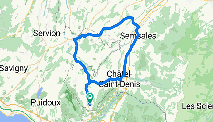
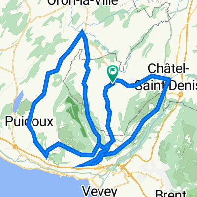
Attalens / Oron / Semsales / Chàtel-Saint-Denis / Attalens
Trasa rowerowa w Attalens, Fryburg, Szwajcaria
Gute Feierabend-Runde mit z.T. längeren Anstiegen.
- 37,7 km
- Dystans
- 427 m
- Przewyższenia
- 430 m
- Spadek
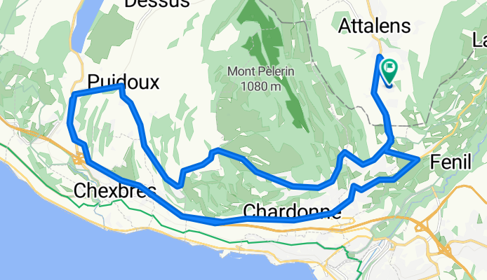
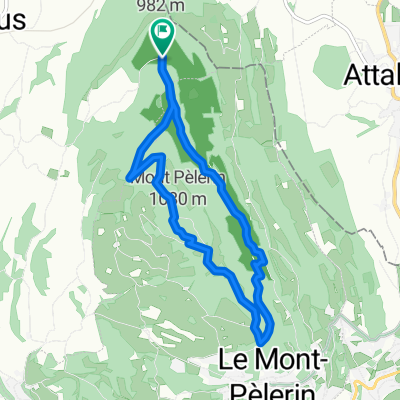
Mont-Pélerin / Genfer See
Trasa rowerowa w Attalens, Fryburg, Szwajcaria
Sehr schöne Strecke z.T. über dem Genfer See und zwischen Weinbergen. Teilweise recht steile Anstiege.
- 28 km
- Dystans
- 460 m
- Przewyższenia
- 459 m
- Spadek
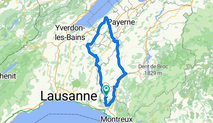
Circuit Estavayer-Le-Lac et la Glâne
Trasa rowerowa w Attalens, Fryburg, Szwajcaria
Circuit pour vélo de route entre Glâne et Broye
- 105,2 km
- Dystans
- 980 m
- Przewyższenia
- 980 m
- Spadek
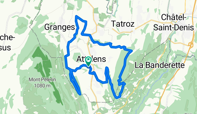
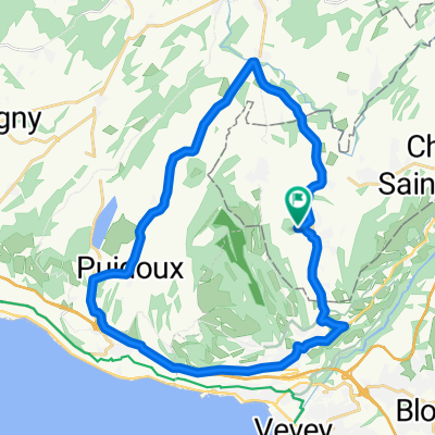
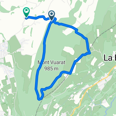
Parcours n°11 - Les Châteaux
Trasa rowerowa w Attalens, Fryburg, Szwajcaria
Parcours de difficulté moyenne reliant deux collines: Le Mont- Pèlerin et le Mont Vuarat. Entre les deux se blottit Attalens où vous ne manquerez pas d‘admirez son château-fort du XIIIe siècle, lieu de départ de la rando. A Bossonnens également, vous passerez devant les ruines en restauration de l‘ancien château du village.
- 17,8 km
- Dystans
- 401 m
- Przewyższenia
- 402 m
- Spadek
Odkryj więcej tras
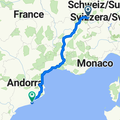 Reise nach Barcelona
- Dystans
- 1031,8 km
- Przewyższenia
- 3767 m
- Spadek
- 4538 m
- Lokalizacja
- Attalens, Fryburg, Szwajcaria
 Snail-Like Dimanche Course In Attalens
- Dystans
- 27,5 km
- Przewyższenia
- 357 m
- Spadek
- 355 m
- Lokalizacja
- Attalens, Fryburg, Szwajcaria
 Itinéraire modéré en Blonay
- Dystans
- 1,1 km
- Przewyższenia
- 22 m
- Spadek
- 0 m
- Lokalizacja
- Attalens, Fryburg, Szwajcaria
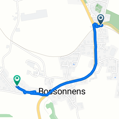
 Route en Chemins 2, Bossonnens à Route en Chemins 2, Bossonnens
- Dystans
- 43,9 km
- Przewyższenia
- 821 m
- Spadek
- 822 m
- Lokalizacja
- Attalens, Fryburg, Szwajcaria
 pédestre : Mont-Pèlerin De Chemin du Montcheseaux 7, Puidoux à Chemin du Montcheseaux 7, Puidoux
- Dystans
- 8,1 km
- Przewyższenia
- 264 m
- Spadek
- 266 m
- Lokalizacja
- Attalens, Fryburg, Szwajcaria
 Voie comme un escargot dans Le Mont-Pèlerin
- Dystans
- 3,5 km
- Przewyższenia
- 100 m
- Spadek
- 28 m
- Lokalizacja
- Attalens, Fryburg, Szwajcaria
 full vuarat circuit (without the part till we get to the Forrest since I forgot to record)
- Dystans
- 5,6 km
- Przewyższenia
- 204 m
- Spadek
- 230 m
- Lokalizacja
- Attalens, Fryburg, Szwajcaria
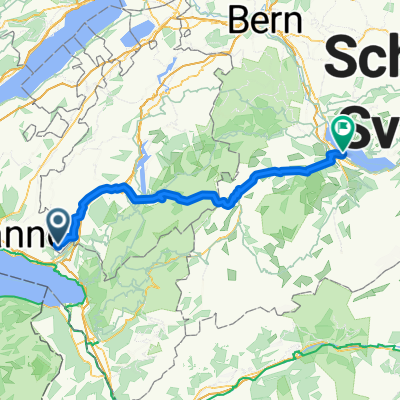 De Chemin de la Greppa 12, Attalens à Schachenstrasse 3 4, Spiez
- Dystans
- 97,3 km
- Przewyższenia
- 1717 m
- Spadek
- 1858 m
- Lokalizacja
- Attalens, Fryburg, Szwajcaria