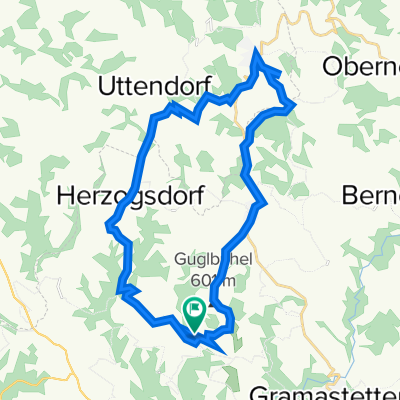
Sankt Gotthard im Mühlkreis na rowerze
Odkrywaj mapę z 59 trasami rowerowymi i szlakami w pobliżu Sankt Gotthard im Mühlkreis, stworzonymi przez naszą społeczność.
Portret regionu
Poznaj Sankt Gotthard im Mühlkreis
Znajdź odpowiednią trasę rowerową dla siebie w Sankt Gotthard im Mühlkreis – mamy tam 59 tras do odkrycia. Większość osób wybiera się tutaj na rower w miesiącu Czerwiec.
4923 km
Zarejestrowany dystans
59
Trasy rowerowe
Wspólnota
Najaktywniejsi użytkownicy w Sankt Gotthard im Mühlkreis
Od naszej społeczności
Najlepsze trasy rowerowe w Sankt Gotthard im Mühlkreis i okolicach
Rottenegg-Feldkirchen-Ottensheim-Rottenegg (Asphalt)
Trasa rowerowa w Sankt Gotthard im Mühlkreis, Upper Austria, Austria
Reine Bolzer-Strecke
- 37,5 km
- Dystans
- 72 m
- Przewyższenia
- 71 m
- Spadek
Obereschelberg-Neußerling
Trasa rowerowa w Sankt Gotthard im Mühlkreis, Upper Austria, Austria
- 36,5 km
- Dystans
- 707 m
- Przewyższenia
- 707 m
- Spadek
Laufstrecke Rodltal
Trasa rowerowa w Sankt Gotthard im Mühlkreis, Upper Austria, Austria
Reine Laufstrecke - vor allem im Winter sehr selektiv und nett.
- 9,7 km
- Dystans
- 327 m
- Przewyższenia
- 326 m
- Spadek
Rottenegg-Feldkirchen-Ottensheim-Rottenegg (Asphalt)
Trasa rowerowa w Sankt Gotthard im Mühlkreis, Upper Austria, Austria
Reine Bolzer-Strecke
(cloned from route 564741)
- 37,5 km
- Dystans
- 95 m
- Przewyższenia
- 94 m
- Spadek
Odkryj więcej tras
- Rottenegg-Gramastetten-Eidenberg-GIS (Asphalt)
- Dystans
- 32,8 km
- Przewyższenia
- 772 m
- Spadek
- 772 m
- Lokalizacja
- Sankt Gotthard im Mühlkreis, Upper Austria, Austria
- Rottenegg - St. Martin - Neußerling
- Dystans
- 62,9 km
- Przewyższenia
- 875 m
- Spadek
- 873 m
- Lokalizacja
- Sankt Gotthard im Mühlkreis, Upper Austria, Austria
- Mühltalrunde
- Dystans
- 65,3 km
- Przewyższenia
- 802 m
- Spadek
- 778 m
- Lokalizacja
- Sankt Gotthard im Mühlkreis, Upper Austria, Austria
- Rottenegg - St. Martin - Neußerling Variante hart
- Dystans
- 73 km
- Przewyższenia
- 854 m
- Spadek
- 852 m
- Lokalizacja
- Sankt Gotthard im Mühlkreis, Upper Austria, Austria
- Oberreumühle 3, Wieshof nach Oberreumühle 3, Wieshof
- Dystans
- 26,7 km
- Przewyższenia
- 683 m
- Spadek
- 684 m
- Lokalizacja
- Sankt Gotthard im Mühlkreis, Upper Austria, Austria
- Weihnachtsrunde
- Dystans
- 28,5 km
- Przewyższenia
- 0 m
- Spadek
- 0 m
- Lokalizacja
- Sankt Gotthard im Mühlkreis, Upper Austria, Austria
- gerling
- Dystans
- 32,8 km
- Przewyższenia
- 76 m
- Spadek
- 274 m
- Lokalizacja
- Sankt Gotthard im Mühlkreis, Upper Austria, Austria
- Donau-NWK-Runde
- Dystans
- 55,1 km
- Przewyższenia
- 997 m
- Spadek
- 997 m
- Lokalizacja
- Sankt Gotthard im Mühlkreis, Upper Austria, Austria