


- 36,4 km
- 960 m
- 973 m
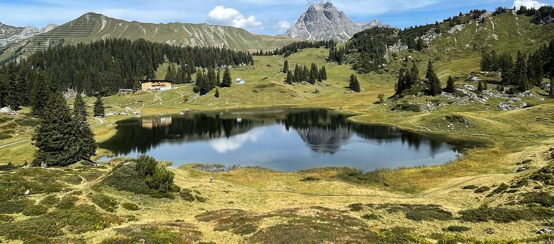
- Wald im Pinzgau, Salzburg, Austria

Salzburg na rowerze
Odkrywaj mapę z 32 485 trasami rowerowymi i szlakami w Salzburg, stworzonymi przez naszą społeczność.
Portret regionu
Poznaj Salzburg
Znajdź odpowiednią trasę rowerową dla siebie w Salzburg – mamy tam 32 485 tras do odkrycia. Większość osób wybiera się tutaj na rower w miesiącach Lipiec i Sierpień.
2 756 692 km
Zarejestrowany dystans
32 485
Trasy rowerowe
Wspólnota
Najaktywniejsi użytkownicy w Salzburg
Starannie wybrane trasy
Odkryj Salzburg dzięki tym kolekcjom
Od naszej społeczności
Najlepsze trasy rowerowe w Salzburg


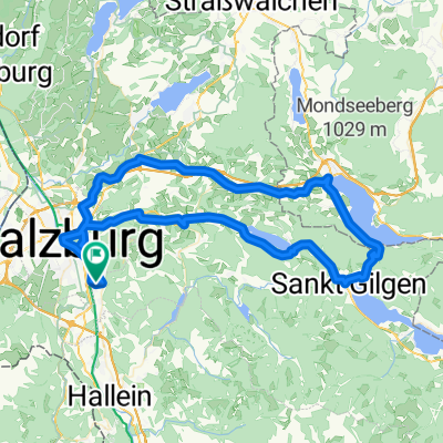
Salzburg | Flachgaurunde
Trasa rowerowa w Salzburg, Salzburg, Austria
- 65,1 km
- Dystans
- 681 m
- Przewyższenia
- 678 m
- Spadek


Stauffeneggstraße, Salzburg nach Stauffeneggstraße, Salzburg
Trasa rowerowa w Bergheim, Salzburg, Austria
- 33,9 km
- Dystans
- 147 m
- Przewyższenia
- 149 m
- Spadek


Salzburg | nördlicher Flachgau und Mattigtal
Trasa rowerowa w Salzburg, Salzburg, Austria
- 75,8 km
- Dystans
- 743 m
- Przewyższenia
- 744 m
- Spadek


Mattsee Seeparkplatz Nord nach Mattsee Seeparkplatz Nord
Trasa rowerowa w Mattsee, Salzburg, Austria
- 16,1 km
- Dystans
- 152 m
- Przewyższenia
- 176 m
- Spadek
Od naszych redaktorów
Najlepsze trasy rowerowe w Salzburg i okolicach

On the racing trail
Gerlospass
Touring the Gerlospass by bike gives you bragging rights, for you are following in the footsteps of the racing greats. The Tour of , the Tour of and the Giro d’Italia have all been routed to include the 1531 meter (5023 ft) high pass. But the Pinzgau region of Salzburg also has plenty of alternatives to offer for those who prefer a gentler ride. Zellersee cycle path or the circular Steinberg-Runde, for example, are especially great for kids.
Featured routes around Gerlospass


Gateway to Carinthia
Katschberg
The gateway from Hohe Tauern mountains to the Gurktaler Alps goes by several names: Katschberg, Katschbergpass or Katschberghöhe. Most motorized traffic goes through the tunnel, giving cyclists free reign over the scenic route via the Katschberg pass. Steep climbs and action-packed descents characterize this magnificent route on the border to .
Featured routes around Katschberg


Traffic-free bike tour
Filzensattel
Filzensattel almost exclusively belongs to cyclists. The faster route for cars between the towns of Saalfelden and Lend is via Zell am See, which makes this less frequented pass an ideal route for bikes. Coming from the east, the climb to 1290 meters (4232 ft) is short but challenging at a gradient of 14 per cent. The reward is a leisurely descent down to Saalfelden.
Featured routes around Filzensattel
- Rennradtour von Bruck über Filzensattel und Dientener Sattel
- 85,7 km
- 2042 m
- 2043 m
- Bruck an der Großglocknerstraße, Salzburg, Austria
- Bischofshofen - Filzensattel - Dientner Sattel - Bischofshofen
- 96,6 km
- 1153 m
- 1152 m
- Bischofshofen, Salzburg, Austria


The "Roof of Austria" by bike
Grossglockner
At 3798 meters (12461 ft), the Grossglockner is Austria’s highest mountain and a must-see peak of the Eastern Alps. Cyclists everywhere love to fear the famous Grossglockner High Alpine Road, situated in the heart of the Hohe Tauern national park . There are two routes leading to Edelweissspitze, the highest point, starting from Bruck in Salzburg or from Heiligenblut in . Whichever one you take, the views from the “Roof of Austria” are bound to be unforgettable!
Featured routes around Grossglockner
- Zell am See - Großglockner Hochalpenstraße - Heiligenblut - Lienz

- 93,5 km
- 2171 m
- 2250 m
- Zell am See, Salzburg, Austria


Route with a view
Dientener Sattel
North of the Salzach River lies the Dientener Sattel. It connects Dienten in the west with Mühlbach and Bischofshofen in the east. On the way across the mountain pass, you are presented with spectacular views of the Hochkönig mountain massif (2941 meters or 9649 ft). Prepare for a moderate ascent and a steep 15% descent from the Dientener Sattel.
Featured routes around Dientener Sattel
- Rennradtour von Bruck über Filzensattel und Dientener Sattel
- 85,7 km
- 2042 m
- 2043 m
- Bruck an der Großglocknerstraße, Salzburg, Austria
- Kaprun-Bischofshofen-Dienten-Kaprun CLONED FROM ROUTE 966814

- 102,2 km
- 1024 m
- 1024 m
- Kaprun, Salzburg, Austria
- Dienten - Bürglalm - Wastlhöhe - Dienter Sattel - Dienten
- 13,3 km
- 667 m
- 666 m
- Dienten am Hochkönig, Salzburg, Austria


Odkryj więcej tras
- Gerichtsstraße nach Gerichtsstraße 6a
- 58,5 km
- 456 m
- 499 m
- Bad Hofgastein, Salzburg, Austria
- Mattsee Seeparkplatz Nord nach Mattsee Seeparkplatz Nord
- 15,8 km
- 144 m
- 164 m
- Mattsee, Salzburg, Austria
- Tödtleinsdorf, Köstendorf nach Tödtleinsdorf, Köstendorf
- 27,3 km
- 266 m
- 286 m
- Schleedorf, Salzburg, Austria
- RCO 2026 Salzburg bis Sankt Johann in Tirol 1. Tag
- 79,2 km
- 1384 m
- 1145 m
- Salzburg, Salzburg, Austria
- Salzburg - Mondseerunde
- 83,1 km
- 717 m
- 717 m
- Elsbethen, Salzburg, Austria
- Bachwinkl, Maria Alm am Steinernen Meer nach Bachwinkl, Maria Alm am Steinernen Meer
- 19,7 km
- 897 m
- 890 m
- Maria Alm am Steinernen Meer, Salzburg, Austria
- R24 Mattigtalradweg
- 46,2 km
- ---
- ---
- Berndorf bei Salzburg, Salzburg, Austria
- RC191022
- 18,9 km
- 73 m
- 75 m
- Salzburg, Salzburg, Austria


Regiony rowerowe w Salzburg
Sankt Gilgen
503 trasy rowerowe
Zederhaus
149 trasy rowerowe
Rauris
96 trasy rowerowe
Strasswalchen
449 trasy rowerowe
Unken
148 trasy rowerowe
Zobacz, gdzie ludzie jeżdżą na rowerze w Austria
Popularne regiony do jazdy na rowerze w Austria