


![Paneuropa-Radweg (Paris - Prag) 2010 [Tag12]](https://media.bikemap.net/routes/656712/staticmaps/in_277a6336-6ba8-4176-b5c7-52f5295b04da_694x400_bikemap-2021-3D-static.png)
- 101,9 km
- 391 m
- 284 m
- Zirndorf, Bawaria, Niemcy

Bawaria na rowerze
Odkrywaj mapę z 363 613 trasami rowerowymi i szlakami w Bawaria, stworzonymi przez naszą społeczność.Portret regionuPoznaj Bawaria
Znajdź odpowiednią trasę rowerową dla siebie w Bawaria – mamy tam 363 613 tras do odkrycia. Większość osób wybiera się tutaj na rower w miesiącach Lipiec i Sierpień.
23 168 701 km
Zarejestrowany dystans
363 613
Trasy rowerowe
WspólnotaNajaktywniejsi użytkownicy w Bawaria


Altmühltal Tag 4 (Kipfenberg - Kehlheim)
Trasa rowerowa w Denkendorf, Bawaria, Niemcy
- 72,8 km
- Dystans
- 322 m
- Przewyższenia
- 366 m
- Spadek


Altmühltal Tag 5 (Kehlheim - Regensburg)
Trasa rowerowa w Kelheim, Bawaria, Niemcy
- 39,8 km
- Dystans
- 164 m
- Przewyższenia
- 175 m
- Spadek


Altmühltal Tag 3 (Möhren/Treuchtlingen - Kipfenberg)
Trasa rowerowa w Treuchtlingen, Bawaria, Niemcy
- 79,1 km
- Dystans
- 846 m
- Przewyższenia
- 888 m
- Spadek


Altmühltal Tag 2 (Herrieden - Treuchtlingen/Möhren)
Trasa rowerowa w Herrieden, Bawaria, Niemcy
- 63,7 km
- Dystans
- 201 m
- Przewyższenia
- 247 m
- Spadek

Paris to Prague
Pan-European Cycle RouteThe “Golden Road”, a historical trade route dating back to the Middle Ages, is now open for cyclists. Under the ambitious name Pan-European cycle route it leads from the French capital through picturesque regions of Germany – Bavaria and – all the way to Prague. The traders used to cover 1570 kilometers (976 miles) on horseback or by cart along this route, but today you will find plenty of infrastructure for your cycling needs.
The Pan-European Cycle Route


calls itself Germany's "Radlhauptstadt" (bicycle capital) and for good reason: more than 1200 kilometers (750 miles) of cycle paths open up the city to cyclists. is an ideal place to discover by bike. Sights like the Frauenkirche, Marienplatz, the Pinakotheken, the English Gardens and Nymphenburg Palace are all a must-see for visitors. A great variety of cycle routes quickly take you beyond the city borders and into the scenic Bavarian countryside. And every Fall, Munich is the center of attention as it throws the world's greatest beer party, Oktoberfest. The only event we'd ever recommend leaving your bike at home for!
Featured route around Munich


One river, eight countries
Danube Cycle PathA river originates in the Black Forest. As it winds its way to the Black Sea, it grows into the second longest waterway in Europe: the Danube. follows the river through eight countries and is one of the most popular long-distance routes for bike tourists. Over 600 kilometers (373 miles) form the German stretch of the Danube Cycle Path and are also part of EuroVelo 6, another stunning route leading from the Atlantic to the Black Sea.
The Danuble Cycle Path in Germany

Best of Alpine scenery
Isar Cycle PathThe Isar River is only the fourth largest river in Bavaria, but the views along its banks are as stunning as those of the Danube, Inn and Main rivers. The cycle path is over 295 kilometers (183 miles) long and follows the Isar’s course through a landscape of exceptional variety. Craggy peaks, Alpine pastures and national parks form the backdrop for this tour through and Bavaria.
The Isar Cycle Path


Everyone’s favorite
Inn Cycle PathBefore it flows into the near Passau, the Inn river meanders over a distance of 500 kilometers (310 miles) from its source at the Swiss Maloja pass through to Bavaria. Cyclists love to follow its course, for the Inn Cycle Path is one of the most magnificent river routes in Europe. The landscapes and views are unparalleled, with near-perfect infrastructure. Its German stretch is mostly flat and well suited for families and groups of all abilities.


Lakes and castles
Lake Constance - Lake Königssee Cycle PathWhile circling the “Swabian Sea” is always a good idea for a bike trip, there are other amazing cycle routes near waiting to be explored. Highly recommended: the Lake Constance-Lake Königssee-cycle path from Lindau to Berchtesgaden national park. Fairytale castles Hohenschwangau and Neuschwanstein as well as magnificent lake landscapes await.
The Lake Constance-Lake Königssee Cycle Path
- 6. Etappe: Bad Saulgau-Königssee: Chiemsee-Königssee
- 98,6 km
- 578 m
- 567 m
- Aschau im Chiemgau, Bawaria, Niemcy
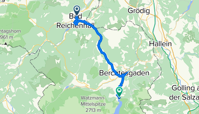
- Bodensee-Königssee-Radweg VIII (Bad Reichenhall - Königssee)

- 25,9 km
- 348 m
- 205 m
- Bad Reichenhall, Bawaria, Niemcy
- Bodensee-Königssee-Radweg IX (Königssee - Salzburg)
- 29 km
- 66 m
- 244 m
- Schönau am Königssee, Bawaria, Niemcy


- Altmühltal Tag1 (Kirnberg - Herrieden)
- 58,7 km
- 243 m
- 188 m
- Gebsattel, Bawaria, Niemcy
- #5 | Drei Flüsse und zwei Schoppen | Gemünden nach Würzburg
- 63,6 km
- 571 m
- 556 m
- Lohr am Main, Bawaria, Niemcy
- 2026_T003_Eching_Erding
- 53,1 km
- 258 m
- 313 m
- Eching, Bawaria, Niemcy
- Maisach-Altomünster
- 64,3 km
- 513 m
- 516 m
- Maisach, Bawaria, Niemcy
- #7 | Regen, Fachwerk und Ankunft im fränkischen Rom | Schweinfurt nach Bamberg
- 65,7 km
- 475 m
- 439 m
- Grafenrheinfeld, Bawaria, Niemcy
- Allach-Gauting
- 63,1 km
- 301 m
- 299 m
- Karlsfeld, Bawaria, Niemcy
- Hammerschmiedweg to Nonner Steg
- 40,7 km
- 885 m
- 944 m
- Bad Reichenhall, Bawaria, Niemcy
- Trainingsstrecke Landau - Simbach
- 20,3 km
- 190 m
- 158 m
- Landau an der Isar, Bawaria, Niemcy


- Berg im Gau21 trasy rowerowe
- Cham262 trasy rowerowe
- Grafling70 trasy rowerowe
- Otterfing153 trasy rowerowe
- Ichenhausen171 trasy rowerowe


