
Akka na rowerze
Odkrywaj mapę z 25 trasami rowerowymi i szlakami w pobliżu Akka, stworzonymi przez naszą społeczność.
Portret regionu
Poznaj Akka
Znajdź odpowiednią trasę rowerową dla siebie w Akka – mamy tam 25 tras do odkrycia.
1265 km
Zarejestrowany dystans
25
Trasy rowerowe
45 603
Populacja
Wspólnota
Najaktywniejsi użytkownicy w Akka


Starannie wybrane trasy
Odkryj Akka dzięki tym kolekcjom
- Wycieczka
Od naszej społeczności
Najlepsze trasy rowerowe w Akka i okolicach
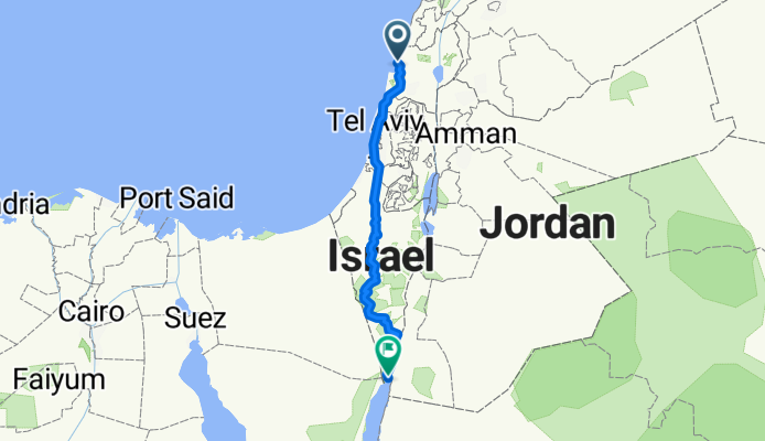
From Akko to Eilat
Trasa rowerowa w Akka, Dystrykt Północny, Izrael
- 552,7 km
- Dystans
- 6035 m
- Przewyższenia
- 6020 m
- Spadek
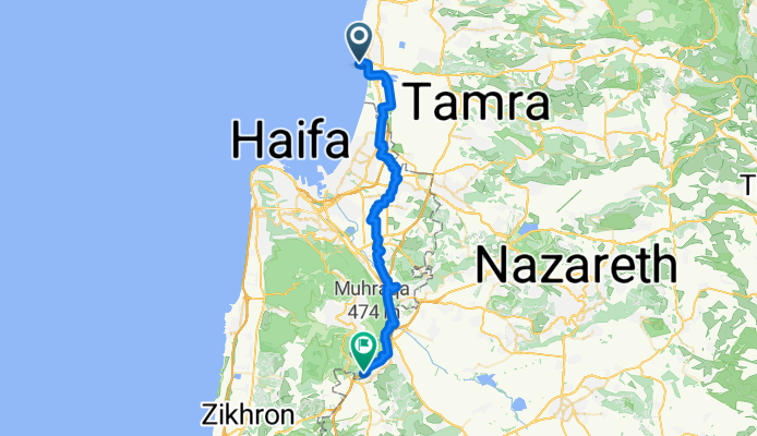
Acre - Daliyat al Karmel
Trasa rowerowa w Akka, Dystrykt Północny, Izrael
- 47 km
- Dystans
- 370 m
- Przewyższenia
- 219 m
- Spadek

My dusty trip
Trasa rowerowa w Akka, Dystrykt Północny, Izrael
- 28,5 km
- Dystans
- 32 m
- Przewyższenia
- 48 m
- Spadek


עכו to דרך ללא שם, עין המפרץ
Trasa rowerowa w Akka, Dystrykt Północny, Izrael
- 63 km
- Dystans
- 287 m
- Przewyższenia
- 289 m
- Spadek
Odkryj więcej tras
 Acre To Kfar Kama 18
- Dystans
- 53,5 km
- Przewyższenia
- 332 m
- Spadek
- 143 m
- Lokalizacja
- Akka, Dystrykt Północny, Izrael
 Ako to Roash hanikra
- Dystans
- 35,3 km
- Przewyższenia
- 89 m
- Spadek
- 84 m
- Lokalizacja
- Akka, Dystrykt Północny, Izrael
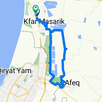
 מסעף עין המפרץ, עכו to Unnamed Road, Kfar Masaryk
- Dystans
- 1,7 km
- Przewyższenia
- 8 m
- Spadek
- 9 m
- Lokalizacja
- Akka, Dystrykt Północny, Izrael
 David Noy Street 39, Acre do HaPalmach Street 71-73, Safed
- Dystans
- 48,8 km
- Przewyższenia
- 1357 m
- Spadek
- 586 m
- Lokalizacja
- Akka, Dystrykt Północny, Izrael
 עין המפרץ 20ק"מ
- Dystans
- 20,4 km
- Przewyższenia
- 56 m
- Spadek
- 58 m
- Lokalizacja
- Akka, Dystrykt Północny, Izrael
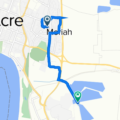
 Unnamed Road to Yehuda Burla Street 6, Acre
- Dystans
- 5,5 km
- Przewyższenia
- 72 m
- Spadek
- 49 m
- Lokalizacja
- Akka, Dystrykt Północny, Izrael
 Yehuda Burla Street 6, Acre to Shvil HaBanim, Ein HaMifrats
- Dystans
- 5,3 km
- Przewyższenia
- 49 m
- Spadek
- 63 m
- Lokalizacja
- Akka, Dystrykt Północny, Izrael
 מסעאופניים17-תחנותרענון
- Dystans
- 76,1 km
- Przewyższenia
- 559 m
- Spadek
- 326 m
- Lokalizacja
- Akka, Dystrykt Północny, Izrael