
Vittel na rowerze
Odkrywaj mapę z 57 trasami rowerowymi i szlakami w pobliżu Vittel, stworzonymi przez naszą społeczność.
Portret regionu
Poznaj Vittel
Znajdź odpowiednią trasę rowerową dla siebie w Vittel – mamy tam 57 tras do odkrycia. Większość osób wybiera się tutaj na rower w miesiącu Lipiec.
4684 km
Zarejestrowany dystans
57
Trasy rowerowe
5728
Populacja
Wspólnota
Najaktywniejsi użytkownicy w Vittel
Od naszej społeczności
Najlepsze trasy rowerowe w Vittel i okolicach
Tour de France 2009, Etappe 13 - 200,0 km
Trasa rowerowa w Vittel, Alsace-Champagne-Ardenne-Lorraine, France
Cloned from:
http://www.bikemap.net/route/95265
- 201,6 km
- Dystans
- 2812 m
- Przewyższenia
- 2530 m
- Spadek
Etappe 13 Tour de France 2009 von Vittel nach Colmar CLONED FROM ROUTE 95265
Trasa rowerowa w Vittel, Alsace-Champagne-Ardenne-Lorraine, France
Tour de France 2009Etappe 13 vom 17.07.2009von Vittel nach Colmar
Mittelgebirgsetappe mit 200 km Länge
zur 12. Etappe 2009 / zur 14. Etappe 2009Le Tour / Etappe 13 - Das Original
Pässe und Steigungen zur Etappe:
Km 46.0 - Côte de Xertigny 2.0 km zu 5.3 % - Km 105,0 - Col de la Schlucht 8,9 km zu 4,1 %- Km 138,5 - Col du Platzerwasel 8,7 km zu 7,6 % - Km 165,5 - Col du Bannstein 2.1 km zu 5.1 % - Km 179,5 - Col du Firstplan 8,4 km zu 5,4 %
- 205,1 km
- Dystans
- 2515 m
- Przewyższenia
- 2663 m
- Spadek
Stage 5 » Vittel › La Planche des Belles Filles (160k)
Trasa rowerowa w Vittel, Alsace-Champagne-Ardenne-Lorraine, France
It only took two stage finishes there for La Planche des Belles Filles to add its name to the history of the Tour. The climb is rather short however it's extremely demanding, especially on the final part. The gradients indeed reach 20%. It'll be a first explanation between the favourites.
- 160,2 km
- Dystans
- 1665 m
- Przewyższenia
- 869 m
- Spadek
Etappe 13 Tour de France 2009 von Vittel nach Colmar CLONED FROM ROUTE 95265
Trasa rowerowa w Vittel, Alsace-Champagne-Ardenne-Lorraine, France
Cloned from:
http://www.bikemap.net/route/95265
- 207,5 km
- Dystans
- 3003 m
- Przewyższenia
- 2741 m
- Spadek
Odkryj więcej tras
- Roundtrip Vittel
- Dystans
- 46,4 km
- Przewyższenia
- 579 m
- Spadek
- 579 m
- Lokalizacja
- Vittel, Alsace-Champagne-Ardenne-Lorraine, France
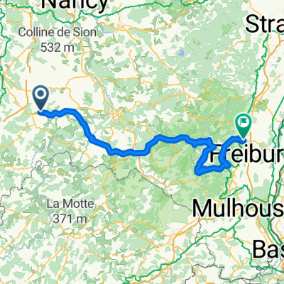
- 10) Vittel - Grand Ballon
- Dystans
- 164,7 km
- Przewyższenia
- 2605 m
- Spadek
- 1593 m
- Lokalizacja
- Vittel, Alsace-Champagne-Ardenne-Lorraine, France
- Vittel 9/6/2016
- Dystans
- 12 km
- Przewyższenia
- 121 m
- Spadek
- 107 m
- Lokalizacja
- Vittel, Alsace-Champagne-Ardenne-Lorraine, France
- De 424 Rue de Lignéville, Vittel à 10 Rue Sainte-Anne, Bulgnéville
- Dystans
- 11,9 km
- Przewyższenia
- 135 m
- Spadek
- 143 m
- Lokalizacja
- Vittel, Alsace-Champagne-Ardenne-Lorraine, France
- VITTEL
- Dystans
- 30,8 km
- Przewyższenia
- 405 m
- Spadek
- 395 m
- Lokalizacja
- Vittel, Alsace-Champagne-Ardenne-Lorraine, France
- VITTEL
- Dystans
- 25,3 km
- Przewyższenia
- 347 m
- Spadek
- 352 m
- Lokalizacja
- Vittel, Alsace-Champagne-Ardenne-Lorraine, France
- VITTEL - LA PLANCHE DES BELLES FILLES
- Dystans
- 159,4 km
- Przewyższenia
- 1703 m
- Spadek
- 1023 m
- Lokalizacja
- Vittel, Alsace-Champagne-Ardenne-Lorraine, France
- bmap
- Dystans
- 3,3 km
- Przewyższenia
- 23 m
- Spadek
- 24 m
- Lokalizacja
- Vittel, Alsace-Champagne-Ardenne-Lorraine, France