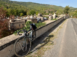
Villefranche-de-Rouergue na rowerze
Odkrywaj mapę z 89 trasami rowerowymi i szlakami w pobliżu Villefranche-de-Rouergue, stworzonymi przez naszą społeczność.
Portret regionu
Poznaj Villefranche-de-Rouergue
Znajdź odpowiednią trasę rowerową dla siebie w Villefranche-de-Rouergue – mamy tam 89 tras do odkrycia. Większość osób wybiera się tutaj na rower w miesiącach Lipiec i Sierpień.
3744 km
Zarejestrowany dystans
89
Trasy rowerowe
14 030
Populacja
Wspólnota
Najaktywniejsi użytkownicy w Villefranche-de-Rouergue
Od naszej społeczności
Najlepsze trasy rowerowe w Villefranche-de-Rouergue i okolicach
Villefranche-de-Rouergue - Circle to Najac
Trasa rowerowa w Villefranche-de-Rouergue, Occitanie, Francja
This was an excellent ride on great roads. I took a little different route this time than the similar ride a few days ago.
Due to a missed turn on the return , I added a little distance and a little more climbing to getting back to our hotel.
- 48,9 km
- Dystans
- 748 m
- Przewyższenia
- 750 m
- Spadek
Villefranche-de-Rouergue - Circle through St Grat, Castanet, and Monteils
Trasa rowerowa w Villefranche-de-Rouergue, Occitanie, Francja
This was an excellent route on mostly scenic low-traffic country roads.
- 53,1 km
- Dystans
- 708 m
- Przewyższenia
- 707 m
- Spadek
2016 Ride Day 168 - Villefranche-de-Rouergue Circle through Najac
Trasa rowerowa w Villefranche-de-Rouergue, Occitanie, Francja
This was a wonderful ride south along D922, then through Najac and back to Villefranche along D47. All excellent zero and low traffic roads. Only within Villefranche were there any cars.
- 50,5 km
- Dystans
- 761 m
- Przewyższenia
- 761 m
- Spadek
2016 Ride Day 169 - Villefranche-de-Rouergue to Montauban
Trasa rowerowa w Villefranche-de-Rouergue, Occitanie, Francja
This was a wonderful circuitous route on great roads. D9 was a particularly nice road. And parts of D15 were very beautiful. All roads were either low or zero traffic roads.
- 112,4 km
- Dystans
- 971 m
- Przewyższenia
- 1125 m
- Spadek
Odkryj więcej tras
 Combenegre Aveyron Lezert
- Dystans
- 23,4 km
- Przewyższenia
- 493 m
- Spadek
- 497 m
- Lokalizacja
- Villefranche-de-Rouergue, Occitanie, Francja
 Villefranche-de-Rouergue - Circle to Najac
- Dystans
- 48,7 km
- Przewyższenia
- 665 m
- Spadek
- 665 m
- Lokalizacja
- Villefranche-de-Rouergue, Occitanie, Francja
 2014 Ride Day 89 - Villefranche-de-Rouergue to Cahors
- Dystans
- 81,4 km
- Przewyższenia
- 356 m
- Spadek
- 491 m
- Lokalizacja
- Villefranche-de-Rouergue, Occitanie, Francja
 Dordogne 20130713
- Dystans
- 94,8 km
- Przewyższenia
- 812 m
- Spadek
- 952 m
- Lokalizacja
- Villefranche-de-Rouergue, Occitanie, Francja
 Od Dordogne do Provence 5.etapa
- Dystans
- 73,9 km
- Przewyższenia
- 507 m
- Spadek
- 646 m
- Lokalizacja
- Villefranche-de-Rouergue, Occitanie, Francja
 Door to Door day 13 Villefranche de Rouergue - Bruniquel 23rd Sept
- Dystans
- 58 km
- Przewyższenia
- 723 m
- Spadek
- 963 m
- Lokalizacja
- Villefranche-de-Rouergue, Occitanie, Francja
 Aveyron-Tag5--1-0719 Runde angepasst
- Dystans
- 94,2 km
- Przewyższenia
- 995 m
- Spadek
- 1106 m
- Lokalizacja
- Villefranche-de-Rouergue, Occitanie, Francja
 martiel bannac
- Dystans
- 23,6 km
- Przewyższenia
- 93 m
- Spadek
- 80 m
- Lokalizacja
- Villefranche-de-Rouergue, Occitanie, Francja


