
Valentigney na rowerze
Odkrywaj mapę z 42 trasami rowerowymi i szlakami w pobliżu Valentigney, stworzonymi przez naszą społeczność.
Portret regionu
Poznaj Valentigney
Znajdź odpowiednią trasę rowerową dla siebie w Valentigney – mamy tam 42 tras do odkrycia. Większość osób wybiera się tutaj na rower w miesiącu Sierpień.
3452 km
Zarejestrowany dystans
42
Trasy rowerowe
12 608
Populacja
Wspólnota
Najaktywniejsi użytkownicy w Valentigney


Od naszej społeczności
Najlepsze trasy rowerowe w Valentigney i okolicach
Après midi sous Bossa Nova
Trasa rowerowa w Valentigney, Burgundia-Franche-Comté, Francja
- 35 km
- Dystans
- 285 m
- Przewyższenia
- 285 m
- Spadek

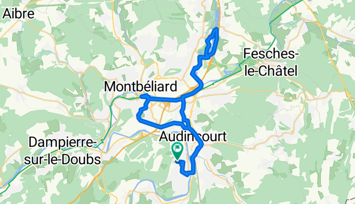
Valentigney - Gunsbach
Trasa rowerowa w Valentigney, Burgundia-Franche-Comté, Francja
Relatively easy, this route can be done in one day, even with bags.
An English and French description follows:
English: You can follow "La coulée verte" from Exincourt until Dannemarie eventhough, here on the map, it follows a road next to the "Canal du Rhône au Rhin".
The road there is really nice, peaceful (only cyclist and pedestrians are allowed)
From Dannemarie until Cernay, the road is gently rolling. After Burnhaupt-le-Haut, follow the road "Route de Schweighouse", you cannot take the D83!
From Cernay until Wintzenheim, you follow the "Route des vins d'Alsace", which cross many beautiful villages, all worth a stop.
The road just after Wintzenheim has heavy traffic, try to quit the D417 as soon as you can.
Français: Il est possible de suivre la coulée verte d'exincourt à Dannemarie, même si sur cette carte la route indiquée est légèrement à côtée. Il suffit de suivre le canal du Rhône au Rhin.
Cette route est superbe et tranquille (seulement pour cycliste et piéton)
De Dannemarie à Cernay, la route est un moins plate, mais encore jolie. Attention en s'approchant de la nationale, le traffic augmente. Après Burnhaupt-le-Haut, prenez la route de Schweighouse, la D83 est interdite au cycliste.
Ensuite de Cernay à Wintzenheim, il suffit de suivre presque tout le temps la route des vins d'Alsace. Les villages traversés sont magnifiques, pensez à y faire quelques arrêts.
La D417 après Wintzenheim a un trafic soutenu, prennez la première opportunité qui se présente pour quitter cette route.
- 126,2 km
- Dystans
- 466 m
- Przewyższenia
- 548 m
- Spadek

JuraExtrem 12.8.-20.8.2023
Trasa rowerowa w Valentigney, Burgundia-Franche-Comté, Francja
- 982,4 km
- Dystans
- 24 123 m
- Przewyższenia
- 24 144 m
- Spadek

sortie préparation sortie tour du Léman 2019
Trasa rowerowa w Valentigney, Burgundia-Franche-Comté, Francja
- 168,8 km
- Dystans
- 1490 m
- Przewyższenia
- 1460 m
- Spadek
Odkryj więcej tras
 Facile à conduire Valentigney
- Dystans
- 41,8 km
- Przewyższenia
- 1037 m
- Spadek
- 580 m
- Lokalizacja
- Valentigney, Burgundia-Franche-Comté, Francja
 Etappe 12
- Dystans
- 84,1 km
- Przewyższenia
- 411 m
- Spadek
- 452 m
- Lokalizacja
- Valentigney, Burgundia-Franche-Comté, Francja
 Pascal Yves daniel
- Dystans
- 131,6 km
- Przewyższenia
- 1280 m
- Spadek
- 1281 m
- Lokalizacja
- Valentigney, Burgundia-Franche-Comté, Francja
 Tag 6 Doubs
- Dystans
- 87,7 km
- Przewyższenia
- 555 m
- Spadek
- 636 m
- Lokalizacja
- Valentigney, Burgundia-Franche-Comté, Francja
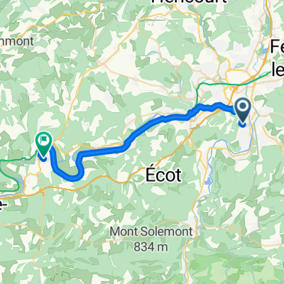
 57 Rue Étienne Oehmichen, Valentigney à Place du 8 Mai, Mandeure
- Dystans
- 4,3 km
- Przewyższenia
- 23 m
- Spadek
- 16 m
- Lokalizacja
- Valentigney, Burgundia-Franche-Comté, Francja
 Step 40km
- Dystans
- 42,1 km
- Przewyższenia
- 603 m
- Spadek
- 605 m
- Lokalizacja
- Valentigney, Burgundia-Franche-Comté, Francja
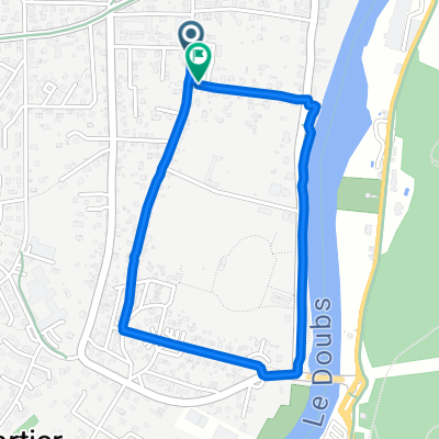 Rue des Chardonnerets, Valentigney à Rue des Chardonnerets, Valentigney
- Dystans
- 2,3 km
- Przewyższenia
- 21 m
- Spadek
- 24 m
- Lokalizacja
- Valentigney, Burgundia-Franche-Comté, Francja
 l’Isle en légende
- Dystans
- 27,9 km
- Przewyższenia
- 206 m
- Spadek
- 230 m
- Lokalizacja
- Valentigney, Burgundia-Franche-Comté, Francja