
Valensole na rowerze
Odkrywaj mapę z 70 trasami rowerowymi i szlakami w pobliżu Valensole, stworzonymi przez naszą społeczność.
Portret regionu
Poznaj Valensole
Znajdź odpowiednią trasę rowerową dla siebie w Valensole – mamy tam 70 tras do odkrycia. Większość osób wybiera się tutaj na rower w miesiącu Czerwiec.
4377 km
Zarejestrowany dystans
70
Trasy rowerowe
2479
Populacja
Wspólnota
Najaktywniejsi użytkownicy w Valensole


Od naszej społeczności
Najlepsze trasy rowerowe w Valensole i okolicach

Tour du Lac Ste Croix par La Palud
Trasa rowerowa w Valensole, Prowansja-Alpy-Lazurowe Wybrzeże, Francja
à faire aussi:
col de l'Espinouse
col de La mort d'Imbert
col de Puimichel
col de St Barnabé (Castellane)
- 115,5 km
- Dystans
- 1488 m
- Przewyższenia
- 1503 m
- Spadek

Strecke C: Valensole-Sisteron
Trasa rowerowa w Valensole, Prowansja-Alpy-Lazurowe Wybrzeże, Francja
Route 31( Führer), D15 bis La Moutte, D4 bis Maligai, N15 kurz, D4 bis kurz vor Sisteron, dann D4085
- 59 km
- Dystans
- 387 m
- Przewyższenia
- 424 m
- Spadek

Allemagne - Gorges du Verdon - Allemagne
Trasa rowerowa w Valensole, Prowansja-Alpy-Lazurowe Wybrzeże, Francja
Allemagne - Gorges du Verdon - Allemagne
- 98,5 km
- Dystans
- 1186 m
- Przewyższenia
- 1161 m
- Spadek

route 1
Trasa rowerowa w Valensole, Prowansja-Alpy-Lazurowe Wybrzeże, Francja
- 42,9 km
- Dystans
- 533 m
- Przewyższenia
- 427 m
- Spadek
Odkryj więcej tras
 Valensole-Manosque-Rellaine-Cereste-Apt
- Dystans
- 74,8 km
- Przewyższenia
- 632 m
- Spadek
- 993 m
- Lokalizacja
- Valensole, Prowansja-Alpy-Lazurowe Wybrzeże, Francja
 Valensole Cycling
- Dystans
- 34 km
- Przewyższenia
- 235 m
- Spadek
- 216 m
- Lokalizacja
- Valensole, Prowansja-Alpy-Lazurowe Wybrzeże, Francja
 Valensole - Camping Verdon
- Dystans
- 16,9 km
- Przewyższenia
- 252 m
- Spadek
- 396 m
- Lokalizacja
- Valensole, Prowansja-Alpy-Lazurowe Wybrzeże, Francja
 2 Chemin des Anciens Abattoirs, Valensole à 2 Chemin des Anciens Abattoirs, Valensole
- Dystans
- 74,5 km
- Przewyższenia
- 1451 m
- Spadek
- 1453 m
- Lokalizacja
- Valensole, Prowansja-Alpy-Lazurowe Wybrzeże, Francja
 Route de manosque
- Dystans
- 5,9 km
- Przewyższenia
- 42 m
- Spadek
- 43 m
- Lokalizacja
- Valensole, Prowansja-Alpy-Lazurowe Wybrzeże, Francja
 Valensole_Moustiers_Sainte-Marie_retour_par_Riez
- Dystans
- 56,7 km
- Przewyższenia
- 568 m
- Spadek
- 592 m
- Lokalizacja
- Valensole, Prowansja-Alpy-Lazurowe Wybrzeże, Francja
 Allemagne en provence- Quinso-Allemagne en Provence
- Dystans
- 39,5 km
- Przewyższenia
- 686 m
- Spadek
- 594 m
- Lokalizacja
- Valensole, Prowansja-Alpy-Lazurowe Wybrzeże, Francja
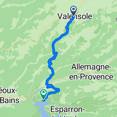
 Route3, Allemagne en provence / esparon. Pima voor niet gevordefe wielerstouristjes die toch...al dan niet met een e- bick de streek willen verkennen!
- Dystans
- 28,9 km
- Przewyższenia
- 453 m
- Spadek
- 457 m
- Lokalizacja
- Valensole, Prowansja-Alpy-Lazurowe Wybrzeże, Francja