
Soultzmatt na rowerze
Odkrywaj mapę z 98 trasami rowerowymi i szlakami w pobliżu Soultzmatt, stworzonymi przez naszą społeczność.
Portret regionu
Poznaj Soultzmatt
Znajdź odpowiednią trasę rowerową dla siebie w Soultzmatt – mamy tam 98 tras do odkrycia. Większość osób wybiera się tutaj na rower w miesiącach Lipiec i Sierpień.
6411 km
Zarejestrowany dystans
98
Trasy rowerowe
2183
Populacja
Wspólnota
Najaktywniejsi użytkownicy w Soultzmatt


Od naszej społeczności
Najlepsze trasy rowerowe w Soultzmatt i okolicach

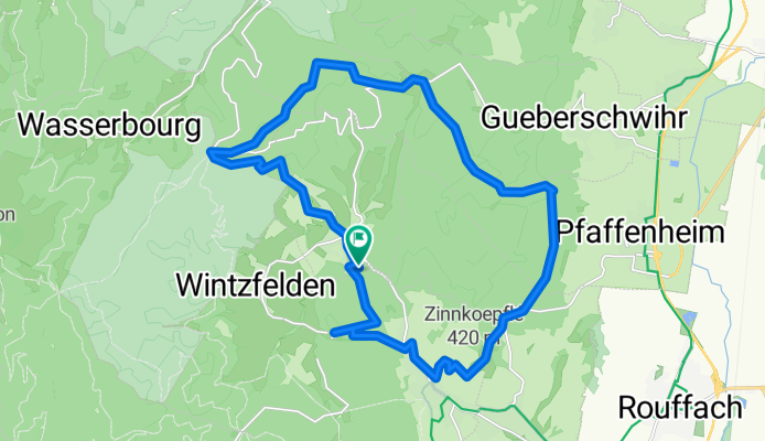
Vogesen II
Trasa rowerowa w Soultzmatt, Grand Est, Francja
- 101,4 km
- Dystans
- 2806 m
- Przewyższenia
- 2321 m
- Spadek

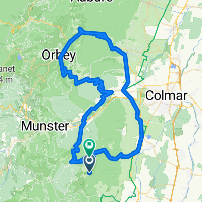
Vosges deluxe #4
Trasa rowerowa w Soultzmatt, Grand Est, Francja
- 186,4 km
- Dystans
- 3752 m
- Przewyższenia
- 3752 m
- Spadek

Rte des Crêtes 2013
Trasa rowerowa w Soultzmatt, Grand Est, Francja
- 113,3 km
- Dystans
- 1842 m
- Przewyższenia
- 1842 m
- Spadek
Osenbach-Osenbühr
Trasa rowerowa w Soultzmatt, Grand Est, Francja
- 23,5 km
- Dystans
- 883 m
- Przewyższenia
- 885 m
- Spadek
Odkryj więcej tras
 Alsace Ballons + 2
- Dystans
- 156,6 km
- Przewyższenia
- 3213 m
- Spadek
- 3230 m
- Lokalizacja
- Soultzmatt, Grand Est, Francja
 Vosges deluxe
- Dystans
- 194,1 km
- Przewyższenia
- 3585 m
- Spadek
- 3585 m
- Lokalizacja
- Soultzmatt, Grand Est, Francja
 Vogezen
- Dystans
- 115,5 km
- Przewyższenia
- 1690 m
- Spadek
- 1690 m
- Lokalizacja
- Soultzmatt, Grand Est, Francja
 quäldich.de - Vogesen, E1 - Auberge du Boenlesgrab
- Dystans
- 44,4 km
- Przewyższenia
- 721 m
- Spadek
- 717 m
- Lokalizacja
- Soultzmatt, Grand Est, Francja
 westhal savern 116 620
- Dystans
- 116,1 km
- Przewyższenia
- 790 m
- Spadek
- 902 m
- Lokalizacja
- Soultzmatt, Grand Est, Francja
 Vogesen II CLONED FROM ROUTE 338990
- Dystans
- 101,6 km
- Przewyższenia
- 2196 m
- Spadek
- 2197 m
- Lokalizacja
- Soultzmatt, Grand Est, Francja
 quälich.de - Vogesen, E1a - Klassiker zum Auftakt
- Dystans
- 65,2 km
- Przewyższenia
- 1306 m
- Spadek
- 1306 m
- Lokalizacja
- Soultzmatt, Grand Est, Francja
 Route nach D40, 68570 Osenbach
- Dystans
- 86,5 km
- Przewyższenia
- 2583 m
- Spadek
- 2445 m
- Lokalizacja
- Soultzmatt, Grand Est, Francja