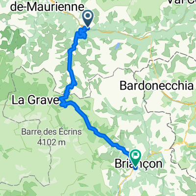
- 71,9 km
- 2042 m
- 1465 m
- Saint-Michel-de-Maurienne, Owernia-Rodan-Alpy, Francja

Saint-Michel-de-Maurienne na rowerze
Odkrywaj mapę z 484 trasami rowerowymi i szlakami w pobliżu Saint-Michel-de-Maurienne, stworzonymi przez naszą społeczność.
Portret regionu
Poznaj Saint-Michel-de-Maurienne
Znajdź odpowiednią trasę rowerową dla siebie w Saint-Michel-de-Maurienne – mamy tam 484 tras do odkrycia. Większość osób wybiera się tutaj na rower w miesiącach Lipiec i Sierpień.
52 939 km
Zarejestrowany dystans
484
Trasy rowerowe
3174
Populacja
Wspólnota
Najaktywniejsi użytkownicy w Saint-Michel-de-Maurienne
Od naszej społeczności
Najlepsze trasy rowerowe w Saint-Michel-de-Maurienne i okolicach
Saint-Michel-de-Maurienne - Marthod
Trasa rowerowa w Saint-Michel-de-Maurienne, Owernia-Rodan-Alpy, Francja
- 86,5 km
- Dystans
- 863 m
- Przewyższenia
- 1394 m
- Spadek
CROIX DE FER
Trasa rowerowa w Saint-Michel-de-Maurienne, Owernia-Rodan-Alpy, Francja
- 63,9 km
- Dystans
- 2571 m
- Przewyższenia
- 2571 m
- Spadek
Telegraphe - Galibier
Trasa rowerowa w Saint-Michel-de-Maurienne, Owernia-Rodan-Alpy, Francja
- 64,7 km
- Dystans
- 2218 m
- Przewyższenia
- 1565 m
- Spadek
FA08 Briancon
Trasa rowerowa w Saint-Michel-de-Maurienne, Owernia-Rodan-Alpy, Francja
- 69,2 km
- Dystans
- 2096 m
- Przewyższenia
- 1479 m
- Spadek
Odkryj więcej tras
- Radreise Ge-Nice-Ledro, St.-Michel-de-Maurienne - Briacon
- 10 tappa traversata delle alpi
- 75,7 km
- 2092 m
- 1625 m
- Saint-Michel-de-Maurienne, Owernia-Rodan-Alpy, Francja
- Etappe 3 - Route des grandes Alpes
- 121,4 km
- 3175 m
- 2863 m
- Saint-Michel-de-Maurienne, Owernia-Rodan-Alpy, Francja
- alpes-2012 Telegraphe-Galibiere
- 111,6 km
- 3206 m
- 2653 m
- Saint-Michel-de-Maurienne, Owernia-Rodan-Alpy, Francja
- Day 4: Route des Grandes Alpes by BY
- 72,6 km
- 2113 m
- 1488 m
- Saint-Michel-de-Maurienne, Owernia-Rodan-Alpy, Francja
- Col du Galibier
- 71,9 km
- 2597 m
- 2058 m
- Saint-Michel-de-Maurienne, Owernia-Rodan-Alpy, Francja
- Saint-Michel de Maurienne - Alpe d'Huez
- 95,6 km
- 3345 m
- 2202 m
- Saint-Michel-de-Maurienne, Owernia-Rodan-Alpy, Francja
- Tour Alpin 2011 - Etappe 3
- 94,5 km
- 3502 m
- 2396 m
- Saint-Michel-de-Maurienne, Owernia-Rodan-Alpy, Francja
Trasy z Saint-Michel-de-Maurienne
Jednodniowa wycieczka rowerowa od
Z Saint-Michel-de-Maurienne do Briançon
Jednodniowa wycieczka rowerowa od
Z Saint-Michel-de-Maurienne do Huez
Rowerowa od
Z Saint-Michel-de-Maurienne do Valloire
Trasy do Saint-Michel-de-Maurienne
Jednodniowa wycieczka rowerowa od
Z Huez do Saint-Michel-de-Maurienne
Jednodniowa wycieczka rowerowa od
Z Bourg-Saint-Maurice do Saint-Michel-de-Maurienne


