Saint-Chaffrey na rowerze
Odkrywaj mapę z 109 trasami rowerowymi i szlakami w pobliżu Saint-Chaffrey, stworzonymi przez naszą społeczność.
Portret regionu
Poznaj Saint-Chaffrey
Znajdź odpowiednią trasę rowerową dla siebie w Saint-Chaffrey – mamy tam 109 tras do odkrycia. Większość osób wybiera się tutaj na rower w miesiącach Lipiec i Sierpień.
10 751 km
Zarejestrowany dystans
109
Trasy rowerowe
1716
Populacja
Wspólnota
Najaktywniejsi użytkownicy w Saint-Chaffrey
Od naszej społeczności
Najlepsze trasy rowerowe w Saint-Chaffrey i okolicach
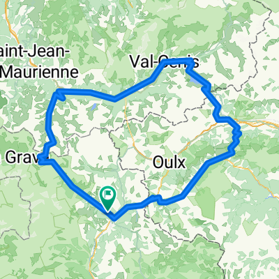
CIRCUIT D ITALIE
Trasa rowerowa w Saint-Chaffrey, Prowansja-Alpy-Lazurowe Wybrzeże, Francja
- 82,5 km
- Dystans
- 1326 m
- Przewyższenia
- 1325 m
- Spadek
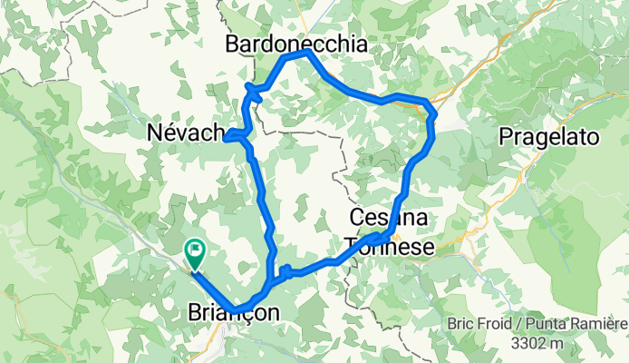
Cesana- Olux -Cesana
Trasa rowerowa w Saint-Chaffrey, Prowansja-Alpy-Lazurowe Wybrzeże, Francja
- 64,2 km
- Dystans
- 1949 m
- Przewyższenia
- 1949 m
- Spadek
Col de Galibier
Trasa rowerowa w Saint-Chaffrey, Prowansja-Alpy-Lazurowe Wybrzeże, Francja
- 32 km
- Dystans
- 1326 m
- Przewyższenia
- 16 m
- Spadek
France, Alpes Nord 2 : Albertville - Col du Granon
Trasa rowerowa w Saint-Chaffrey, Prowansja-Alpy-Lazurowe Wybrzeże, Francja
- 256,5 km
- Dystans
- 4489 m
- Przewyższenia
- 6491 m
- Spadek
Odkryj więcej tras
 Nevache - Pragelato
- Dystans
- 51,1 km
- Przewyższenia
- 1155 m
- Spadek
- 1462 m
- Lokalizacja
- Saint-Chaffrey, Prowansja-Alpy-Lazurowe Wybrzeże, Francja
 Col de Granon
- Dystans
- 26,6 km
- Przewyższenia
- 1104 m
- Spadek
- 1035 m
- Lokalizacja
- Saint-Chaffrey, Prowansja-Alpy-Lazurowe Wybrzeże, Francja
 JK Tour de France
- Dystans
- 1070 km
- Przewyższenia
- 2569 m
- Spadek
- 3917 m
- Lokalizacja
- Saint-Chaffrey, Prowansja-Alpy-Lazurowe Wybrzeże, Francja
 D6-SeyenAdventures-Graviflette2020-v7
- Dystans
- 74,6 km
- Przewyższenia
- 3518 m
- Spadek
- 3829 m
- Lokalizacja
- Saint-Chaffrey, Prowansja-Alpy-Lazurowe Wybrzeże, Francja
 Lautaret, Croix de Fer, Telegraph, Galibier
- Dystans
- 205,8 km
- Przewyższenia
- 4074 m
- Spadek
- 4071 m
- Lokalizacja
- Saint-Chaffrey, Prowansja-Alpy-Lazurowe Wybrzeże, Francja
 Etape 6c - Route grands Alpes
- Dystans
- 6,4 km
- Przewyższenia
- 22 m
- Spadek
- 171 m
- Lokalizacja
- Saint-Chaffrey, Prowansja-Alpy-Lazurowe Wybrzeże, Francja
 4 Chantemerle - Modane
- Dystans
- 77,7 km
- Przewyższenia
- 2254 m
- Spadek
- 2560 m
- Lokalizacja
- Saint-Chaffrey, Prowansja-Alpy-Lazurowe Wybrzeże, Francja
 Les 5 majeurs
- Dystans
- 228,4 km
- Przewyższenia
- 5625 m
- Spadek
- 5623 m
- Lokalizacja
- Saint-Chaffrey, Prowansja-Alpy-Lazurowe Wybrzeże, Francja


