
Rethel na rowerze
Odkrywaj mapę z 14 trasami rowerowymi i szlakami w pobliżu Rethel, stworzonymi przez naszą społeczność.
Portret regionu
Poznaj Rethel
Znajdź odpowiednią trasę rowerową dla siebie w Rethel – mamy tam 14 tras do odkrycia.
2419 km
Zarejestrowany dystans
14
Trasy rowerowe
8505
Populacja


Od naszej społeczności
Najlepsze trasy rowerowe w Rethel i okolicach

Rethel - Sens
Trasa rowerowa w Rethel, Grand Est, Francja
- 210,2 km
- Dystans
- 905 m
- Przewyższenia
- 931 m
- Spadek
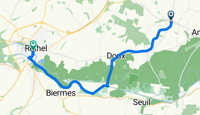
Place de la Gare, Lucquy nach Place de la République, Rethel
Trasa rowerowa w Rethel, Grand Est, Francja
- 13,3 km
- Dystans
- 64 m
- Przewyższenia
- 68 m
- Spadek


Joinville 1987
Trasa rowerowa w Rethel, Grand Est, Francja
- 167,2 km
- Dystans
- 619 m
- Przewyższenia
- 517 m
- Spadek
Odkryj więcej tras
 1.rethel-rethel
- Dystans
- 182,7 km
- Przewyższenia
- 638 m
- Spadek
- 638 m
- Lokalizacja
- Rethel, Grand Est, Francja
 Rethel-Travemünde
- Dystans
- 1107,6 km
- Przewyższenia
- 815 m
- Spadek
- 881 m
- Lokalizacja
- Rethel, Grand Est, Francja
 43KM Landschap Wasigny
- Dystans
- 43,3 km
- Przewyższenia
- 402 m
- Spadek
- 409 m
- Lokalizacja
- Rethel, Grand Est, Francja
 rethel/charleville
- Dystans
- 195,1 km
- Przewyższenia
- 3036 m
- Spadek
- 2991 m
- Lokalizacja
- Rethel, Grand Est, Francja
 DAG 2 | Coucy - Arc-en-Barrois
- Dystans
- 223,9 km
- Przewyższenia
- 564 m
- Spadek
- 365 m
- Lokalizacja
- Rethel, Grand Est, Francja
 35KM Wasigny
- Dystans
- 35,9 km
- Przewyższenia
- 198 m
- Spadek
- 209 m
- Lokalizacja
- Rethel, Grand Est, Francja
 28KM Wasigny
- Dystans
- 28,8 km
- Przewyższenia
- 328 m
- Spadek
- 341 m
- Lokalizacja
- Rethel, Grand Est, Francja
 10km
10km- Dystans
- 9,6 km
- Przewyższenia
- 151 m
- Spadek
- 111 m
- Lokalizacja
- Rethel, Grand Est, Francja