Mont Sainte Victoire
- 63,6 km
- 879 m
- 878 m
- Pourrières, Prowansja-Alpy-Lazurowe Wybrzeże, Francja

Odkrywaj mapę z 23 trasami rowerowymi i szlakami w pobliżu Pourrières, stworzonymi przez naszą społeczność.
Portret regionu
Znajdź odpowiednią trasę rowerową dla siebie w Pourrières – mamy tam 23 tras do odkrycia.
1182 km
Zarejestrowany dystans
23
Trasy rowerowe
4292
Populacja
Wspólnota
Od naszej społeczności
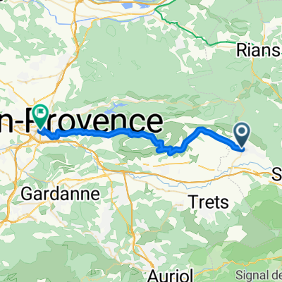
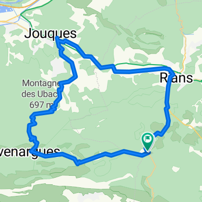
Trasa rowerowa w Pourrières, Prowansja-Alpy-Lazurowe Wybrzeże, Francja
Trasa rowerowa w Pourrières, Prowansja-Alpy-Lazurowe Wybrzeże, Francja
Trasa rowerowa w Pourrières, Prowansja-Alpy-Lazurowe Wybrzeże, Francja
Trasa rowerowa w Pourrières, Prowansja-Alpy-Lazurowe Wybrzeże, Francja