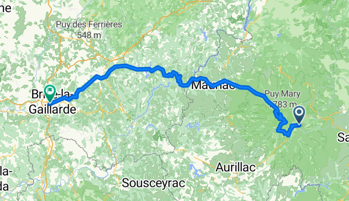
Jak może wyglądać jazda na rowerze w Murat.

Murat na rowerze

Odkrywaj mapę z 137 trasami rowerowymi i szlakami w pobliżu Murat, stworzonymi przez naszą społeczność.

Portret regionu

Poznaj Murat

Znajdź odpowiednią trasę rowerową dla siebie w Murat – mamy tam 137 tras do odkrycia. Większość osób wybiera się tutaj na rower w miesiącach Maj i Sierpień.

12 622 km

Zarejestrowany dystans

137

Trasy rowerowe

2316

Populacja

Wspólnota

Najaktywniejsi użytkownicy w Murat

Od naszej społeczności
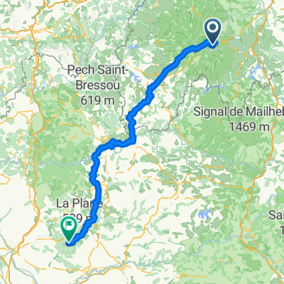
Najlepsze trasy rowerowe w Murat i okolicach

Genf-Bordeaux, 3.Etappe: Lavigerie P.Peyrol-Saint-Vincent-de-Cosse
Rower szosowyUtwardzony
Huber Martin
2

Genf-Bordeaux, 3.Etappe: Lavigerie P.Peyrol-Saint-Vincent-de-Cosse

Trasa rowerowa w Murat, Auvergne-Rhône-Alpes, France

sehr schöner Pass. ca. 7km ab Unterkunft, steigt erst mit ca.5-6% später mehr, interessante steile Abfahrt bis Aurillac, dann ca. 20km grössere Strasse aber wenig/keine LKW, Abzweigung in kleine Strasse zur Dordogne Flusslandschaft über die nächsten 100km. Atemberaubend, wünderschöne Felslandschaft mit Fluss und dazwischen eingeklemmte Dörfer. 6.5 km nach La Roque-Gageac ist unser Schloss: Château de Monrecour, rechts der Strasse unübersehbar. Schwimmbad und eine excelente Küche erwartet uns.
190,6 km
Dystans
784 m
Przewyższenia
1870 m
Spadek
C: Lavigerie (pas de peyrol) - Saint-Vincent-de-Cosse, 3. Etappe: Genf - Bordeaux
Rower szosowyUtwardzony
Huber Martin
2

C: Lavigerie (pas de peyrol) - Saint-Vincent-de-Cosse, 3. Etappe: Genf - Bordeaux

Trasa rowerowa w Murat, Auvergne-Rhône-Alpes, France

Start von 1150 bis 1600 müM ca. 8 km bis zum Pas de Peyrol. Lange Abfahrt, flach dem Fluss entlang zum Schluss, Dordogne ist eine sensationell schöne Flusslandschaft. Schloss erwartet uns.
189,6 km
Dystans
892 m
Przewyższenia
1947 m
Spadek
Massif Central 2009 - Tour 1 - Pässe des Cantal
Rower szosowyUtwardzony
2

Massif Central 2009 - Tour 1 - Pässe des Cantal

Trasa rowerowa w Murat, Auvergne-Rhône-Alpes, France

gefahren am 2.7.09 Start/Ziel Murat (geparkt beim Schulzentrum) insgesamt (d.h. Murat - Murat) 148, 9 km (ab Col de Serre gleiche Straße wie Hinweg) und 2760 Höhenmeter (Werte von Garmin Edge 305) der Abschnitt Salers - Aurillac ist streckenweise etwas zäh, der Rest it dafr um so schöner. Absolut sehenswert: Salers ! und wer noch nicht genug Höhenmeter hat, der steigt per Treppe vom Pas de Payrol auf den Puy Mary...
128,1 km
Dystans
2865 m
Przewyższenia
2758 m
Spadek
Ride Day 33—14 Oct 2005—15300 Murat to 19110 Bort-les-Orgues
Rower szosowyUtwardzony
Jeff Kadet
0

Ride Day 33—14 Oct 2005—15300 Murat to 19110 Bort-les-Orgues

Trasa rowerowa w Murat, Auvergne-Rhône-Alpes, France

Today really felt like an easy day. After the initial climb from Murat at about 900 M to the Col d’Entremont at 1210 M, it was pretty much downhill all the way to Bort-Les-Orgues, which is something above 400 M. Getting into town, we crossed the Dordogne River. In contrast to yesterday’s miserable weather, today’s was picture perfect with a warm and friendly sun that, along with the route, periodically had me thinking: “It can’t get any better than this”. D16 was a perfect forest road that tracked the Santoire River. It lead us from Condat into the Gorges de la Rhue on D679 that was another perfect road. Along these roads, the fall colors were even more vivid than what we’d been seeing previously. A real pleasure. Just before entering Bort-les-Orgues, we passed from the Cantal Department into the Corrèze Department. This meant that we also went from the Auvergne Region into the Limousin Region. Background:My wife and I have been doing self-supported tours in Western Europe (a majority in France) since 1993.  This series of rides covers our 2005 2 month route through parts of France.  Our beginning and ending point is near Chaduri (south of Angoulême) where our friends have a farm with Gites and Chambres d'Hotes.We rode our Dawes touring bicycles purchased in 1993 heavily loaded with 700Cx32 tires.  All of our riding was on paved roads, mostly with very little traffic.If any questions, feel free to email me at jeffkadet@netdiving.comJeff
64,9 km
Dystans
588 m
Przewyższenia
1058 m
Spadek

Odkryj więcej tras